


The Times Map of the World
2016
|
12th Revised edition
Times Books (Verlag)
978-0-00-815853-8 (ISBN)
Times Books (Verlag)
978-0-00-815853-8 (ISBN)
- Titel erscheint in neuer Auflage
- Artikel merken
Zu diesem Artikel existiert eine Nachauflage
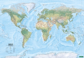
This folded world map has been fully revised and updated to include the latest political changes. The map contains politically coloured mapping which shows individual countries and their capital city, major roads, railways and cities and towns clearly.
Local name forms are used for all towns and cities with the English or historical alternative shown in brackets e.g. Mumbai (Bombay), Sankt Peterburg (Leningrad) where space permits. This makes the map readily accessible to the general reader who needs an up-to-date map to follow reports of world events in newspapers, on radio and television. It is perfect for the home and office.
This map includes:
• All recent political changes carried out to mapping
• Changes to international dateline
Area of coverage:
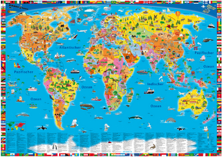
All of the world, centred on the Greenwich Meridian, and including maps of the North and South Pole regions.
Scale:
Scale 1:30 000 000; 1cm to 300 km; 1 inch to 474 miles.
Size of world map unfolded 637 x 1016mm
Local name forms are used for all towns and cities with the English or historical alternative shown in brackets e.g. Mumbai (Bombay), Sankt Peterburg (Leningrad) where space permits. This makes the map readily accessible to the general reader who needs an up-to-date map to follow reports of world events in newspapers, on radio and television. It is perfect for the home and office.
This map includes:
• All recent political changes carried out to mapping
• Changes to international dateline
Area of coverage:
All of the world, centred on the Greenwich Meridian, and including maps of the North and South Pole regions.
Scale:
Scale 1:30 000 000; 1cm to 300 km; 1 inch to 474 miles.
Size of world map unfolded 637 x 1016mm
The world's most prestigious and authoritative maps and atlases.
| Erscheint lt. Verlag | 7.4.2016 |
|---|---|
| Verlagsort | London |
| Sprache | englisch |
| Maße | 136 x 255 mm |
| Gewicht | 90 g |
| Themenwelt | Reisen ► Karten / Stadtpläne / Atlanten ► Welt / Arktis / Antarktis |
| Naturwissenschaften ► Geowissenschaften ► Geografie / Kartografie | |
| ISBN-10 | 0-00-815853-3 / 0008158533 |
| ISBN-13 | 978-0-00-815853-8 / 9780008158538 |
| Zustand | Neuware |
| Informationen gemäß Produktsicherheitsverordnung (GPSR) | |
| Haben Sie eine Frage zum Produkt? |
Mehr entdecken
aus dem Bereich

aus dem Bereich
Karte (plano) (2025)
Freytag-Berndt und ARTARIA (Verlag)
689,90 €