Spatial Analysis
Productivity Press (Verlag)
978-1-4987-0763-3 (ISBN)
- Titel erscheint in neuer Auflage
- Artikel merken
The book enables readers to:
Identify types and characterize non-spatial and spatial data
Demonstrate their competence to explore, visualize, summarize, analyze, optimize, and clearly present statistical data and results
Construct testable hypotheses that require inferential statistical analysis
Process spatial data, extract explanatory variables, conduct statistical tests, and explain results
Understand and interpret spatial data summaries and statistical tests
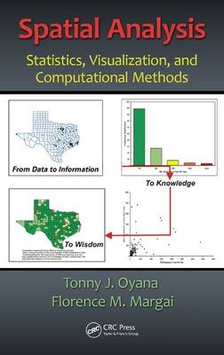
Spatial Analysis: Statistics, Visualization, and Computational Methods incorporates traditional statistical methods, spatial statistics, visualization, and computational methods and algorithms to provide a concept-based problem-solving learning approach to mastering practical spatial analysis. Topics covered include: spatial descriptive methods, hypothesis testing, spatial regression, hot spot analysis, geostatistics, spatial modeling, and data science.
Dr. Tonny J. Oyana received his Ph.D and his postdoctoral training from the University of Buffalo, New York, USA. He is currently the director of spatial analytics and informatics, Research Center for Health Disparities, Equity, and the Exposome; and a professor of spatial information systems in the Department of Preventive Medicine at the University of Tennessee Health Science Center, Knoxville, USA. His research focuses on establishing the relationship between environmental health and exposure; advancing GIS methods, algorithm design, and spatial analytical methods; and understanding the factors that contribute toward land systems change. In addition, he has authored more than 80 scientific works. Dr. Florence M. Margai (now deceased) was a professor in the Department of Geography at Binghamton University, New York, USA, where she taught courses that reflected her areas of specialization: advanced statistics, environmental health hazards, health disparities, and environmental analysis using geospatial and visualization technologies. She also served as the associate dean of Harpur College of Arts and Sciences, Vestal, New York, USA. Margai obtained her Ph.D from Kent State University, Ohio, USA, and worked with nonprofit organizations to assist in the geographic targeting of vulnerable population groups for disease intervention and health promotional campaigns, sustainability, and capacity development initiatives.
The Context and Relevance of Spatial Analysis
From Data to Information, to Knowledge and Wisdom
Spatial Analysis Using a GIS Timeline
Geographic Data: Properties, Strengths, and Analytical
Challenges
Conclusion
Challenge Assignments
Review and Study Questions
Glossary of Key Terms
References
Scientific Observations and Measurements in Spatial Analysis
Scales of Measurement
Population and Sample
Conclusion
Challenge Assignments
Review and Study Questions
Glossary of Key Terms
References
Using Statistical Measures to Analyze Data Distributions
Descriptive Statistics
Spatial Statistics: Measures for Describing Basic Characteristics of Spatial Data
Spatial Measures of Central Tendency
Spatial Measures of Dispersion
Random Variables and Probability Distribution
Conclusion
Challenge Assignments
Review and Study Questions
Glossary of Key Terms
References
Exploratory Data Analysis, Visualization, and Hypothesis Testing
Exploratory Data Analysis, Geovisualization, and Data
Visualization Methods
Exploratory Approaches for Visualizing Spatial Datasets
Visualizing Multidimensional Datasets: An Illustration Based on the US Educational Achievements Rates, 1970–2012
Hypothesis Testing, Confidence Intervals, and p Values
Computation
Statistical Conclusion
Conclusion
Challenge Assignments
Review and Study Questions
Glossary of Key Terms
References
Analyzing Spatial Statistical Relationships
Engaging in Correlation Analysis
Ordinary Least Squares and Geographically Weighted Regression
Methods
Conclusion
Challenge Assignments
Review and Study Questions
Glossary of Key Terms
References
Engaging in Point Pattern Analysis
Rationale for Studying Point Patterns and Distributions
Exploring Patterns, Distributions, and Trends Associated with Point Features
Conclusions
Challenge Assignments
Review and Study Questions
Glossary of Key Terms
References
Engaging in Areal Pattern Analysis Using Global and Local
Statistics
Rationale for Studying Areal Patterns
The Notion of Spatial Relationships
Quantifying Spatial Autocorrelation Effects in Areal Patterns
Conclusions
Challenge Assignments
Review and Study Questions
Glossary of Key Terms
References
Engaging in Geostatistical Analysis
Rationale for Using Geostatistics to Study Complex Spatial
Patterns
Basic Interpolation Equations
Spatial Structure Functions for Regionalized Variables
Kriging Method and its Theoretical Framework
Conditional Geostatistical Simulation
Inverse Distance Weighting
Conclusions
Challenge Assignments
Review and Study Questions
Glossary of Key Terms
References
Data Science: Understanding Computing Systems and Analytics for Big Data
Introduction to Data Science
Rationale for a Big Geospatial Data Framework
Data Management
Analytics and Strategies for Big Geospatial Data
Conclusions
Challenge Assignments
Review and Study Questions
Glossary of Key Terms
References
| Zusatzinfo | 32 Scatter Color figures on pages 6, 58, 82, 101, 103, 104, 105, 106, 115, 133, 138, 141, 142, 152, 156, 165, 166, 169, 171, 174, 189, 212, 226, 240, 241, 245, 246, 251, 253, 271, 276, 277.; Line of Equations 100; 45 Tables, black and white; 96 Illustrations, black and white |
|---|---|
| Verlagsort | Portland |
| Sprache | englisch |
| Maße | 156 x 234 mm |
| Gewicht | 680 g |
| Themenwelt | Naturwissenschaften ► Geowissenschaften ► Geografie / Kartografie |
| Naturwissenschaften ► Geowissenschaften ► Geologie | |
| ISBN-10 | 1-4987-0763-7 / 1498707637 |
| ISBN-13 | 978-1-4987-0763-3 / 9781498707633 |
| Zustand | Neuware |
| Informationen gemäß Produktsicherheitsverordnung (GPSR) | |
| Haben Sie eine Frage zum Produkt? |
aus dem Bereich


