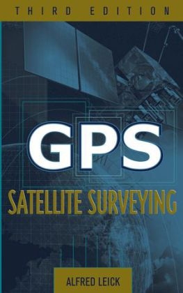
GPS Satellite Surveying
John Wiley & Sons Inc (Verlag)
978-0-471-05930-1 (ISBN)
- Titel erscheint in neuer Auflage
- Artikel merken
The revised and updated authoritative volume on GPS use in surveying Comprehensive and thorough in its coverage, GPS Satellite Surveying, Third Edition is the updated edition of Alfred Leick's classic introduction to the field. Written to help specialists get the most out of GPS surveying techniques and the resulting measurements, this standard industry reference provides the latest fundamental and cutting-edge material for working with GPS today. A unique volume in the field, this Third Edition offers an unrivaled presentation of procedures that apply to the Russian GLONASS, the forthcoming European GALILEO, and U.S. GPS satellite systems. New coverage addresses emerging precise-point positioning technology, as well as the most current information on: * Geodetic reference systems * GPS modernization * Least-squares adjustments * Pseudoranges and carrier phases * The troposphere and ionosphere * The LAMBDA technique * The ellipsoidal and conformal mapping models GPS Satellite Surveying, Third Edition is a dependable, up-to-date reference for surveyors, civil engineers, transportation engineers, geologists, geographers, technicians, and students.
ALFRED LEICK, PhD, is Professor of Spatial Information Science and Engineering at the University of Maine. During his career, he has served on the Board of Directors of the American Association of Geodetic Surveying and authored two previous editions of GPS Satellite Surveying (Wiley).
Preface. Acknowledgements. Abbreviations. Notation. 1. Introduction. 2. Geodetic Reference Systems. 3. Satellite Systems. 4. Least-Squares Adjustments. 5.Pseudorange and Carrier Phase Observables. 6. Troposphere and Ionosphere. 7. Processing Pseudoranges and Carrier Phases. 8. Network Adjustments. 9. Two-Dimensional Geodetic Models. Appendix A. General Background. Appendix B. The Ellipsoid. Appendix C. Conformal Mapping. References. Author Index. Subject Index.
| Erscheint lt. Verlag | 20.1.2004 |
|---|---|
| Zusatzinfo | Illustrations |
| Verlagsort | New York |
| Sprache | englisch |
| Maße | 164 x 237 mm |
| Gewicht | 794 g |
| Einbandart | gebunden |
| Themenwelt | Naturwissenschaften ► Geowissenschaften ► Geografie / Kartografie |
| Technik ► Bauwesen | |
| ISBN-10 | 0-471-05930-7 / 0471059307 |
| ISBN-13 | 978-0-471-05930-1 / 9780471059301 |
| Zustand | Neuware |
| Haben Sie eine Frage zum Produkt? |
aus dem Bereich


