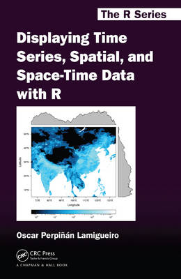
Displaying Time Series, Spatial, and Space-Time Data with R
Crc Press Inc (Verlag)
978-1-4665-6520-3 (ISBN)
- Titel ist leider vergriffen;
keine Neuauflage - Artikel merken
A data graphic is not only a static image, but it also tells a story about the data. It activates cognitive processes that are able to detect patterns and discover information not readily available with the raw data. This is particularly true for time series, spatial, and space-time datasets.
Focusing on the exploration of data with visual methods, Displaying Time Series, Spatial, and Space-Time Data with R presents methods and R code for producing high-quality graphics of time series, spatial, and space-time data. Practical examples using real-world datasets help you understand how to apply the methods and code.
The book illustrates how to display a dataset starting with an easy and direct approach and progressively adding improvements that involve more complexity. Each of the book’s three parts is devoted to different types of data. In each part, the chapters are grouped according to the various visualization methods or data characteristics.
Web Resource
Along with the main graphics from the text, the author’s website offers access to the datasets used in the examples as well as the full R code. This combination of freely available code and data enables you to practice with the methods and modify the code to suit your own needs.
Oscar Perpiñán Lamigueiro is a lecturer of photovoltaic and solar energy at the Escuela de Organización Industrial (EOI) and an assistant professor of electrical engineering at the Universidad Politécnica de Madrid (UPM). He develops R packages that provide graphical methods to display multivariate time series, spatial data, and space-time data (rasterVis and solaR).
Introduction
What This Book Is About
What You Will Not Find in This Book
How to Read This Book
R Graphics
Packages
Software Used to Write This Book
About the Author
Acknowledgments
TIME SERIES
Displaying Time Series: Introduction
Packages
Further Reading
Time on the Horizontal Axis
Time Graph of Different Meteorological Variables
Time Series of Variables with the Same Scale
Stacked Graphs
Time as a Conditioning or Grouping Variable
Scatterplot Matrix: Time as a Grouping Variable
Scatterplot with Time as a Conditioning Variable
Time as a Complementary Variable
Polylines
Choosing Colors
Labels to Show Time Information
Country Names: Positioning Labels
A Panel for Each Year
Traveling Bubbles
About the Data
SIAR
Unemployment in the United States
Gross National Income and CO2 Emissions
SPATIAL DATA
Displaying Spatial Data: Introduction
Packages
Further Reading
Thematic Maps
Proportional Symbol Mapping
Choropleth Maps
Raster Maps
Vector Fields
Reference and Physical Maps
Physical Maps
OpenStreetMap with Hill Shade Layers
About the Data
Air Quality in Madrid
Spanish General Elections
CM SAF
Land Cover and Population Rasters
SPACE-TIME DATA
Displaying Spatiotemporal Data: Introduction
Contents
Packages
Further Reading
Spatiotemporal Raster Data
Introduction
Level Plots
Graphical Exploratory Data Analysis
Space-Time and Time Series Plots
Animation
Spatiotemporal Point Observations
Introduction
Data and Spatial Information
Graphics with spacetime
Animation
Bibliography
Index
| Reihe/Serie | Chapman & Hall/CRC: The R Series |
|---|---|
| Zusatzinfo | 76 Illustrations, color |
| Verlagsort | Bosa Roca |
| Sprache | englisch |
| Maße | 156 x 235 mm |
| Gewicht | 499 g |
| Themenwelt | Mathematik / Informatik ► Mathematik ► Computerprogramme / Computeralgebra |
| Naturwissenschaften ► Biologie | |
| Naturwissenschaften ► Geowissenschaften ► Geologie | |
| ISBN-10 | 1-4665-6520-9 / 1466565209 |
| ISBN-13 | 978-1-4665-6520-3 / 9781466565203 |
| Zustand | Neuware |
| Haben Sie eine Frage zum Produkt? |
aus dem Bereich


