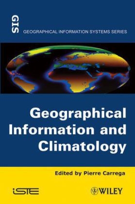
Geographical Information and Climatology
ISTE Ltd and John Wiley & Sons Inc (Verlag)
978-1-84821-185-8 (ISBN)
- Titel z.Zt. nicht lieferbar
- Versandkostenfrei innerhalb Deutschlands
- Auch auf Rechnung
- Verfügbarkeit in der Filiale vor Ort prüfen
- Artikel merken
This book includes two parts. The first part is more theoretical and general, and it covers fundamental principles : geospatial climate data measurement ; spatial analysis, mapping and climate ; geographical information, remote sensing and climatology ; and geographical information for initialisation of forecasting and climate models.
The second part describes geographical information used in various climate applications of importance today, related to risk : urban climate ; air pollution ; hydrological problems linked to climatology ; forest fires.
Pierre Carrega is Professor at Université de Nice-Sophia Antipolis, France.
Preface vii
Chapter 1. Basics of Climatological and Meteorological Observations for GIS Applications 1
Wolfgang SCHOENER
1.1. Data measurements and observations in climatology 2
1.2. Data quality control and data homogenization in climatology 12
1.3. Metadata: documenting quality and usability 20
1.4. Future perspectives 25
1.5. Bibliography 26
Chapter 2. Spatial Analysis, Cartography and Climate 29
Daniel JOLY
2.1. Introduction 29
2.2. Geographic information necessary for interpolation 32
2.3. The main interpolation methods 36
2.4. Geographic information used in statistical interpolations: advantages and disadvantages 42
2.5. Conclusion 67
2.6. Bibliography 69
Chapter 3. Geographical Information, Remote Sensing and Climatology 73
Vincent DUBREUIL
3.1. Introduction 73
3.2. The development phases of meteorological satellites 74
3.3. Examples of how geostationary data are used in Brazil 85
3.4. Examples of NOAA-AVHRR data used in Western France 92
3.5. Conclusion 99
3.6. Acknowledgements 100
3.7. Bibliography 100
Chapter 4. Geographical Information for the Initialization of Numerical Weather Forecast Models and Climate Modeling 103
Pierre BESSEMOULIN
4.1. Introduction 103
4.2. Brief description of the climate system 103
4.3. Brief overview of numerical weather forecast models 107
4.4. Role and description of the Earth’s surface 111
4.5. Description of surface parameters used in a forecast model 119
4.6. Bibliography 123
Chapter 5. Assessing and Modeling the Urban Climate in Lisbon 125
Maria João ALCOFORADO
5.1. Introduction 125
5.2. Historical evolution of urban climate studies 126
5.3. Spatial scales 127
5.4. Climatic modifications induced by settlements 128
5.5. Urban climate monitoring methods 130
5.6. Modeling 134
5.7. Modeling Lisbon’s urban climate at the mesoscale 135
5.8. Modeling Lisbon’s urban climate at the microscale (Telheiras city-district) 144
5.9. Conclusion 152
5.10. Acknowledgements 153
5.11. Bibliography 154
Chapter 6. Geographical Information, Climate and Atmospheric Pollution 159
Isabelle ROUSSEL
6.1. Introduction 159
6.2. Peak pollution periods and alerts: pollution and climate paroxysm 161
6.3. LAURE and territory age 171
6.4. The geography of science and action 180
6.5. Conclusion 190
6.6. Bibliography 191
Chapter 7. Geographical Information and Climatology for Hydrology 195
Jean-Pierre LABORDE
7.1. Hydrological problems of today’s society 195
7.2. Pluviometry: a spatially continuous piece of geographical information 200
7.3. The problems associated with recording rainfall and average spatial rainfall 218
7.4. Conclusion 228
7.5. Bibliography 229
Chapter 8. Geographical Information, Climatology and Forest Fires 233
Pierre CARREGA
8.1. Forest fires: associated risks and individual components 233
8.2. The influence that different climate and weather factors have on forest fires: the indexes 238
8.3. Using geographic information to work out the meteorological risks associated with forest fires 246
8.4. Conclusion
List of Authors 271
Index 273
| Verlagsort | London |
|---|---|
| Sprache | englisch |
| Maße | 158 x 234 mm |
| Gewicht | 590 g |
| Einbandart | gebunden |
| Themenwelt | Naturwissenschaften ► Geowissenschaften ► Geografie / Kartografie |
| Naturwissenschaften ► Geowissenschaften ► Meteorologie / Klimatologie | |
| ISBN-10 | 1-84821-185-6 / 1848211856 |
| ISBN-13 | 978-1-84821-185-8 / 9781848211858 |
| Zustand | Neuware |
| Informationen gemäß Produktsicherheitsverordnung (GPSR) | |
| Haben Sie eine Frage zum Produkt? |
aus dem Bereich


