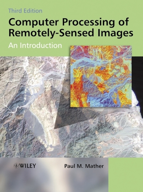
Computer Processing of Remotely-Sensed Images
John Wiley & Sons Ltd (Verlag)
978-0-470-84919-4 (ISBN)
- Titel ist leider vergriffen;
keine Neuauflage - Artikel merken
Remotely-sensed images of the Earth's surface provide a valuable source of information about the geographical distribution and properties of natural and cultural features. This fully revised and updated edition of a highly regarded textbook deals with the mechanics of processing remotely-sensed images. Presented in an accessible manner, the book covers a wide range of image processing and pattern recognition techniques. Its features include: new topics on LiDAR data processing, SAR interferometry, the analysis of imaging spectrometer image sets and the use of the wavelet transform; an accompanying CD-ROM with: updated MIPS software, including modules for standard procedures such as image display, filtering, image transforms, graph plotting, import of data from a range of sensors; a set of exercises, including data sets, illustrating the application of discussed methods using the MIPS software; and, an extensive list of WWW resources including colour illustrations for easy download.
Preface to the First Edition.Preface to the Second Edition .Preface to the Third Edition.List of Examples.1. Remote Sensing: Basic Principles.1.1 Introduction.1.2 Electromagnetic radiation and its properties.1.2.1 Terminology.1.2.2 Nature of electromagnetic radiation.1.2.3 The electromagnetic spectrum.1.2.4 Sources of electromagnetic radiation.1.2.5 Interactions with the Earth's atmosphere.1.3 Interaction with Earth-surface materials.1.3.1 Introduction.1.3.2 Spectral reflectance of Earth surface materials.1.3.2.1 Vegetation.1.3.2.2 Geology.1.3.2.3 Water bodies.1.3.2.4 Soils.1.4 Summary.2. Remote Sensing Platforms and Sensors.2.1 Introduction.2.2 Characteristics of imaging remote sensing instruments.2.2.1 Spatial resolution.2.2.2 Spectral resolution.2.2.3 Radiometric resolution.2.3 Optical, near-infrared and thermal imaging sensors.2.3.1 Along-Track Scanning Radiometer (ATSR).2.3.2 Advanced Very High Resolution Radiometer (AVHRR).2.3.3 MODIS (MODerate Resolution Imaging Spectrometer).2.3.4 Ocean observing instruments.2.3.5 IRS-1 LISS.2.3.6 Landsat Instruments.2.3.6.1 Landsat Multi-spectral Scanner (MSS).2.3.6.2 Landsat Thematic Mapper (TM).2.3.6.3 Enhanced Thematic Mapper Plus (ETM+).2.3.6.4 Landsat follow-on programme.2.3.7 SPOT sensors.2.3.7.1 SPOT High Resolution Visible (HRV).2.3.7.2 Vegetation (VGT).2.3.7.3 SPOT follow-on programme.2.3.8 Advanced Spaceborne Thermal Emission and Reflection Radiometer (ASTER).2.3.9 High-resolution commercial and micro-satellite systems.2.3.9.1 High-resolution commercial satellites - IKONOS.2.3.9.2 High-resolution commercial satellites - QuickBird.2.4 Microwave imaging sensors.2.4.1 ERS SAR.2.4.2 RADARSAT.2.5 Summary.3. Hardware and Software Aspects of Digital Image Processing.3.1 Introduction.3.2 Properties of digital remote sensing data.3.2.1 Digital data.3.2.2 Data formats.3.2.3 System processing.3.3 MIPS software.3.3.1 Installing MIPS.3.3.2 Using MIPS.3.3.3 Summary of MIPS functions.3.4 Summary.4. Pre-processing of Remotely Sensed Data.4.1 Introduction.4.2 Cosmetic operations.4.2.1 Missing scan lines.4.2.2 De-striping methods.4.2.2.1 Linear method.4.2.2.2 Histogram matching.4.2.2.3 Other destriping methods.4.3 Geometric correction and registration.4.3.1 Orbital geometry model.4.3.2 Transformation based on ground control points.4.3.3 Resampling procedures.4.3.4 Image registration.4.3.5 Other geometric correction methods.4.4 Atmospheric correction.4.4.1 Background.4.4.2 Image-based methods.4.4.3 Radiative transfer models.4.4.4 Empirical line method.4.5 Illumination and view angle effects.4.6 Sensor calibration.4.7 Terrain effects.4.8 Summary.5. Image Enhancement Techniques.5.1 Introduction.5.2 Human visual system.5.3 Contrast enhancement.5.3.1 Linear contrast stretch.5.3.2 Histogram equalisation.5.3.3 Gaussian Stretch.5.4 Pseudocolour enghancement.5.4.1 Density slicing.5.4.2 Pseudocolour transform.5.5 Summary.6. Image Transforms.6.1 Introduction.6.2 Arithmetic operations.6.2.1 Image addition.6.2.2 Image subtraction.6.2.3 Image multiplication.6.2.4 Image division and vegetation ratios.6.3 Empirically based image transforms.6.3.1 Perpendicular Vegetation Index.6.3.2 Tasselled Cap (Kauth-Thomas) transformation.6.4 Principal Components Analysis.6.4.1 Standard Principal Components Analysis.6.4.2 Noise-adjusted Principal Components Analysis.6.4.3 Decorrelation stretch.6.5 Hue, Saturation and Intensity (HIS) transform.6.6 The Discrete Fourier Transform.6.6.1 Introduction.6.6.2 Two-dimensional DFT.6.6.3 Applications.6.7 The Discrete Wavelet Transform.6.7.1 Introduction.6.7.2 The one-dimensional Discrete Wavelet Transform.6.7.3 The two-dimensional Discrete Wavelet Transform.6.8 Summary.7. Filtering Techniques.7.1 Introduction.7.2 Spatial domain low-pass (smoothing) filters.7.2.1 Moving average filter.7.2.2 Median filter.7.2.3 Adaptive filters.7.3 Spatial domain high-pass (sharpening) filters.7.3.1 Image subtraction method.7.3.2 Derivative-based methods.7.4 Spatial domain edge detectors.7.5 Frequency domain filters.7.6 Summary.8. Classification.8.1 Introduction.8.2 Geometrical basis of classification.8.3 Unsupervised classification.8.3.1 The k-means algorithm.8.3.2 ISODATA.8.3.3 A modified k-means algorithm.8.4 Supervised classification.8.4.1 Training samples.8.4.2 Statistical classifiers.8.4.2.1 Parallelepiped classifier.8.4.2.2 Centroid (k-means) classifier.8.4.2.3 Maximum likelihood method.8.4.3 Neural classifiers.8.5 Fuzzy classification and linear spectral unmixing.8.5.1 The linear mixture model.8.5.2 Fuzzy classifiers.8.6 Other approaches to image classification.8.7 Incorporation of non-spectral features.8.7.1 Texture.8.7.2 Use of external data.8.8 Contextual information.8.9 Feature selection.8.10 Classification accuracy.8.11 Summary.9. Advanced Topics.9.1 Introduction.9.2 SAR Interferometry.9.2.1 Basic principles.9.2.3 Interferometric processing.9.2.3 Problems in SAR interferometry.9.2.4 Applications of SAR interferometry.9.3 Imaging spectrometry.9.3.1 Introduction.9.3.2 Processing imaging spectrometer data.9.3.2.1 Derivative analysis.9.3.2.2 Smoothing and denoising the reflectance spectrum Savitzky-Golay polynomial smoothing Denoising using the Discrete Wavelet Transform.9.3.2.3 Determinationof 'red edge' characteristics of vegetation.9.3.2.4 Continuum removal.9.4 Lidar.9.4.1 Introduction.9.4.2 Lidar details.9.4.3 Lidar applications.Appendix A: Description of Sample Image Data Sets.References.Index.
| Erscheint lt. Verlag | 27.4.2004 |
|---|---|
| Zusatzinfo | Illustrations |
| Verlagsort | Chichester |
| Sprache | englisch |
| Maße | 191 x 246 mm |
| Gewicht | 769 g |
| Einbandart | Paperback |
| Themenwelt | Informatik ► Grafik / Design ► Digitale Bildverarbeitung |
| Naturwissenschaften ► Geowissenschaften ► Geografie / Kartografie | |
| ISBN-10 | 0-470-84919-3 / 0470849193 |
| ISBN-13 | 978-0-470-84919-4 / 9780470849194 |
| Zustand | Neuware |
| Informationen gemäß Produktsicherheitsverordnung (GPSR) | |
| Haben Sie eine Frage zum Produkt? |
aus dem Bereich


