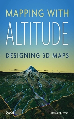
Mapping with Altitude
ESRI Press (Verlag)
978-1-58948-553-2 (ISBN)
Explore and master another dimension.
Spatial information that is inherently 3D, like buildings, topography, and subsurface geology, can be displayed in a way that is both intuitive and measurable. What’s more, 3D representations can be used to model structures before they are built, identifying potential problems.
Mapping with Altitude: Designing 3D Maps helps you deliver clear, compelling cartographic representations in 3D that are both eye-catching and informative. Understand scale, surfaces, base heights, texturing, and lighting models. Discover new twists on well-defined 2D cartographic principles, such as size, color, and text. Consider ways to convey time.
Mapping with Altitude focuses on the decisions you’ll make and the specific techniques you can use as you delve into the world of 3D map authoring.
Originally from Australia, Nathan C. Shephard currently works at Esri headquarters in Redlands, California where he leads a team of software engineers working on projects such 3D navigation, 3D symbology, and the authoring of animation videos. He acts as a 3D evangelist whenever he can, including presenting an annual '3D Cartography' technical workshop in San Diego. In his free time he writes fiction, designs mobile apps, and spends time with his wife and two daughters.
Why 3D?
Anatomy of a 3D scene
Authoring for specific scales
Delivery format
Using surfaces
Displaying draped content
Displaying features: Geometry types, base-heights, and anchor points
Displaying features: Shape, rotation, and scaling
Displaying features: Textures and materials
Displaying features: Animated symbols
Displaying text and labels
Temporal content in 3D
Configuring the scene
Exploring the scene
3D cartography call to action
| Erscheinungsdatum | 02.09.2019 |
|---|---|
| Zusatzinfo | Illustrations |
| Verlagsort | Redlands |
| Sprache | englisch |
| Maße | 203 x 254 mm |
| Themenwelt | Sachbuch/Ratgeber ► Beruf / Finanzen / Recht / Wirtschaft ► Bewerbung / Karriere |
| Mathematik / Informatik ► Informatik ► Grafik / Design | |
| Naturwissenschaften ► Geowissenschaften ► Geografie / Kartografie | |
| ISBN-10 | 1-58948-553-X / 158948553X |
| ISBN-13 | 978-1-58948-553-2 / 9781589485532 |
| Zustand | Neuware |
| Informationen gemäß Produktsicherheitsverordnung (GPSR) | |
| Haben Sie eine Frage zum Produkt? |
aus dem Bereich


