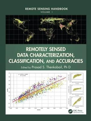
Remotely Sensed Data Characterization, Classification, and Accuracies
Seiten
2015
Crc Press Inc (Verlag)
978-1-4822-1786-5 (ISBN)
Crc Press Inc (Verlag)
978-1-4822-1786-5 (ISBN)
- Titel z.Zt. nicht lieferbar
- Versandkostenfrei innerhalb Deutschlands
- Auch auf Rechnung
- Verfügbarkeit in der Filiale vor Ort prüfen
- Artikel merken
A volume in the Remote Sensing Handbook series, Remotely Sensed Data Characterization, Classification, and Accuracies documents the scientific and methodological advances that have taken place during the last 50 years. The other two volumes in the series are Land Resources Monitoring, Modeling, and Mapping with Remote Sensing, and Remote Sensing of Water Resources, Disasters, and Urban Studies.
This volume demonstrates the experience, utility, methods, and models used in studying a wide array of remotely sensed data characterization, classification, and accuracies for terrestrial applications. Leading experts on global geographic coverage, study areas, and array of satellite and sensors contribute to this unique handbook. This theoretical as well as highly practical book represents a thorough history of advancement in the field over last 50 years, bringing us to where we are now, and highlighting future possibilities.
Highlights include:
Fundamental and advanced topics in remote-sensing satellites and sensors
Remote sensing data calibration, normalization, harmonization, and synthesis
Optical, Radar, LiDAR, thermal, hyperspectral, and other satellite sensors, normalization of remotely sensed data, and data degradations
Digital image processing, urban image classification, and image classification methods in land use/land cover, cropland, change detection studies
Enhanced vegetation indices and standardization of vegetation indices
Object-based image analysis (OBIA) and geospatial data integration
LiDAR data processing and applications
Geoprocessing, GIS, and GIScience
GNSS applications
Crowdsourcing and cloud computing
Google Earth for Earth Sciences
Map accuracies
Remote-sensing law or space law, and a host of other topics
Considered magnum opus on the subject, the three-volume Remote Sensing Handbook is edited by Dr. Prasad S. Thenkabail of the United States Geological Survey and a renowned international expert in remote sensing and GIScience, with contributions from the very best leading global experts, the handbook gives you a knowledge base on the evolution of remote sensing science, current state-of-the-art technology, and a future vision for the field.
Thenkabail Ph.D and Prasad S.
Satellites and Sensors from Different Eras and Their Characteristics. Data Normalization, Harmonization, and Inter-sensor Calibration. Image Processing Methods and Approaches. Change Detection. GPS. GIS, Remote Sensing, and Spatial Modeling for Decision Support. GNSS Remote Sensing. Crowdsourcing. Cloud Computing and Remote Sensing. Google Earth for Remote Sensing. Accuracies, Errors, and Uncertainties. Summary.
| Reihe/Serie | Remote Sensing Handbook |
|---|---|
| Zusatzinfo | 92 Tables, color; 336 Illustrations, color |
| Verlagsort | Bosa Roca |
| Sprache | englisch |
| Maße | 210 x 280 mm |
| Gewicht | 2100 g |
| Themenwelt | Informatik ► Grafik / Design ► Digitale Bildverarbeitung |
| Naturwissenschaften ► Geowissenschaften ► Geografie / Kartografie | |
| Technik ► Umwelttechnik / Biotechnologie | |
| ISBN-10 | 1-4822-1786-4 / 1482217864 |
| ISBN-13 | 978-1-4822-1786-5 / 9781482217865 |
| Zustand | Neuware |
| Informationen gemäß Produktsicherheitsverordnung (GPSR) | |
| Haben Sie eine Frage zum Produkt? |
Mehr entdecken
aus dem Bereich
aus dem Bereich
alles zum Drucken, Scannen, Modellieren
Buch | Softcover (2024)
Markt + Technik Verlag
24,95 €
Modelle für 3D-Druck und CNC entwerfen
Buch | Softcover (2022)
dpunkt (Verlag)
34,90 €


