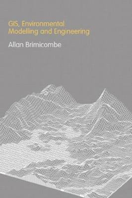
GIS Environmental Modelling and Engineering
Taylor & Francis Ltd (Verlag)
978-0-415-25922-4 (ISBN)
- Titel erscheint in neuer Auflage
- Artikel merken
Spatial dimensions need to be properly captured if modelling and engineering techniques are to be successfully applied in addressing environmental problems. The links between the geographical information systems (GIS) that capture this data, simulation modelling, and engineering offer tremendous possibilities for building versatile support systems for managing the environment. GIS, Environmental Modelling and Engineering focuses on using GIS and external models to solve real environmental problems, promoting the critical thinking needed for the effective applications of these systems and their analytical outputs.
Divided into three major sections, this textbook first concentrates on defining GIS, identifying how data is structured, and explaining common functionality. The text examines GIS from a technological perspective, exploring the evolution of its scientific basis and its synergies with other technologies within a geocomputational paradigm. The next section explores modelling from a neutral scientific perspective in its role of simulating phenomena, as well as from a more specific perspective in its role within environmental science and engineering. The third and largest section looks at how GIS and simulation modelling are joined. It provides case studies and covers issues such as interoperability, data quality, model validity, space-time dynamics, and decision-support systems.
This volume provides seniors and postgraduate students with a structured, coherent text that goes beyond introductory subject matter by enabling readers to think critically about the data acquisition process and the results they get from the technology.
Professor Allan Brimicombe is Head of the Centre for Geo-Information Studies at the University of East London. Prior to this he was the founding Head of the Department of Land Surveying and Geo-Informatics at the Hong Kong Polytechnic University which in turn was preceded by a successful international career in consulting engineering.
INTRODUCTION
Metaphors of Nature
A Solution Space?
Scope and Plan of This Book
SECTION A
FROM GIS TO GEOCOMPUTATION
In The Beginning…
Technological Facilitation
Representing Spatial Phenomena in GIS
Putting the Real World on a Diskette
Data Characteristics
Basic Functionality of GIS
A Systems Definition of GIS
Limitations of GIS and the Rise of Geocomputation
THE RISE OF GEO-INFORMATION SCIENCE AND ENGINEERING
Technology First…
Science to Follow…
And Now…Geo-Information Engineering
SECTION B
APPROACHES TO MODELLING
A Model of an X
Typology of Models
Building Models
Evaluating Models
Applying Models
A Summary of Model Development
THE ROLE AND NATURE OF ENVIRONMENTAL MODELS
The Context of Environmental Modelling
The Decision Environment
Conceptual Models
Empirical Models
Models Incorporating Artificial Intelligence
Process Models
SECTION C
CASE STUDIES IN GIS, ENVIRONMENTAL MODELLING AND ENGINEERING
Modelling Approaches in GIS and Environmental Modelling
Spatial Coexistence
Source-Pathway Characterization
Cluster Detection
Conclusion
ISSUES OF COUPLING THE TECHNOLOGIES
Some Preconditions
Initial Conceptualizations
An Over-Simplification of the Issues
Maturing Conceptualizations
Maturing Typology of Integration
DATA AND INFORMATION QUALITY ISSUES
The Issue is…Uncertainty
Early Warnings
Finding a Way Forward
Measuring Spatial Data Quality
Modelling Error and Uncertainty in GIS
Managing Fitness-For-Use
MODELLING ISSUES
Issues of Scale
Issues of Algorithm
Issues of Model Structure
Issues of Calibration
Bring Data Issues and Modelling Issues Together
DECISION-MAKING UNDER UNCERTAINTY
Exploring the Decision Space: Spatial Decision Support Systems
Communication of Spatial Concepts
Participatory Planning and Web-Based GIS
All's Well that End's Well?
| Erscheint lt. Verlag | 29.8.2003 |
|---|---|
| Zusatzinfo | 115 Line drawings, black and white; 11 Tables, black and white; 23 Illustrations, black and white |
| Verlagsort | London |
| Sprache | englisch |
| Maße | 156 x 235 mm |
| Gewicht | 522 g |
| Themenwelt | Informatik ► Grafik / Design ► Digitale Bildverarbeitung |
| Naturwissenschaften ► Geowissenschaften ► Geografie / Kartografie | |
| ISBN-10 | 0-415-25922-3 / 0415259223 |
| ISBN-13 | 978-0-415-25922-4 / 9780415259224 |
| Zustand | Neuware |
| Haben Sie eine Frage zum Produkt? |
aus dem Bereich


