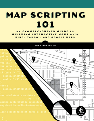
Map Scripting 101
No Starch Press,US (Verlag)
978-1-59327-271-5 (ISBN)
- Titel ist leider vergriffen;
keine Neuauflage - Artikel merken
You'll also learn how to: * Create, embed, and manipulate basic maps by setting zoom levels and map boundaries * Show, hide, and filter location markers and info-bubbles * Customize your maps for visitors based on their location * Use common data formats like GPS XML, Google Earth's KML, and GeoRSS * Create graphical overlays on maps to better analyze data and trends * Use freely available geodata from websites like Yelp and Upcoming-and public domain geodata from the US government Map Scripting 101 is perfect for any web developer getting started with map scripting, whether you want to track earthquakes around the world, or just mark the best coffee shops in Dubuque.
Dedication; ACKNOWLEDGMENTS; INTRODUCTION; About This Book; How to Use This Book; About the Website; Chapter 1: MAPPING BASICS; 1.1 The Mapping APIs: Google, Yahoo!, and Mapstraction; 1.2 Describe a Point on the Earth; 1.3 Create Your First Map; 1.4 Find the Underlying Map Tiles; 1.5 Change the Map Size; 1.6 Add Zoom and Other Controls; 1.7 Set Zoom Level; 1.8 Set Map Type; 1.9 Recenter the Map; 1.10 Retrieve the Center of the Map; 1.11 Find Point Where User Clicked; Chapter 2: PLOTTING MARKERS AND MESSAGE BOXES; 2.1 #1: Add a Marker to Your Map; 2.2 #2: Remove or Hide a Marker; 2.3 #3: Show a Message Box When Your Marker Is Clicked; 2.4 #4: Show and Hide Message Boxes Without Clicking the Marker; 2.5 #5: Create a Custom Icon Marker; 2.6 #6: Create Numbered Markers; 2.7 #7: Loop Through All Markers; 2.8 #8: Determine the Correct Zoom Level to Use Based on Markers; 2.9 #9: Filter Out Certain Markers; 2.10 #10: Remove or Hide All Markers; 2.11 #11: Handle Clusters of Markers; Chapter 3: GEOCODING; 3.1 How Do Geocoders Work?; 3.2 JavaScript vs. HTTP Geocoding; 3.3 #12: Geocode with JavaScript; 3.4 #13: Geocode with an HTTP Web Service; 3.5 #14: Reverse Geocoding: Get an Address from a Point; 3.6 #15: Get Postal Code Coordinates; Chapter 4: LAYER IT ON; 4.1 #16: Draw Lines on a Map; 4.2 #17: Draw Shapes on a Map; 4.3 #18: Add Circles to Show Search Radius; 4.4 #19: Draw a Rectangle to Declare an Area; 4.5 #20: Draw Lines Along Clicks; 4.6 #21: Color States/Countries on a Map; 4.7 #22: Add Custom Controls; 4.8 #23: Create Your Own Zoom Interface; 4.9 #24: Plot Image Thumbnails on a Map; 4.10 #25: Overlay an Image on a Map; 4.11 #26: Use Custom Tiles; Chapter 5: HANDLE MAP EVENTS; 5.1 Mapstraction's Event Model; 5.2 #27: The User Clicks the Map; 5.3 #28: The User Drags the Map; 5.4 #29: The Zoom Level Changes; 5.5 #30: A Marker Is Added to or Removed from the Map; 5.6 #31: A Polyline Is Added to or Removed from the Map; 5.7 #32: The User Opens or Closes a Message Box; 5.8 #33: The User Clicks a Marker; 5.9 #34: Return to the Center When the Message Box Is Closed; 5.10 #35: The User Moves the Map Outside Preset Bounds; Chapter 6: EXPLORE PROXIMITY; 6.1 #36: Calculate Distance Between Two Points; 6.2 #37: Find True Distance with Routing; 6.3 #38: Create Driving Directions; 6.4 #39: Determine Closest Marker; 6.5 #40: Find a Point Along a Line; 6.6 #41: Plot Local Results on a Map; 6.7 #42: Retrieve Local Results with HTTP; 6.8 #43: Check Whether a Point Is Within a Bounding Box; 6.9 #44: Get a Random Point in a Bounding Box; 6.10 #45: Check Whether a Point Is Within a Shape; 6.11 #46: Get Nearest Locations from Your Own Database; Chapter 7: USER LOCATION; 7.1 #47: Ask Users Where They Are; 7.2 #48: Get Location Using JavaScript; 7.3 #49: Use Fire Eagle to Get Location; 7.4 #50: Get Location by IP; 7.5 #51: Roll Your Own IP Database; Chapter 8: DATA FORMATS; 8.1 #52: Use XML; 8.2 #53: Use JSON; 8.3 #54: Use GeoRSS; 8.4 #55: Use KML; 8.5 #56: Use GPX; 8.6 #57: Convert from XML to JSON; 8.7 #58: Filter, Merge, and Sort Data with Yahoo Pipes!; Chapter 9: GO SERVER-SIDE; 9.1 #59: Install PHP; 9.2 #60: A Quick PHP Introduction; 9.3 #61: Retrieve a Web Page; 9.4 #62: Install MySQL; 9.5 #63: Store Locations to a Database; 9.6 #64: Import Data from a Spreadsheet; 9.7 #65: Use MySQL from PHP; 9.8 #66: Plot Locations from a Database; 9.9 #67: Get Nearest Locations from a Database; 9.10 #68: Get Nearest Locations to a Postal Code; Chapter 10: MASHUP PROJECTS; 10.1 What Is a Mashup?; 10.2 #69: Create a Weather Map; 10.3 #70: Display Recent Earthquakes Worldwide; 10.4 #71: Search Music Events by Location; 10.5 #72: Plot Twitter Geo-Tweets; 10.6 #73: Find a Coffee Shop to Meet in the Middle; JAVASCRIPT QUICK START; Where JavaScript Goes; Variables; Conditionals; Loops; Functions; Using jQuery; MAPSTRACTION REFERENCE; Class mxn.Mapstraction; Class mxn.BoundingBox; Class mxn.LatLonPoint; Class mxn.Marker; Class mxn.Polyline; Namespace mxn.util; UPDATES;
| Erscheint lt. Verlag | 25.8.2010 |
|---|---|
| Verlagsort | San Francisco |
| Sprache | englisch |
| Einbandart | Paperback |
| Themenwelt | Mathematik / Informatik ► Informatik ► Programmiersprachen / -werkzeuge |
| Mathematik / Informatik ► Informatik ► Theorie / Studium | |
| Mathematik / Informatik ► Informatik ► Web / Internet | |
| ISBN-10 | 1-59327-271-5 / 1593272715 |
| ISBN-13 | 978-1-59327-271-5 / 9781593272715 |
| Zustand | Neuware |
| Informationen gemäß Produktsicherheitsverordnung (GPSR) | |
| Haben Sie eine Frage zum Produkt? |
aus dem Bereich


