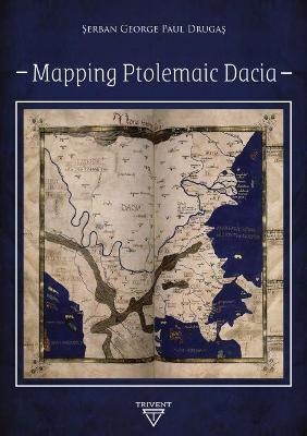
Mapping Ptolemaic Dacia
Trivent Publishing (Verlag)
978-615-81353-6-8 (ISBN)
- Keine Verlagsinformationen verfügbar
- Artikel merken
This is a contribution to the decipherment of Ptolemy's universal map, with focus on the territory known as Dacia. The information provided by Ptolemy was translated into modern data considering local features and complying with certain general principles. The difficulty of this task consisted in the way the ancient manuscripts transmitted the original location coordinates, as well as in the way Ptolemy patched together information from ancient itineraries and other sources.
The author of this volume conceived a general formula for mapping Dacia based on the information found in the two oldest sources he used. Furthermore, he determined local patterns with the help of the other sources – therefore, defining locations resulted in a better determination of the surrounding relative positions. This information, as well as the correlation of the Ptolemaic locations with archaeological findings, provides an increased recognition of Ptolemaic Dacia, while also contributing to exposing the Ptolemaic universal map.
?erban George Paul Druga? holds a doctoral degree from the "Lucian Blaga" University of Sibiu (Romania), for a study on anthropology in religious and scientific thought. He has published several studies on theology and history, including a few on Dacian history. ?erban is a member of the Balkan History Association (BHA) and a collaborator of the Hiperboreea Journal, the biannual publication of the BHA.
Introduction
CHAPTER 1. General Ptolemaic Principles
CHAPTER 2. Ptolemaic and Modern Earth Models. Initial Methodological Framework
CHAPTER 3. Ptolemaic Poleis and Places in Dacia and in Adjacent areas. What We Know
CHAPTER 4. Establishing Local Working Algorithms
CHAPTER 5. Calculating the Coordinates of Some Dacian Poleis from the Established Grid
CHAPTER 6. A Synthesis on the Local Ptolemaic Patterns in Dacia
CHAPTER 7. SWOT Analysis
CHAPTER 8. Limits, Rivers, Tribes and Neighbours of Ptolemaic Dacia
Conclusive remarks
Bibliography
List of Figures
List of Tables
Index
| Erscheint lt. Verlag | 28.2.2020 |
|---|---|
| Zusatzinfo | 62 illustrations |
| Sprache | englisch |
| Maße | 148 x 210 mm |
| Themenwelt | Geisteswissenschaften ► Archäologie |
| Geschichte ► Allgemeine Geschichte ► Vor- und Frühgeschichte | |
| Geschichte ► Allgemeine Geschichte ► Altertum / Antike | |
| Geisteswissenschaften ► Geschichte ► Teilgebiete der Geschichte | |
| ISBN-10 | 615-81353-6-4 / 6158135364 |
| ISBN-13 | 978-615-81353-6-8 / 9786158135368 |
| Zustand | Neuware |
| Haben Sie eine Frage zum Produkt? |
aus dem Bereich


