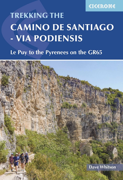
Camino de Santiago - Via Podiensis
Cicerone Press (Verlag)
978-1-78631-102-3 (ISBN)
A guidebook to walking the Via Podiensis (GR65) pilgrimage route, the major French variant of the Camino de Santiago or Way of St James. The route covers 735km (457 miles) through southern France from Le Puy-en-Velay to Saint-Jean-Pied-de-Port, where walkers can connect to the Camino Frances to continue to Santiago de Compostela. The trail takes 4–6 weeks to hike and is suitable for any reasonably fit walker.
The route is described from north to south in 28 stages, each between 16 and 35km (10–22 miles) in length. Two major variants, the Célé Valley (GR651) and Rocamadour (GR6 and GR46), are also detailed as well as routes connecting to the Camino del Norte.
1:100,000 mapping plus larger-scale urban maps for key locations
GPX files available to download
Handy stage planning tables and pilgrim lodging listings help you plan your itinerary
Detailed information about refreshments and facilities along the route
Advice on planning and preparation
Dave Whitson is a high school History teacher in Portland, Oregon and a graduate of the University of Washington. He made his first pilgrimage in 2002 on the Camino Francés and was inspired to return with a group of his high school students, which he did in 2004. He has led seven student pilgrimage trips, including five on the Camino de Santiago.
Overview map of the Via Podiensis
Route summary tables
Map key
Introduction
The stories of St James and St Roch
The Via Podiensis: yesterday and today
Regions encountered along the route
A turbulent history
Planning your walk
Choosing your route
When to go
Preparation and planning
Being a pilgrim
Getting there and back
Where to stay
Tips for making the most of your walk
What to pack
Food and drink
Postal services and baggage transportation
Telephones and internet
Other local facilities
How to use this guide
Route descriptions
Route summary information
Walking directions and waymarking
Municipality information headings
Accommodation listings
Elevation profiles
Maps
GPX tracks
Planning tools
The Via Podiensis
Stage 1 Le Puy-en-Velay to Montbonnet
Stage 2 Montbonnet to Saugues
Stage 3 Saugues to Domaine du Sauvage
Stage 4 Domaine du Sauvage to Aumont-Aubrac
Stage 5 Aumont-Aubrac to Nasbinals
Stage 6 Nasbinals to Saint-Côme-d'Olt
Stage 7 Saint-Come-d'Ôlt to Estaing
Stage 8 Estaing to Conques
Stage 9 Conques to Livinhac-le-Haut
Stage 10 Livinhac-le-Haut to Figeac
Stage 11 Figeac to Cajarc
Stage 12 Cajarc to Varaire
Stage 13 Varaire to Cahors
Stage 14 Cahors to Lascabanes
Stage 15 Lascabanes to Lauzerte
Stage 16 Lauzerte to Moissac
Stage 17 Moissac to Auvillar
Stage 18 Auvillar to Lectoure
Stage 19 Lectoure to Condom
Stage 20 Condom to Éauze
Stage 21 Éauze to Nogaro
Stage 22 Nogaro to Aire-sur-l'Adour
Stage 23 Aire-sur-l'Adour to Arzacq-Arraziguet
Stage 24 Arzacq-Arraziguet to Arthez-de-B&##xe9;arn
Stage 25 Arthez-de-B&##xe9;arn to Navarrenx
Stage 26 Navarrenx to Aroue
Stage 27 Aroue to Ostabat-Asme
Stage 28 Ostabat-Asme to Saint-Jean-Pied-de-Port
C&##xe9;l&##xe9; Valley variant
Stage C1 Figeac to Espagnac-Sainte-Eulalie
Stage C2 Espagnac-Sainte-Eulalie to Marcilhac-sur-C&##xe9;l&##xe9;
Stage C3 Marcilhac-sur-C&##xe9;l&##xe9; to Cabrerets
Stage C4 Cabrerets to Saint-Cirq-Lapopie
Stage C5 Saint-Cirq-Lapopie to Cahors
Rocamadour variant
Stage R1 Figeac to Lacapelle-Marival
Stage R2 Lacapelle-Marival to Gramat
Stage R3 Gramat to Rocamadour
Stage R4 Rocamadour to Labastide-Murat
Stage R5 Labastide-Murat to Vers
Stage R6 Vers to Cahors
Connecting to the Camino del Norte
The GR10
The Voie Nive Bidassoa
Appendix A Stage planning tables
Appendix B Useful sources of information
Appendix C English-French glossary
Appendix D Suggestions for further reading
Appendix E Major festivals along the way
| Erscheinungsdatum | 12.07.2022 |
|---|---|
| Reihe/Serie | Cicerone guidebooks |
| Verlagsort | Kendal |
| Sprache | englisch |
| Maße | 116 x 172 mm |
| Gewicht | 340 g |
| Themenwelt | Sachbuch/Ratgeber ► Sport |
| Reiseführer ► Europa ► Frankreich | |
| Reisen ► Sport- / Aktivreisen ► Europa | |
| Geisteswissenschaften ► Religion / Theologie | |
| ISBN-10 | 1-78631-102-X / 178631102X |
| ISBN-13 | 978-1-78631-102-3 / 9781786311023 |
| Zustand | Neuware |
| Haben Sie eine Frage zum Produkt? |
aus dem Bereich


