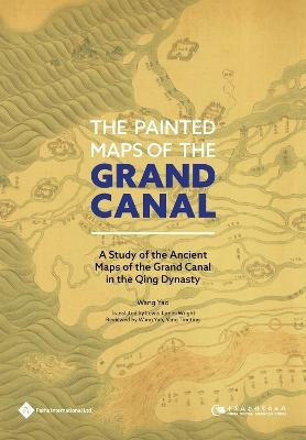
The Painted Maps of the Grand Canal
Paths Publishing Group (Verlag)
978-1-84464-595-4 (ISBN)
Wang Yao graduated from Peking University as a master, and he graduated from the Graduate School of Chinese Academy of Social Sciences, Institute of Chinese Borderland Studies as a PhD. He worked in the Dongcheng District Government in Beijing. He's now an assistant Professor of Xinjiang Research office, Institute of Ethnology and Anthropology, Chinese Academy of Social Sciences. His major is Chinese borderland studies. His special interests are historical geography of Xinjiang in Qing Dynasty (mainly the urban history, the route between Xinjiang and Central Asia. etc), the Chinese ancient maps (mainly including the ancient maps of Xinjiang, the ancient maps of the Grand Canal, the coastal ancient maps .etc) and water conservancy history (mainly including the Grand Canal, the Yellow River and the Hongze Lake. etc). He has published about 20 papers in various journals.
Content Grand Canal
Introduction
1. The Undervalued Charm of Ancient Chinese Maps
2. Results of Existing Research
3. Content and Framework of Research
Chapter One?Pearls in the Ocean: the Production and Preservation of Maps of the Grand Canal in the Qing Dynasty
1. Major Archives in China and Abroad and the Distribution of Grand Canal Maps
2. Categorization of Maps of the Grand Canal
3. Artistic Techniques and Formatting of Maps of the Grand Canal
4. Purposes and Academic Value of Maps of the Grand Canal
Chapter Two History in Illustration: Identifying the Temporal Characteristics of Canal Maps in the Qing Dynasty
1. Maps of the Grand Canal from the Reign of Emperor Kangxi
2. Maps of the Grand Canal from the Reign of Emperor Qianlong
3. Maps of the Grand Canal from the Reigns of Emperors Jiaqing and Daoguang until the 5th Year of Emperor Xianfeng’s Reign
4. Maps of the Grand Canal from the 5th Year of Emperor Xianfeng’s Reign until the End of Emperor Xuantong’s Reign
5. Summary
Chapter Three A Portrait of the Land: Different
Spatial Narratives in Maps of the Grand Canal
1. The Jiangnan Canal Network and Liyun Channel
2. The Zhong Channel and Segments of the Canal in Shandong Province
3. Southern Canal Network, Northern Canal Network and the Tonghui Channel
4. Summary
Chapter Four A Different Kind of Map: Assessment
Plans and Maps of Grain Transportation Routes from Qing Dynasty
1. Content of Canal Consulting and Assessment Plans
2. Characterisitics and Background of Canal Assessment Maps
3. Sources and Circulation of some Canal Assessment Maps
4. Contents and Characteristics of Grain Transportation Maps
Chapter Five A Vast Enterprise: Maps of Canal Conservancy Projects and the State of Canal Administration during the Qing Dynasty
1. Complete Map of the Grand Canal and Southern Inspection Tour of Emperor Kangxi
2. Maps of Sluices and Dams in the Lower Reaches of the Yellow River During the Qianlong’s Reign and the Administration of Rivers and Canals in Qingkou Area in Kangxi’s Reign
3. Maps of the Grand Canal that Accompanied Memorials to the Grand Council and the Administration of Rivers and Canals in Qingkou Area in Qianlong’s reign
4. Illustrated Guide to Sluices and Reservoirs in the Yellow River Basin and Southern Canal Networkand the Zhong Channel Administration in Qianlong’s reign
5. Complete Map of the Grand Canal in Shandong and the Administration of Canal in Shandong in Emperor Guangxu’s Reign
Conclusion
Appendix
Bibliography
| Erscheinungsdatum | 02.10.2020 |
|---|---|
| Übersetzer | Lewis James Wright |
| Sprache | englisch |
| Maße | 170 x 246 mm |
| Gewicht | 333 g |
| Themenwelt | Natur / Technik ► Fahrzeuge / Flugzeuge / Schiffe ► Schiffe |
| Geisteswissenschaften ► Geschichte ► Hilfswissenschaften | |
| Geisteswissenschaften ► Geschichte ► Regional- / Ländergeschichte | |
| ISBN-10 | 1-84464-595-9 / 1844645959 |
| ISBN-13 | 978-1-84464-595-4 / 9781844645954 |
| Zustand | Neuware |
| Haben Sie eine Frage zum Produkt? |
aus dem Bereich


