


Philip's World Flags Wall Map
2003
Philip's (Verlag)
978-0-540-08316-9 (ISBN)
Philip's (Verlag)
978-0-540-08316-9 (ISBN)
- Titel ist leider vergriffen;
keine Neuauflage - Artikel merken
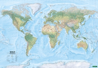
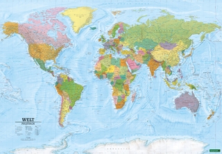
Created from the latest digital cartography, this wall chart features a coloured large-scale map of the world in political colouration and with clear lettering. Beneath the map are a series of country-by-country world flags, in alphabetical order, from Afghanistan to Zimbabwe.
Created from the latest digital cartography, this wall chart features a coloured large-scale map of the world in political colouration with clear lettering and symbols for easy reference. Countries are picked out in distinctive colours to aid identification, with town and city names clearly shown. Beneath the map are a series of country-by-country world flags, in alphabetical order, from Afghanistan to Zimbabwe. The map would be suitable for mounting on a bedroom wall or in a classroom or an office.
Created from the latest digital cartography, this wall chart features a coloured large-scale map of the world in political colouration with clear lettering and symbols for easy reference. Countries are picked out in distinctive colours to aid identification, with town and city names clearly shown. Beneath the map are a series of country-by-country world flags, in alphabetical order, from Afghanistan to Zimbabwe. The map would be suitable for mounting on a bedroom wall or in a classroom or an office.
| Erscheint lt. Verlag | 17.3.2003 |
|---|---|
| Zusatzinfo | Col.M. |
| Verlagsort | London |
| Sprache | englisch |
| Maße | 1070 x 770 mm |
| Gewicht | 175 g |
| Themenwelt | Reisen ► Karten / Stadtpläne / Atlanten ► Welt / Arktis / Antarktis |
| Geisteswissenschaften ► Geschichte ► Hilfswissenschaften | |
| ISBN-10 | 0-540-08316-X / 054008316X |
| ISBN-13 | 978-0-540-08316-9 / 9780540083169 |
| Zustand | Neuware |
| Informationen gemäß Produktsicherheitsverordnung (GPSR) | |
| Haben Sie eine Frage zum Produkt? |
Mehr entdecken
aus dem Bereich

aus dem Bereich
Karte (plano) (2025)
Freytag-Berndt und ARTARIA (Verlag)
689,90 €
Karte (plano) (2025)
Freytag-Berndt und ARTARIA (Verlag)
689,90 €