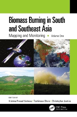
Biomass Burning in South and Southeast Asia
CRC Press (Verlag)
978-1-032-01351-0 (ISBN)
Volume 1 of a two volume set, this book is a self-contained, state-of-the-art analysis of remote sensing, ground-based, and spatial techniques used for characterizing biomass burning events and pollution. It is a collective achievement of renowned scientists working throughout South and Southeast Asia. They discuss the complexity of vegetation patterns, biomass characteristics, fire distribution, drivers of fires, and several examples of the use of novel satellite algorithms for mapping and monitoring biomass burning events. The book is highly interdisciplinary and integrates earth science and environmental science including ecology, fire science, spatial geography, remote sensing, and geospatial technologies.
Unique in its discussion of the sources and the causes of biomass burning and atmospheric research in South and Southeast Asia.
Explains how remote sensing and geospatial technologies help the mapping and monitoring of biomass burning events and their impacts.
Focuses on large spatial scales integrating top-down and bottom-up methodologies.
Addresses the pressing issues of environmental pollution that are rampant in South and Southeast Asia.
Includes contributions from global experts actually working on biomass burning projects in the US, Japan, South/Southeast Asia, and Europe.
This book will serve as a valuable source of information for remote sensing scientists, geographers, ecologists, atmospheric scientists, environmental scientists, and all who wish to advance their knowledge on fires and biomass burning in South/Southeast Asia.
Krishna Prasad Vadrevu is a scientist at the NASA Marshall Space Flight Center, Huntsville, Alabama. His current research is on remote sensing of land cover and land use change (LCLUC). He has 17 years of research experience and is interested in land-atmosphere interactions. He also serves as the lead scientist for NASA South/Southeast Research Initiative and coordinator for the NASA LCLUC program. Toshimasa Ohara is a scientist at National Institute of Environmental Studies, Tsukuba, Japan. He has 32 years of research experience in air quality modeling, emission inventories, and pollution research. He is a lead developer for Regional Emission Inventory in Asia (REAS) and currently interested in linking top-down and bottom-up approaches for emissions quantification. Christopher Justice is a full professor at the Department of Geographical Sciences, University of Maryland, College Park. He has 38 years of research experience in remote sensing. His current research is on land cover and land use change, global fire, and global agricultural monitoring systems, all using remote sensing. He is the NASA LCLUC program scientist, member of MODIS science team, and global implementation lead for the GEO Global Agricultural Monitoring Task. He is also co-director for the center of Global Agricultural Monitoring and Research.
Chapter 1 Biomass Burning in South/Southeast Asia ・ Needs and Priorities [Krishna Prasad Vadrevu, Toshimasa Ohara, and Christopher Justice] Section I Mapping and Monitoring of Fires, including Burned Areas Chapter 2 Identification of Smoldering Peatland Fires in Indonesia via Triple-Phase Temperature Analysis of VIIRS Nighttime Data [Christopher D. Elvidge, Mikhail Zhizhin, Kimberly Baugh, and Feng-Chi Hsu] Chapter 3 Evaluation of Sentinel-3 SLSTR Data for Mapping Fires in Forests, Peatlands, and Croplands ・ A Case Study over Australia, Indonesia, and India [Aditya Eaturu and Krishna Prasad Vadrevu] Chapter 4 An Assessment of Burnt Area Signal Variations in Laos Using Sentinel-1A&B Datasets [Krishna Prasad Vadrevu, Aditya Eaturu, Sumalika Biswas, and Chittana Phompila] Chapter 5 Peatland Surface Loss due to Fires in Central Kalimantan, Indonesia ・ A Case Study Using Differential Interferometry SAR (DInSAR) [Yessy Arvelyna, Hidenori Takahashi, Lies Indrayanti, Hiroshi Hayasaka, Krishna Prasad Vadrevu, Retno Maryani, Mitsuru Osaki, and Hirose Kazuyo] Chapter 6 Burnt Area Mapping in Nainital, Uttarakhand, India, Using Very High-Resolution PlanetScope Imagery [Krishna Prasad Vadrevu, Aditya Eaturu, and Sumalika Biswas] Chapter 7 Investigations on Land and Forest Fires in the North Indian Region over a Decade [Narendra Singh and Ashish Kumar] Chapter 8 Spatial Point Patterns and Scale Analysis of Vegetation Fires in Laos and Cambodia [Krishna Prasad Vadrevu, Sumalika Biswas, and Aditya Eaturu] Section II Land Use, Forests, and Biomass Burning Chapter 9 Vegetation Fire Status and Management in Bhutan [Pankaj Thapa, Krishna Prasad Vadrevu, Aditya Eaturu, and Sumalika Biswas] Chapter 10 Biomass Burning in Malaysia: Sources and Impacts [Justin Sentian, Franky Herman, Vivian Kong Wan Yee, Carolyn Melissa Payus, and Mohd Sharul Mohd Nadzir] Chapter 11 Swidden Agriculture and Biomass Burning in the Philippines [Gay J. Perez, Josefino C. Comiso, and Mylene G. Cayetano] Section III Climate Drivers and Biomass Burning Chapter 12 Fire Danger Indices and Methods: An Appraisal [Krishna Prasad Vadrevu] Chapter 13 Air Pollution Conditions near Peat Fire-Prone Areas during El Nino in Central Kalimantan, Indonesia [Hiroshi Hayasaka, Alpon Sepriando, Aswin Usup, and Naito Daisuke] Chapter 14 Biomass Burning and Haze in Indonesia, Long-Term Climate Perspective, and Impact on Regional Air Quality [Sheila Dewi Ayu Kusumaningtyas, Edvin Aldrian, Sunaryo Sunaryo, and Roni Kurniawan] Chapter 15 Meteorological Drivers of Anomalous Wildfire Activity in the Western Ghats, India [Narendran Kodandapani] Chapter 16 Geochemical Evidence for Biomass Burning Signals on Tibetan Glaciers [Chao You and Chao Xu]
| Erscheinungsdatum | 02.02.2024 |
|---|---|
| Zusatzinfo | 26 Tables, black and white; 36 Line drawings, color; 71 Halftones, color; 107 Illustrations, color |
| Verlagsort | London |
| Sprache | englisch |
| Maße | 156 x 234 mm |
| Gewicht | 453 g |
| Themenwelt | Naturwissenschaften ► Geowissenschaften ► Geografie / Kartografie |
| Naturwissenschaften ► Physik / Astronomie ► Angewandte Physik | |
| Technik ► Bauwesen | |
| Technik ► Umwelttechnik / Biotechnologie | |
| ISBN-10 | 1-032-01351-6 / 1032013516 |
| ISBN-13 | 978-1-032-01351-0 / 9781032013510 |
| Zustand | Neuware |
| Informationen gemäß Produktsicherheitsverordnung (GPSR) | |
| Haben Sie eine Frage zum Produkt? |
aus dem Bereich


