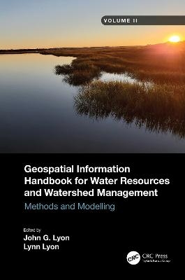
Geospatial Information Handbook for Water Resources and Watershed Management, Volume II
CRC Press (Verlag)
978-1-032-00649-9 (ISBN)
- Titel z.Zt. nicht lieferbar
- Versandkostenfrei innerhalb Deutschlands
- Auch auf Rechnung
- Verfügbarkeit in der Filiale vor Ort prüfen
- Artikel merken
Volume II of Geospatial Information Handbook for Water Resources and Watershed Management discusses Geospatial Technology (GT) approaches using integrated modeling as applied to advanced water resource assessments. Features include multiple date land cover analyses as change in land cover influences water quality, model sensitivity analyses of DEM resolution and influences on modeling water characteristics like Manning’s n, development of seabed cover classification and sensitivity, and forecasting urban growth over time with climate vulnerability impacts on water. A detailed case study presents a range of water quality issues, all effectively demonstrating GT inputs to water quality studies from headwaters to receiving estuarine waters. Also analyzed are the comparison of evapotranspiration simulation performance by APEX model in dryland and irrigated cropping systems and perspectives on the future of transient storage modeling.
Captures advanced technologies and applications for implementation with models to address a broad spectrum of water issues
Provides real-world applications and case studies using advanced spectral and spatial sensors combined with geospatially facilitated water process models
Features a Neuse River Basin case study integrating hydrologic methods and modeling along with remote sensing and GIS technologies for nonpoint source water quality evaluations
Global coverage with applications demonstrated by more than 170 experts from around the world
This handbook is a wide-ranging and contemporary reference of advanced geospatial techniques used in numerous practical applications at the local and regional scale and is an in-depth resource for professionals and the water research community worldwide.
Over the years John and Lynn Lyon have worked on water issues with great interest and heart. A hallmark of their scholarship has been helping others with scientific authorship. Books are a great way to capture thoughts and methods making them accessible to others worldwide. In that vein here they have advanced a whole cadre of thought leaders with a broad focus on water. Whether local, regional, continental, or global scale water issues unite passions. Part of the challenge is the breadth and complexity of water. If many people take a piece the whole society can fashion sustainable outcomes. The Handbook is focused on presenting a number of ways to facilitate these thoughtful contributions. John earned his Doctorate at the University of Michigan and Lynn earned her Master’s Degree at Ohio State University.
1. Introduction to Volume II and Neuse River Watershed and Water Quality Case Study, 2. Neuse Case Study and Water Quality–Related Methods, 3. Virtual Field Reference Database for Assessment of Land Cover Data and Variability, 4. Vegetation Dynamics and Identification of Land Cover Change in a Complex Land Use Community, 5. Land-Cover Change Detection Using Multi-Temporal MODIS NDVI Data, 6. Spectral and GIS Rule-Based Land-Cover Classification in the Neuse River, 7. Modeling the Distribution of Diffuse Nitrogen Sources and Sinks in the Neuse River Basin, 8. Monitoring of Water Colorants Using AVIRIS Hyperspectral Sensing, 9. DEM Resolution and Roughness Effect in Relation to Model Performance, 10. Application of Densely Stacked Satellite Image Classification and Multinomial Logistic Regression Analysis in Predicting Urban Sprawl, 11. A Feasibility Study of Seabed Cover Classification Standards
| Erscheinungsdatum | 24.11.2022 |
|---|---|
| Zusatzinfo | 68 Tables, black and white; 20 Line drawings, color; 27 Line drawings, black and white; 8 Halftones, color; 6 Halftones, black and white; 28 Illustrations, color; 33 Illustrations, black and white |
| Verlagsort | London |
| Sprache | englisch |
| Maße | 156 x 234 mm |
| Gewicht | 1140 g |
| Themenwelt | Technik ► Bauwesen |
| Technik ► Umwelttechnik / Biotechnologie | |
| Weitere Fachgebiete ► Land- / Forstwirtschaft / Fischerei | |
| ISBN-10 | 1-032-00649-8 / 1032006498 |
| ISBN-13 | 978-1-032-00649-9 / 9781032006499 |
| Zustand | Neuware |
| Haben Sie eine Frage zum Produkt? |
aus dem Bereich


