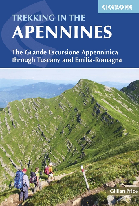
Trekking in the Apennines
Cicerone Press (Verlag)
978-1-85284-766-1 (ISBN)
A guidebook to trekking the Grande Escursione Appenninica (GEA), a 400km waymarked trail through Italy’s Appenine mountains. Extending from Bocca Trabaria to Passo Due Santi through the regions of Tuscany and Emilia-Romagna, the route is straightforward and suitable for a broad range of trekkers, with walking on paths, forestry tracks and quiet lanes.
The GEA is presented in 23 day stages, graded by difficulty, of between 8 and 25km, with accommodation available at each stage end (though camping is also possible on some stages). With convenient access by public transport, it is also easy to walk a shorter section of the route.
Route description illustrated with sketch mapping and elevation profiles
Comprehensive notes on accommodation and facilities
Peaks including Monte Prado (the highest peak in Tuscany)
Advice on preparation and planning
Sized to easily fit in a jacket pocket
Gillian Price was born in England but has lived in Venice for many years. Gillian has steadily explored the mountain ranges of Italy and Corsica, and brought them to life for visitors in a series of outstanding guides for Cicerone. She is an active member of the Italian Alpine Club (CAI) and Mountain Wilderness.
Contents
Map key
Overview map
Introduction
The GEA trek
The Apennines
Highlights and short walks
Plants and flowers
Animal life
Getting there
Local transport
Tourist information
When to go
Accommodation
Food and drink
What to take
Maps
Emergencies
How to use this guide
Dos and don'ts
Background reading
The GEA
Stage 1 Bocca Trabaria to Passo di Viamaggio
Stage 2 Passo di Viamaggio to Caprese Michelangelo
Stage 3 Caprese Michelangelo to La Verna
Stage 4 La Verna to Badia Prataglia
Stage 5 Badia Prataglia to Rifugio Citt&##xe0; di Forlì
Stage 6 Rifugio Citt&##xe0; di Forlì to Passo del Muraglione
Stage 7 Passo del Muraglione to Colla di Casaglia
Stage 8 Colla di Casaglia to Badia Moscheta
Stage 9 Badia Moscheta to Passo del Giogo
Stage 10 Passo del Giogo to Passo della Futa
Stage 11 Passo della Futa to Montepiano
Stage 12 Montepiano to Rifugio Pacini
Stage 13 Rifugio Pacini to Pracchia
Stage 14 Pracchia to Lago Scaffaiolo
Stage 15 Lago Scaffaiolo to Boscolungo
Stage 16 Boscolungo to Lago Santo Modenese
Stage 17 Lago Santo Modenese to Passo delle Radici
Stage 18 Passo delle Radici to Passo di Pradarena
Stage 19 Passo di Pradarena to Passo del Cerreto
Stage 20 Passo del Cerreto to Prato Spilla
Stage 21 Prato Spilla to Lago Santo Parmense
Stage 22 Lago Santo Parmense to Passo della Cisa
Stage 23 Passo della Cisa to Passo dei Due Santi
Appendix A Route summary
Appendix B Italian-English glossary
Appendix C Useful contacts
| Erscheint lt. Verlag | 15.1.2016 |
|---|---|
| Reihe/Serie | Cicerone guidebooks |
| Zusatzinfo | 83 colour photos 37 maps |
| Verlagsort | Kendal |
| Sprache | englisch |
| Maße | 116 x 172 mm |
| Gewicht | 180 g |
| Themenwelt | Sachbuch/Ratgeber ► Sport |
| Reiseführer ► Europa ► Italien | |
| Reisen ► Sport- / Aktivreisen ► Europa | |
| ISBN-10 | 1-85284-766-2 / 1852847662 |
| ISBN-13 | 978-1-85284-766-1 / 9781852847661 |
| Zustand | Neuware |
| Haben Sie eine Frage zum Produkt? |


