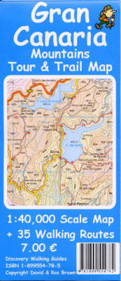
Gran Canaria Mountains Tour and Trail Map
2002
Discovery Walking Guides Ltd (Verlag)
978-1-899554-78-2 (ISBN)
Discovery Walking Guides Ltd (Verlag)
978-1-899554-78-2 (ISBN)
- Titel ist leider vergriffen;
keine Neuauflage - Artikel merken
Provides a detailed 1:40,000 scale map of the Central Mountains region of Gran Canaria. The Navigation grid and datum information mean this map is GPS enabled allowing you to use modern GPS, or traditional 'map & compass', navigation.
A massively detailed 1:40,000 scale map of the Central Mountains region of Gran Canaria. Navigation grid and datum information mean this map is GPS enabled allowing you to use modern GPS, or traditional 'map & compass', navigation. On the reverse of the map are 35 walking routes, described with their GPS Waypoints (actual grid references for compass users), ranging from straightforward up to experienced levels of walking ability. All 35 routes are graded for difficulty, time, distance, ascents & descents; and each route is clearly highlighted on the map sheet. "Gran Canaria Mountains Tour & Trail Map" is the essential purchase for everyone seeking to explore this exciting region of one of the most beautiful Canary Islands.
A massively detailed 1:40,000 scale map of the Central Mountains region of Gran Canaria. Navigation grid and datum information mean this map is GPS enabled allowing you to use modern GPS, or traditional 'map & compass', navigation. On the reverse of the map are 35 walking routes, described with their GPS Waypoints (actual grid references for compass users), ranging from straightforward up to experienced levels of walking ability. All 35 routes are graded for difficulty, time, distance, ascents & descents; and each route is clearly highlighted on the map sheet. "Gran Canaria Mountains Tour & Trail Map" is the essential purchase for everyone seeking to explore this exciting region of one of the most beautiful Canary Islands.
| Erscheint lt. Verlag | 11.3.2002 |
|---|---|
| Reihe/Serie | Tour & Trail Maps |
| Verlagsort | Northampton |
| Sprache | englisch |
| Maße | 140 x 240 mm |
| Gewicht | 90 g |
| Themenwelt | Sachbuch/Ratgeber ► Sport |
| Reisen ► Karten / Stadtpläne / Atlanten ► Europa | |
| Reisen ► Karten / Stadtpläne / Atlanten ► Welt / Arktis / Antarktis | |
| ISBN-10 | 1-899554-78-5 / 1899554785 |
| ISBN-13 | 978-1-899554-78-2 / 9781899554782 |
| Zustand | Neuware |
| Haben Sie eine Frage zum Produkt? |
Mehr entdecken
aus dem Bereich
aus dem Bereich
Straßen- und Freizeitkarte 1:250.000
Karte (gefalzt) (2023)
Freytag-Berndt und ARTARIA (Verlag)
12,90 €
Karte (gefalzt) (2023)
Freytag-Berndt und ARTARIA (Verlag)
12,90 €
Östersund
Karte (gefalzt) (2023)
Freytag-Berndt und ARTARIA (Verlag)
12,90 €


