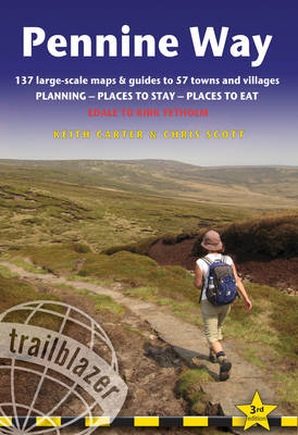
Pennine Way
Edale to Kirk Yetholm
Seiten
2011
|
3rd Revised edition
Trailblazer Publications (Verlag)
978-1-905864-34-8 (ISBN)
Trailblazer Publications (Verlag)
978-1-905864-34-8 (ISBN)
- Titel erscheint in neuer Auflage
- Artikel merken
Zu diesem Artikel existiert eine Nachauflage
Practical guide with 137 large scale maps (1:20,000). Includes accommodation guide, pubs and restaurants and public transport information. Britain's best-known National Trail winds for 256 miles through three National Parks - the Peak District, Yorkshire Dales and Northumberland.
Practical guide with 137 large scale maps (1:20,000). Includes accommodation guide, pubs and restaurants and public transport information. Britain's best-known National Trail winds for 256 miles through three National Parks ��� the Peak District, Yorkshire Dales and Northumberland. This superb footpath showcases Britain's finest upland scenery, while touching the literary landscape of the Bronte family and Roman history along Hadrian's Wall. The guide includes: 137 large-scale walking maps; itineraries for all walkers; practical information for all budgets - guides to 57 towns and villages showing where to stay, where to eat, what to see, plus detailed street plans; comprehensive public transport information; flora and fauna ��� four page full colour flower guide, plus an illustrated section on local wildlife; green hiking; and GPS waypoints.
Practical guide with 137 large scale maps (1:20,000). Includes accommodation guide, pubs and restaurants and public transport information. Britain's best-known National Trail winds for 256 miles through three National Parks ��� the Peak District, Yorkshire Dales and Northumberland. This superb footpath showcases Britain's finest upland scenery, while touching the literary landscape of the Bronte family and Roman history along Hadrian's Wall. The guide includes: 137 large-scale walking maps; itineraries for all walkers; practical information for all budgets - guides to 57 towns and villages showing where to stay, where to eat, what to see, plus detailed street plans; comprehensive public transport information; flora and fauna ��� four page full colour flower guide, plus an illustrated section on local wildlife; green hiking; and GPS waypoints.
Keith Carter has over 40 years' experience of hiking Britain's long-distance paths with numerous magazine articles published on the subject.
| Erscheint lt. Verlag | 28.4.2011 |
|---|---|
| Reihe/Serie | British Walking Guides |
| Zusatzinfo | Illustrations (chiefly col.), maps (some col.) |
| Verlagsort | Hindhead, Surrey |
| Sprache | englisch |
| Maße | 120 x 180 mm |
| Gewicht | 21 g |
| Themenwelt | Sachbuch/Ratgeber ► Sport |
| Reiseführer ► Europa ► Großbritannien | |
| ISBN-10 | 1-905864-34-5 / 1905864345 |
| ISBN-13 | 978-1-905864-34-8 / 9781905864348 |
| Zustand | Neuware |
| Haben Sie eine Frage zum Produkt? |
Mehr entdecken
aus dem Bereich
aus dem Bereich
individuell reisen mit vielen praktischen Tipps
Buch | Softcover (2024)
Michael Müller (Verlag)
29,90 €


