Builth Wells
1999
|
Revised edition
Ordnance Survey (Verlag)
978-0-319-21812-9 (ISBN)
Ordnance Survey (Verlag)
978-0-319-21812-9 (ISBN)
- Titel ist leider vergriffen;
keine Neuauflage - Artikel merken
Zu diesem Artikel existiert eine Nachauflage
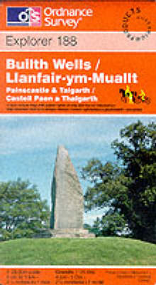
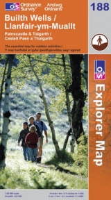
This map is part of the Ordnance Survey's Explorer series designed to replace the old Pathfinder map series. At 1:25,000 scale this detailed map shows a host of attractions including gardens which are open to the public, nature reserves and country parks.
This map is part of the Ordnance Survey's Explorer series designed to replace the old Pathfinder map series. At 1:25,000 scale this detailed map shows a host of attractions including gardens which are open to the public, nature reserves and country parks as well as all official footpaths, bridleways, roads and lanes. Other facilities covered include: camping and caravan sites, picnic areas and viewpoints, selected places of interest, rights of way information for England and Wales, National Trail and Recreational Path routes, and selected tourist information. The main advantages of this map are the geographical design of the sheetlines to capture the best local coverage, and the coverage of a larger area for value for money. The series is aimed mainly at the experienced map user but can be used by tourists and locals alike.
This map is part of the Ordnance Survey's Explorer series designed to replace the old Pathfinder map series. At 1:25,000 scale this detailed map shows a host of attractions including gardens which are open to the public, nature reserves and country parks as well as all official footpaths, bridleways, roads and lanes. Other facilities covered include: camping and caravan sites, picnic areas and viewpoints, selected places of interest, rights of way information for England and Wales, National Trail and Recreational Path routes, and selected tourist information. The main advantages of this map are the geographical design of the sheetlines to capture the best local coverage, and the coverage of a larger area for value for money. The series is aimed mainly at the experienced map user but can be used by tourists and locals alike.
Ordnance Survey is Britain's national mapping agency, responsible for the official, definitive mapping of the whole country. They produce and market a wide range of maps for educational and leisure purposes, as well as producing computer data products for government, business and administrative use.
| Erscheint lt. Verlag | 3.2.1999 |
|---|---|
| Reihe/Serie | Explorer Maps ; Sheet 188 |
| Verlagsort | Hants |
| Sprache | englisch |
| Themenwelt | Sachbuch/Ratgeber ► Sport |
| Reisen ► Karten / Stadtpläne / Atlanten ► Europa | |
| ISBN-10 | 0-319-21812-0 / 0319218120 |
| ISBN-13 | 978-0-319-21812-9 / 9780319218129 |
| Zustand | Neuware |
| Informationen gemäß Produktsicherheitsverordnung (GPSR) | |
| Haben Sie eine Frage zum Produkt? |
Mehr entdecken
aus dem Bereich
aus dem Bereich
Straßen- und Freizeitkarte 1:250.000
Karte (gefalzt) (2023)
Freytag-Berndt und ARTARIA (Verlag)
12,90 €
Baskenland, Navarra, Aragon, Andorra, Katalonien
Karte/Kartografie (2023)
MAIRDUMONT (Verlag)
11,95 €
Karte (gefalzt) (2024)
Freytag-Berndt und ARTARIA (Verlag)
12,90 €


