


2009 Map of France
2008
|
New edition
Collins (Verlag)
978-0-00-728507-5 (ISBN)
Collins (Verlag)
978-0-00-728507-5 (ISBN)
- Titel erscheint in neuer Auflage
- Artikel merken
Zu diesem Artikel existiert eine Nachauflage
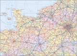
New edition of annually revised, politically coloured map of France. The ideal map for planning and route-finding.
Scale 1 : 1 000000 (1cm to 10 kms / 1 inch to 16miles)
AREA OF COVERAGE
From the Belgian and German borders in the north to the Spanish border in the south, and from the Brest Peninsula in the west to the Italian and Swiss borders in the east. Also includes the island of Corsica.
MAP DETAIL
Politically coloured mapping showing individual Départements by name. Motorways, roads, airports, cities and towns. Motorways and Euroroutes numbered.
INCLUDES
Through-route map of Paris, Lyon, Marseille, Strasbourg, and Toulouse
Distance chart giving distances in kilometres between main towns
Key to Département names and numbers, and list of Regions
Internet links to further information
Map legend in English, French and German
Index to place names
WHO THE PRODUCT IS AIMED AT
Home and business reference users.
| Erscheint lt. Verlag | 6.10.2008 |
|---|---|
| Reihe/Serie | International Road Map |
| Verlagsort | London |
| Sprache | englisch |
| Maße | 140 x 250 mm |
| Gewicht | 131 g |
| Themenwelt | Reisen ► Karten / Stadtpläne / Atlanten ► Europa |
| ISBN-10 | 0-00-728507-8 / 0007285078 |
| ISBN-13 | 978-0-00-728507-5 / 9780007285075 |
| Zustand | Neuware |
| Haben Sie eine Frage zum Produkt? |
Mehr entdecken
aus dem Bereich


aus dem Bereich
Karte (gefalzt) (2023)
Freytag-Berndt und ARTARIA (Verlag)
12,90 €
Straßen- und Freizeitkarte 1:250.000
Karte (gefalzt) (2023)
Freytag-Berndt und ARTARIA (Verlag)
12,90 €
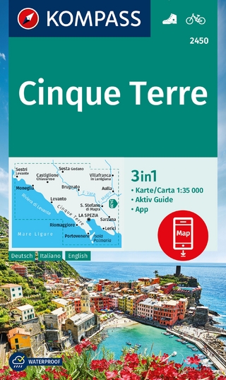
3in1 Wanderkarte : mit Aktiv Guide : inklusive Karte zur offline …
Karte (gefalzt) (2023)
Kompass-Karten (Verlag)
12,95 €