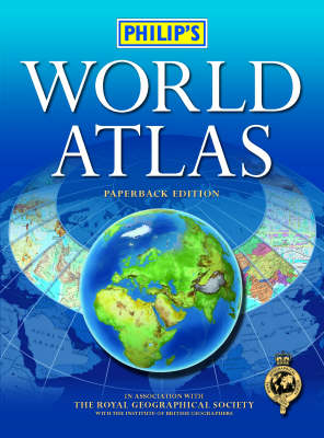
Philip's World Atlas
Paperback Edition
Seiten
2007
Philip's (Verlag)
978-0-540-09011-2 (ISBN)
Philip's (Verlag)
978-0-540-09011-2 (ISBN)
- Titel erscheint in neuer Auflage
- Artikel merken
Zu diesem Artikel existiert eine Nachauflage
Includes 96 pages of authoritative world maps, a comprehensive index, 69 city maps, and a thematic section providing charts, diagrams and data on key geographical topics. This book includes a 48-page 'World Cities' section that provides urban-area and city-center maps marking tourist sites for 69 of the world's most important cities.
This information-packed paperback atlas has been fully revised and updated for 2007-2008. With 96 pages of authoritative world maps, a comprehensive index, 69 city maps, and a thematic section providing charts, diagrams and data on key geographical topics, it is recommended for use in the office, at home or by students.The 96 pages of physical and political maps give a balanced coverage of the world at well-chosen scales. The hill-shading on the physical maps provides an exceptionally vivid portrayal of landforms.The 32-page introductory section - 'The World in Focus' - is invaluable for school project work, containing clear up-to-date maps, graphs and diagrams on the environment, climate and weather, population, resources, economics and energy. The 48-page 'World Cities' section provides urban-area and city-centre maps marking tourist sites for 69 of the world's most important cities, backed up by a comprehensive index. Full-page satellite images for 9 of the cities featured complete this section.Completing the atlas is an extensive 35,000-name index, including geographical features as well as towns and cities, with both letter-figure grid references and latitude and longitude co-ordinates for speed and accuracy of use.
This information-packed paperback atlas has been fully revised and updated for 2007-2008. With 96 pages of authoritative world maps, a comprehensive index, 69 city maps, and a thematic section providing charts, diagrams and data on key geographical topics, it is recommended for use in the office, at home or by students.The 96 pages of physical and political maps give a balanced coverage of the world at well-chosen scales. The hill-shading on the physical maps provides an exceptionally vivid portrayal of landforms.The 32-page introductory section - 'The World in Focus' - is invaluable for school project work, containing clear up-to-date maps, graphs and diagrams on the environment, climate and weather, population, resources, economics and energy. The 48-page 'World Cities' section provides urban-area and city-centre maps marking tourist sites for 69 of the world's most important cities, backed up by a comprehensive index. Full-page satellite images for 9 of the cities featured complete this section.Completing the atlas is an extensive 35,000-name index, including geographical features as well as towns and cities, with both letter-figure grid references and latitude and longitude co-ordinates for speed and accuracy of use.
| Erscheint lt. Verlag | 24.9.2007 |
|---|---|
| Verlagsort | London |
| Sprache | englisch |
| Maße | 230 x 310 mm |
| Gewicht | 1142 g |
| Themenwelt | Reisen ► Karten / Stadtpläne / Atlanten ► Welt / Arktis / Antarktis |
| ISBN-10 | 0-540-09011-5 / 0540090115 |
| ISBN-13 | 978-0-540-09011-2 / 9780540090112 |
| Zustand | Neuware |
| Haben Sie eine Frage zum Produkt? |
Mehr entdecken
aus dem Bereich
aus dem Bereich
mit Fakten und Infos zu allen Kontinenten
Buch | Hardcover (2024)
Kosmos Kartografie in der Franckh-Kosmos Verlags-GmbH & Co. …
24,00 €


