Cayman Islands Wallmap Laminated Edn
Seiten
2007
Macmillan Caribbean
978-1-4050-2521-8 (ISBN)
Macmillan Caribbean
978-1-4050-2521-8 (ISBN)
- Titel ist leider vergriffen;
keine Neuauflage - Artikel merken
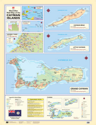
Consists of large-scale maps of Grand Cayman, Cayman Brac and Little Cayman. This title also features a plan of the capital Georgetown and a small thematic map of the major tourist sites. It is durable, finished with a tough wipe-down surface which can be marked with water-based pens and wiped clean.
This wall map consists of large-scale maps of Grand Cayman, Cayman Brac and Little Cayman. Also featured are a plan of the capital Georgetown and a small thematic map of the major tourist sites."Macmillan Caribbean Wall Maps" - These accurate wall maps have been produced using the latest digital cartographic techniques that ensure information is displayed with clarity and precision. The large format, full colour layout and clear labeling make them easy to read from a distance. The laminated editions are supplied with 4 metal corner eyelets for ease of display. It is durable, finished with a tough wipe-down surface which can be marked with water-based pens and wiped clean. Also featured are the national flags, climate charts, fact files giving useful information on the islands and small Caribbean location maps.
This wall map consists of large-scale maps of Grand Cayman, Cayman Brac and Little Cayman. Also featured are a plan of the capital Georgetown and a small thematic map of the major tourist sites."Macmillan Caribbean Wall Maps" - These accurate wall maps have been produced using the latest digital cartographic techniques that ensure information is displayed with clarity and precision. The large format, full colour layout and clear labeling make them easy to read from a distance. The laminated editions are supplied with 4 metal corner eyelets for ease of display. It is durable, finished with a tough wipe-down surface which can be marked with water-based pens and wiped clean. Also featured are the national flags, climate charts, fact files giving useful information on the islands and small Caribbean location maps.
| Erscheint lt. Verlag | 17.1.2007 |
|---|---|
| Verlagsort | Oxford |
| Sprache | englisch |
| Maße | 9 x 47 mm |
| Gewicht | 218 g |
| Themenwelt | Reisen ► Karten / Stadtpläne / Atlanten ► Welt / Arktis / Antarktis |
| ISBN-10 | 1-4050-2521-2 / 1405025212 |
| ISBN-13 | 978-1-4050-2521-8 / 9781405025218 |
| Zustand | Neuware |
| Haben Sie eine Frage zum Produkt? |