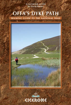
Offa's Dyke Path
Cicerone Press (Verlag)
978-1-85284-549-0 (ISBN)
- Titel erscheint in neuer Auflage
- Artikel merken
The Offas Dyke Path, a 177 mile National Trail, runs along the England / Wales border between Chepstow and Prestatyn. The main route is described in this guide in 15 stages, as are alternative routes which visit places of interest or detour to accommodation, as well as planning information to create flexible itineraries. The route - fully accompanied with OS maps - offers an attractive, and at times demanding, prospect for long-distance walkers as it wanders along the Wye Valley, the Black Mountains, Shropshire Hills and the Clwydian Range. Useful information on parking, maps required, distances, travel and accommodation is all included. Offa's Dyke was constructed by the powerful King of Mercia in the late eighth century to mark out the western boundary of his kingdom. The Offa's Dyke Path follows this centuries-old boundary and encounters, quiet walking, bustling towns (including Oswestry and Hay-on-Wye), gentle countryside, castles and ancient remains along its route, as the Path makes its way through varied, sometimes wild, often remote, and frequently superb scenery.
After a working career in London, David moved to Worcester and explored the Malvern Hills, the Cotswolds and a clutch of hills south of Birmingham as well as the territories of the rivers Severn and Wye which have been pursued from source to sea. A particular interest has been Shropshire and the Welsh Marches in which Offa's Dyke has played an important part. David has had a number of books published, including five by Cicerone, with his wife closely involved in all aspects of his work.
Map: Offa's Dyke Path
Foreword to 2008 Edition
Introduction
Offa's Dyke Path: the Route
Historical Setting
Practical Matters
Maps, Waymarking and Route Description
Changes Along the Dyke
Clothing and Equipment
Accommodation
The Rise and Fall of the Kingdom of Mercia
Offa's Dyke
The Border Today
Other Long-distance Routes
1 Sedbury Cliffs to Monmouth
The Lower Wye Valley
2 Monmouth to Pandy
Sheep Country
3 Pandy to Hay-on-Wye
Crossing the Black Mountains
4 Hay-on-Wye to Kington
In the Steps of the Drovers
5 Kington to Knighton
Back to the Dyke
6 Knighton to Newcastle
Teme to Clun
7 Newcastle to Montgomery
Crossing the Oldest Road
8 Montgomery to Buttington Bridge (for Welshpool)
Over the Long Mountain
9 Welshpool (via Buttington Bridge) to Llanymynech
Waterside Walking
10 Llanymynech to River Morda (for Oswestry)
The Quarry Way
11 Oswestry (via River Morda) to Trevor Rocks (for Llangollen)
The Last of the Dyke
12 Llangollen (via Trevor Rocks) to Pen-y-stryt
Under Eglwyseg Rocks and Over the Moor
13 Pen-y-stryt to Bwlch Penbarra
The Clwydian Range
14 Bwlch Penbarra to Bodfari
Mother of the Mountains
15 Bodfari to Prestatyn
The Last Lap
APPENDIX ONE
Useful Information
Maps
Tourist Information Offices
Travel
Accommodation
Places of Interest
APPENDIX TWO
Mileage Chart
| Erscheint lt. Verlag | 7.5.2013 |
|---|---|
| Zusatzinfo | 85 colour photos and 55 OS map extracts |
| Verlagsort | Kendal |
| Sprache | englisch |
| Maße | 116 x 172 mm |
| Gewicht | 380 g |
| Themenwelt | Sachbuch/Ratgeber ► Sport |
| Reiseführer ► Europa ► Großbritannien | |
| ISBN-10 | 1-85284-549-X / 185284549X |
| ISBN-13 | 978-1-85284-549-0 / 9781852845490 |
| Zustand | Neuware |
| Haben Sie eine Frage zum Produkt? |
aus dem Bereich


