Walking in Kent
Cicerone Press (Verlag)
978-1-85284-462-2 (ISBN)
- Titel erscheint in neuer Auflage
- Artikel merken
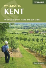
Walking in Kent describes 40 circular day walks in the Garden of England selected by Kev Reynolds. This guidebook includes the best routes from the previous two volumes (now out of print), as well as recently discovered routes in all corners of the county. There's plenty to appeal to both family strollers and determined ramblers, and each route has been rewalked by the author and carefully revised. Come walking in Kent and you'll discover some of Britain's finest non-mountain landscapes, as well as hidden architectural treasures and historic villages. But best of all, there is the surprise of long unhindered views and big skies over Kent, where Britain begins. The guide includes: 40 walks, with variations; easy-to-follow route descriptions; OS map extracts; background information; and full colour illustrations.
Kev Reynolds, author of this guide, is a freelance writer, photojournalist and lecturer. A prolific compiler of guidebooks, his first title for Cicerone Press (Walks & Climbs in the Pyrenees) appeared in 1978; he has since produced 27 titles for the same publisher, with others being researched at present. A member of the Outdoor Writers' Guild, the Alpine Club and Austrian Alpine Club, his passion for mountains and the countryside remains undiminished after a lifetime's activity, and he regularly travels throughout Britain to share that enthusiasm through his lectures.
Preface
Introduction
Kent - A Walker's County
Notes for Walkers
Using the Guide
The Country Code
The Walks
West Kent and The Weald
1 Lullingstone Park - Shoreham - Lullingstone Park
2 Shoreham - Romney Street - Shoreham
3 Westerham - French Street - Chartwell - Westerham
4 Crockham Hill - Toys Hill - Obriss - Crockham Hill
5 Toys Hill - Ide Hill - Crockham Hill - French Street - Toys Hill
6 Ide Hill - Manor Farm - Ide Hill
7 Sevenoaks Weald - Boarhill - Sevenoaks Weald
8 Shipbourne - Underriver - Ightham Mote - Shipbourne
9 Four Elms - Winkhurst Green - Bough Beech - Four Elms
10 Marsh Green - Crippenden Manor - Marsh Green
11 Cowden - Horseshoe Green - Bassett's Farm - Cowden
12 Cowden - Hoath Corner - Cowden
13 Chiddingstone - Penshurst - Chiddingstone
14 Penshurst - Salmans - Nashes Farm - Penshurst
15 Penshurst - Fordcombe - Penshurst
16 Groombridge - Speldhurst - Groombridge
17 Brenchley - Matfield - Brenchley
18 Yalding - Hunton - Buston Manor - Yalding
19 Teston Bridge - Wateringbury - Kettle Corner - Teston Bridge
20 Linton - Boughton Monchelsea Place - Linton
21 Ulcombe Church - Boughton Malherbe - Grafty Green - Ulcombe
22 Pluckley - Little Chart - Egerton - Pluckley
23 Tenterden (Wittersham Road) - Small Hythe - Tenterden
24 Appledore - Stone-in-Oxney - Royal Military Canal - Appledore
North and East Kent
25 Camer Country Park - Luddesdown - Great Buckland - Camer Country Park
26 Stansted - Fairseat - Hodsoll Street - Ridley - Stansted
27 Trosley Country Park - Coldrum Stones - Ryarsh - Trosley Country Park
28 Newington - Upchurch - Lower Halstow - Newington
29 Leysdown-on-Sea - Shellness - Harty - Leysdown-on-Sea
30 Faversham - Oare Creek - Uplees - Oare - Faversham
31 Faversham - Ham Marshes - Oare Creek - Faversham
32 Wye - Crundale - Coombe Manor - Wye
33 Wye - Wye Downs - Cold Blow - Wye
34 Chilham - Julliberrie Downs - Chilham
35 Stodmarsh Nature Reserve - Grove Ferry - Stodmarsh
36 St Nicholas at Wade - Chitty - Sarre - St Nicholas at Wade
37 Bridge - Patrixbourne - Kingston - Bishopsbourne - Bridge
38 Elham - Breach - Elham
39 Sandwich - Sandwich Bay - Sandwich
40 Dover (Langdon Cliffs) - St Margaret's at Cliffe - Langdon Cliffs
Longer Walks
41 The Darent Valley Path
42 The Eden Valley Walk
43 The Elham Valley Way
44 The Greensand Way
45 The High Weald Walk
46 The Medway Valley Walk
47 The North Downs Way
48 The Royal Military Canal Path
49 The Saxon Shore Way
50 The Stour Valley Walk
51 The Wealdway
Appendix I: Route Table
Appendix II: Useful Addresses
Appendix III: Recommended Reading
| Erscheint lt. Verlag | 2.7.2014 |
|---|---|
| Zusatzinfo | 90 colours photos and 40 maps |
| Verlagsort | Kendal |
| Sprache | englisch |
| Maße | 116 x 172 mm |
| Gewicht | 290 g |
| Themenwelt | Sachbuch/Ratgeber ► Sport |
| Reiseführer ► Europa ► Großbritannien | |
| ISBN-10 | 1-85284-462-0 / 1852844620 |
| ISBN-13 | 978-1-85284-462-2 / 9781852844622 |
| Zustand | Neuware |
| Informationen gemäß Produktsicherheitsverordnung (GPSR) | |
| Haben Sie eine Frage zum Produkt? |
aus dem Bereich


