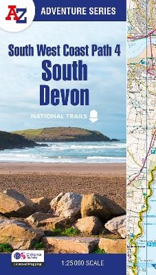
South West Coast Path 4 – South Devon
With Ordnance Survey Mapping
Seiten
2025
|
4th Revised edition
Harpercollins (Verlag)
978-0-00-870764-4 (ISBN)
Harpercollins (Verlag)
978-0-00-870764-4 (ISBN)
- Noch nicht erschienen (ca. März 2025)
- Versandkostenfrei innerhalb Deutschlands
- Auch auf Rechnung
- Verfügbarkeit in der Filiale vor Ort prüfen
- Artikel merken
Plan your next adventure along the South Devon section of the South West Coast Path with trusted mapping from A-Z
The perfect companion for those who love the great outdoors, the A-Z Adventure Series features 1:25000 Ordnance Survey mapping in a convenient book, complete with index.
The South West Coast Path is a National Trail along the Somerset, Devon, Cornwall and Dorset coasts. This stunning walk from Minehead, Somerset covers 630 miles to South Haven Point in Poole Harbour, passing through two World Heritage Sites (the Jurassic Coast and the Cornwall and West Devon Mining Landscape), Exmoor National Park, Land's End and many areas of outstanding natural beauty.
This A-Z Adventure Atlas of the South West Coast Path: South Devon features 50 pages of continuous Ordnance Survey mapping covering the route from Plymouth and following the route east to Lyme Regis. The trail is easy to follow, highlighted in yellow to stand out from other footpaths, with mileage markers to gauge distances when planning your own sections of the walk to enjoy.
The book includes a route planner showing distances between places and indicates available amenities, including:
Information Centres
Visitor Centres
Hotels/B&Bs
Youth Hostels
Campsites (seasonal opening)
Public Houses
Shops
Restaurants
Cafes (seasonal opening)
Petrol stations
A series of five A-Z Adventure Atlases together cover the South West Coast Path:
South West Coast Path: North Devon and Somerset (9780008707651)
South West Coast Path: North Cornwall (9780008707620)
South West Coast Path: South Cornwall (9780008707637)
South West Coast Path: South Devon (9780008707644)
South West Coast Path: Dorset (9780008707668)
Other National Trails available within the A-Z Adventure Series include: Peak District (Dark Peak), Cotswold Way, Peddars Way and Norfolk Coast Path, Pembrokeshire Coast Path, North Coast 500 and South Downs Way.
Britain’s leading street map publisher providing cartographic services, digital data products and paper mapping publications (including Street Atlases, Visitors Guides, Great Britain Road Atlases and The Adventure Series).
| Erscheint lt. Verlag | 13.3.2025 |
|---|---|
| Reihe/Serie | A -Z Adventure Series |
| Verlagsort | London |
| Sprache | englisch |
| Maße | 134 x 240 mm |
| Gewicht | 270 g |
| Themenwelt | Sachbuch/Ratgeber ► Sport |
| Reiseführer ► Europa ► Großbritannien | |
| ISBN-10 | 0-00-870764-2 / 0008707642 |
| ISBN-13 | 978-0-00-870764-4 / 9780008707644 |
| Zustand | Neuware |
| Informationen gemäß Produktsicherheitsverordnung (GPSR) | |
| Haben Sie eine Frage zum Produkt? |
Mehr entdecken
aus dem Bereich
aus dem Bereich
Geschichten, Geheimnisse und anderes cooles Zeug
Buch | Softcover (2024)
MAIRDUMONT (Verlag)
17,95 €


