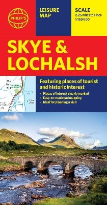
Philip's Skye and Lochalsh: Leisure and Tourist Map
Featuring Places of tourist and historic interest
2025
Philip's (Verlag)
978-1-84907-706-4 (ISBN)
Philip's (Verlag)
978-1-84907-706-4 (ISBN)
- Noch nicht erschienen (ca. Februar 2025)
- Versandkostenfrei innerhalb Deutschlands
- Auch auf Rechnung
- Verfügbarkeit in der Filiale vor Ort prüfen
- Artikel merken
Brand new edition from Philip's of this information-packed sheet map of Skye and Lochalsh, giving detailed coverage of the road network, and featuring all the major places of tourist, cultural and historic interest.
From the colourful town of Portree to the best water sport locations, the map shows all the major places of tourist and historic interest, including beaches, castles, camping sites, gardens, golf courses, museums, nature and pony trails, ancient historic sites, sports and entertainment venues, wildlife spots and most of all where to enjoy the extraordinarily dramatic landscape. A clear and handy index to principal places of interest - from Flora MacDonald's grave to the Skye Museum of Island Life - is also included.
Whether local or a visiting Prince, the conveniently folded single-sided sheet map is ideally suited for both leisure and business.
Philip's has been at the forefront of creating maps and atlases since 1834. Whether a local street map or a fact-packed World Atlas, we use the most up-to-date technology, expertise and our global network to ensure our customers have all the information they need.
| Erscheint lt. Verlag | 6.2.2025 |
|---|---|
| Reihe/Serie | Philip's Red Books |
| Verlagsort | London |
| Sprache | englisch |
| Maße | 130 x 236 mm |
| Gewicht | 107 g |
| Themenwelt | Reisen ► Karten / Stadtpläne / Atlanten ► Europa |
| ISBN-10 | 1-84907-706-1 / 1849077061 |
| ISBN-13 | 978-1-84907-706-4 / 9781849077064 |
| Zustand | Neuware |
| Haben Sie eine Frage zum Produkt? |
Mehr entdecken
aus dem Bereich
aus dem Bereich
Straßen- und Freizeitkarte 1:250.000
Karte (gefalzt) (2023)
Freytag-Berndt und ARTARIA (Verlag)
12,90 €
Karte (gefalzt) (2023)
Freytag-Berndt und ARTARIA (Verlag)
12,90 €
Östersund
Karte (gefalzt) (2023)
Freytag-Berndt und ARTARIA (Verlag)
12,90 €


