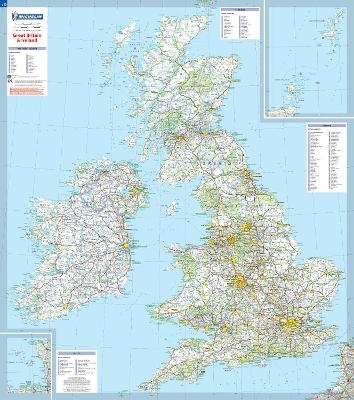
Great Britain & Ireland - Michelin rolled & tubed wall map Paper
Wall Map
Seiten
2005
|
2008
Michelin Editions des Voyages (Verlag)
978-2-06-710650-5 (ISBN)
Michelin Editions des Voyages (Verlag)
978-2-06-710650-5 (ISBN)
Michelin's encapsulated and paper wall maps give you a unique veiw of the Earth which will evoke a desire to explore the World.
This Great Britain and Ireland wall map will give an overview of British and Irish cities, administrative boundaries, as well as primary and secondary road networks at a glance.
This map is presented in a tube, on a scale 1/1,000,000 and measures 100 x 88 cm.
Our maps are regularly updated even if the ISBN does not change.
(Edition updated in 2008)
| Erscheint lt. Verlag | 29.3.2005 |
|---|---|
| Verlagsort | Paris |
| Sprache | englisch |
| Maße | 113 x 250 mm |
| Gewicht | 118 g |
| Themenwelt | Reisen ► Karten / Stadtpläne / Atlanten ► Europa |
| ISBN-10 | 2-06-710650-3 / 2067106503 |
| ISBN-13 | 978-2-06-710650-5 / 9782067106505 |
| Zustand | Neuware |
| Haben Sie eine Frage zum Produkt? |
Mehr entdecken
aus dem Bereich
aus dem Bereich
Straßen- und Freizeitkarte 1:250.000
Karte (gefalzt) (2023)
Freytag-Berndt und ARTARIA (Verlag)
12,90 €
Karte (gefalzt) (2023)
Freytag-Berndt und ARTARIA (Verlag)
12,90 €
Östersund
Karte (gefalzt) (2023)
Freytag-Berndt und ARTARIA (Verlag)
12,90 €


