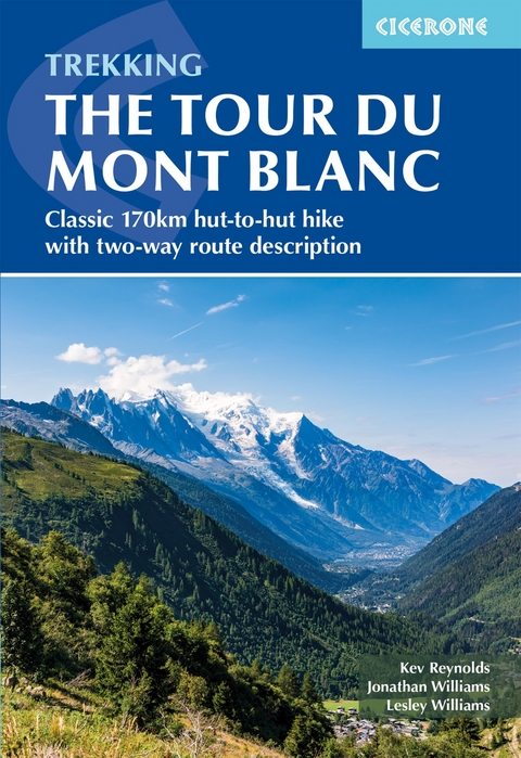
Trekking the Tour du Mont Blanc
Cicerone Press (Verlag)
978-1-78631-228-0 (ISBN)
A guidebook to hiking the Tour du Mont Blanc (TMB), a spectacular circuit around Mont Blanc. Covering 170km (105 miles), the TMB takes around 11 days to walk from its official start at Les Houches (France), passing through Courmayeur (Italy) and Champex (Switzerland) before returning to France via the Chamonix valley. A well-serviced introduction to high-level mountain trekking for walkers with good levels of fitness, it can also be run, fastpacked or hiked in 5–9 days.
The route is described in both directions in 11 daily stages between 7 and 21km (5–13 miles) in length. Variant routes and alternative stages are also provided, giving the option of visiting cols, refuges and viewpoints not included on the official TMB route.
Contains step-by-step description of the route alongside 1:100,000 maps
Handy facilities planner, route summary tables and accommodation listings help you plan your itinerary
Includes transport info, a French–English glossary, notes on local history and sites of interest
A map booklet, containing 1:25,000 IGN mapping and route line, is available separately from Cicerone
GPX files available to download
A collaborative effort between Kev Reynolds and Jonathan and Lesley Williams who – following Kev’s death in December 2021 – updated and refreshed the route details, planning resources and maps based on research trips in 2022 and 2023. Jonathan and Lesley are retiring from being Cicerone’s publisher and marketing director (respectively), so have few excuses for not spending days in the hills.
Contents
Overview map
Overview profile
Map key
Mountain safety
Route summary table
Introduction
The Tour of Mont Blanc
The route
Clockwise or anti-clockwise?
Suggested itineraries
How to get there
When to go
Accommodation
Languages
Maps and waymarks
Preparation and equipment
Safety in the mountains
Using this guide
The Tour of Mont Blanc - anti-clockwise
Stage 1 Les Houches - Bionnassay - Les Contamines
Stage 1A Les Houches - Refuge de Miage - Les Contamines
Stage 2 Les Contamines - Croix du Bonhomme - Les Chapieux
Stage 3 Les Chapieux - Col de la Seigne - Rifugio Elisabetta
Stage 4 Rifugio Elisabetta - Courmayeur
Stage 5 Courmayeur - Rifugio Bonatti
Stage 6 Rifugio Bonatti - Grand Col Ferret - La Fouly
Stage 7 La Fouly - Champex
Stage 8 Champex - Alp Bovine - Trient
Stage 8A Champex - Fen&##xea;tre d'Arpette - Trient
Stage 9 Trient - Col de Balme - Tr&##xe9;-le-Champ
Stage 10 Tr&##xe9;-le-Champ - Refuge La Fl&##xe9;g&##xe8;re
Stage 11 Refuge La Fl&##xe9;g&##xe8;re - Le Br&##xe9;vent - Les Houches
Places and items of interest on the TMB
The story of Mont Blanc
The Tour of Mont Blanc - clockwise
Stage 1 Champex - Ferret
Stage 2 Ferret - Grand Col Ferret - Rifugio Bonatti
Stage 3 Rifugio Bonatti - Courmayeur
Stage 4 Courmayeur - Rifugio Elisabetta
Stage 5 Rifugio Elisabetta - Refuge de la Croix du Bonhomme
Stage 6 Refuge de la Croix du Bonhomme - Les Contamines
Stage 7 Les Contamines - Bionnassay - Les Houches
Stage 7A Les Contamines - Refuge de Miage - Les Houches
Stage 8 Les Houches - Le Br&##xe9;vent - La Fl&##xe9;g&##xe8;re
Stage 9 La Fl&##xe9;g&##xe8;re - Col de Balme - Trient
Stage 10 Trient - Alp Bovine - Champex
Stage 10A Trient - Fen&##xea;tre d'Arpette - Champex
Appendix A Route facilities table (anti-clockwise)
Appendix B Accommodation
Appendix C Campsites on the TMB
Appendix D Useful contacts
Appendix E Further reading
Appendix F French-English glossary
| Erscheinungsdatum | 29.05.2024 |
|---|---|
| Reihe/Serie | Cicerone guidebooks |
| Zusatzinfo | 70 photographs, 45 maps and profiles |
| Verlagsort | Kendal |
| Sprache | englisch |
| Maße | 116 x 172 mm |
| Gewicht | 240 g |
| Themenwelt | Sachbuch/Ratgeber ► Sport |
| Reiseführer ► Europa ► Frankreich | |
| Reiseführer ► Europa ► Italien | |
| Reiseführer ► Europa ► Schweiz | |
| Reisen ► Sport- / Aktivreisen ► Europa | |
| ISBN-10 | 1-78631-228-X / 178631228X |
| ISBN-13 | 978-1-78631-228-0 / 9781786312280 |
| Zustand | Neuware |
| Informationen gemäß Produktsicherheitsverordnung (GPSR) | |
| Haben Sie eine Frage zum Produkt? |
aus dem Bereich


