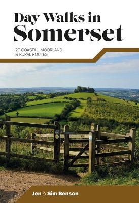
Day Walks in Somerset
Vertebrate Publishing Ltd (Verlag)
978-1-912560-60-8 (ISBN)
Day Walks in Somerset features 20 routes between 7 and 15 miles (11km and 24km) in length, spread across the county of Somerset, including the Exmoor National Park. Researched and written by experienced and local authors Jen and Sim Benson, the walks range from gentle rambles to more challenging day walks, all through interesting and varied landscapes.
Split into five sections – Exmoor; Quantock Hills & Blackdown Hills; Somerset Levels; Mendip Hills; and Bath & North East Somerset – this guidebook explores the best that Somerset has to offer.
Together with stunning photography, each route features Ordnance Survey 1:25,000 maps, easy-to-follow directions, details of distance and navigation information, and refreshment stops and local information.
Jen and Sim Benson are writers and photographers with a love of the great outdoors. They write for Trail magazine, Country Walking magazine, and Walk magazine, the quarterly publication of the Ramblers, where they are also resident gear experts. They have written widely for the national press, covering a range of topics including training and injury, kit, route-finding, photography and family adventures. Their books include 100 Great Walks with Kids, Short Runs in Beautiful Places and The Adventurer’s Guide to Britain. They regularly collaborate with organisations including the National Trust, Forestry England and the Wildlife Trusts. Jen has a BSc in Podiatry and an MSc in Sport and Exercise Medicine. Sim has a degree in Environmental Science and a long history of running, climbing and expeditions in many different locations around the world. Together, they share a passion for promoting sustainability within outdoor recreation.
Somerset Area Map & Route Finder
Introduction
Acknowledgements
About the walks
Navigation
GPS & mobile phones
Comfort
Safety
The Countryside Code
How to use this book
Maps, descriptions, distances
Km/mile conversion chart
Section 1 – Exmoor
1 Selworthy & Bossington, 16.5km
2 Dunkery Beacon & Horner Wood, 18km
3 Dunster Castle & Woods, 17km
4 Around Wimbleball Lake, 13.4km
Section 2 – Quantock Hills & Blackdown Hills
5 Kilve Coast & Beacon Hill, 20.1km
6 Northern Quantock Hills, 11.2km
7 Wills Neck & Cothelstone Hill, 15.6km
8 East Deane Way Link-Up, 19.4km
Section 3 – Somerset Levels
9 Bridgwater & Taunton Canal, 21.9km
10 Burrow Mump & West Sedgemoor, 24.2km
11 Collard Hill & Lollover Hill, 12.5km
12 Cadbury Castle & the Corton Ridge, 16.3km
Section 4 – Mendip Hills
13 Brean Down, 20.6km
14 Crook Peak, 14km
15 Cheddar Gorge, 15.5km
16 Ebbor Gorge, 12km
Section 5 – Bath & North East Somerset
17 Ashton Court & Leigh Woods, 13.3km
18 Ammerdown, 12.6km
19 Cotswold Way, 17.9km
20 Kennet & Avon Canal Loop, 14.6km
Appendix
| Erscheinungsdatum | 05.05.2023 |
|---|---|
| Reihe/Serie | Day Walks |
| Zusatzinfo | Ordnance Survey 1:25,000 maps; Colour photographs |
| Sprache | englisch |
| Maße | 120 x 175 mm |
| Gewicht | 250 g |
| Themenwelt | Sachbuch/Ratgeber ► Natur / Technik ► Natur / Ökologie |
| Sachbuch/Ratgeber ► Sport | |
| Reiseführer ► Europa ► Großbritannien | |
| ISBN-10 | 1-912560-60-7 / 1912560607 |
| ISBN-13 | 978-1-912560-60-8 / 9781912560608 |
| Zustand | Neuware |
| Haben Sie eine Frage zum Produkt? |
aus dem Bereich


