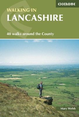
Walking in Lancashire
Cicerone Press (Verlag)
978-1-85284-439-4 (ISBN)
- Titel ist leider vergriffen;
keine Neuauflage - Artikel merken
Walking in Lancashire covers the delightful area from the Irish Sea to the Trough of Bowland and from Kirkby Lonsdale in the north to Cliviger in the south. The 40 walks are all circular with one exception and range in length from 8 to 19 km (5 to 13 miles) in length and extend around Cockerham, Lytham, Martin Mere and Croston to the heights of Boulsworth Hill, Ward's Stone, Fair Snape Fell and Pendle Hill. The routes are all are suitable for most walkers as there is a variety of terrain to be explored.
Lancashire has a great variety of landscape, ranging from the low lying land around Cockerham, Lytham, Martin Mere and Croston to the heights of Boulsworth Hill, Ward's Stone, Fair Snape Fell and Pendle Hill. Its hedgerows, pastures, riverbanks, hills, moors and shoreline are rich in bird and plant life. Its many picturesque villages are rich too, in fine churches, ancient dwellings, pleasing bridges and interesting legends.
Some of the walks are more like gentle strolls that make a good introduction to walking and help the less fit to prepare for more challenging walks.
Mary Welsh is an award-winning writer of walking books and a travel writer, and has produced more than 35 walking guidebooks, and writes regular columns in magazines and newspapers and for the internet. She has lived in the north of England for nearly 30 years.
The Walks
Silverdale
Warton Crag and Leighton Moss
Arkholme and Gressingham
Nether Burrow and Leck
Kirkby Lonsdale and Whittington
Crook of Lune and Aughton
Hornby and Melling
Low Bentham
Sunderland Point
Glasson and the Lancaster Canal
Cockerham and Cockersand Abbey
Abbeystead and Dolphinholme
Tarnbrook and Marshaw Wyre
Clougha Pike
Ward's Stone, Bowland
Slaidburn
Bolton-by-Bowland
Dunsop Bridge, Bowland
Whitewell, Bowland
Garstang and Nicky Nook
Garstang and Cabus Nook
Knott End-on-Sea and Preesall
Skippool Creek, Wyre Estuary
Bleasdale Fells
Hurst Green and Cromwell Bridge
Whalley
Downham
Weets Hill, Barnoldswick
Wycoller and Boulsworth Hill
Pendle Hill
Chipping and Dinkling Green
Longridge Fell
Ribchester
Lytham
Croston and the Rufford branch of the Leeds-Liverpool Canal
Martin Mere and Mere Sands Wood
Parbold and the Leeds-Liverpool Canal
Darwen Moor, Jubilee Tower and the Witton Weavers Way
Thieveley Pike, Cliviger Gorge
Hurstwood and Worsthorne Moor
| Erscheint lt. Verlag | 5.5.2017 |
|---|---|
| Zusatzinfo | 40 maps and over 80 colour photos |
| Verlagsort | Kendal |
| Sprache | englisch |
| Maße | 116 x 172 mm |
| Gewicht | 240 g |
| Themenwelt | Sachbuch/Ratgeber ► Sport |
| Reiseführer ► Europa ► Großbritannien | |
| ISBN-10 | 1-85284-439-6 / 1852844396 |
| ISBN-13 | 978-1-85284-439-4 / 9781852844394 |
| Zustand | Neuware |
| Informationen gemäß Produktsicherheitsverordnung (GPSR) | |
| Haben Sie eine Frage zum Produkt? |
aus dem Bereich


