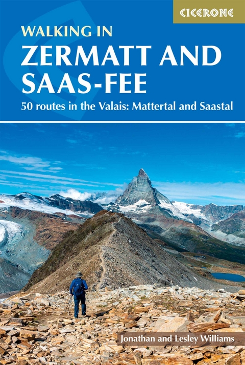
Walking in Zermatt and Saas-Fee
Cicerone Press (Verlag)
978-1-78631-075-0 (ISBN)
A guidebook to 50 graded day walks in Switzerland’s Valais. Exploring the areas around the towns of Zermatt and Saas-Fee in the Mattertal and Saastal valleys, the walks are suitable for beginner and experienced walkers alike.
Walks range from 4 to 29km (3–18 miles) and can be enjoyed in 2–10 hours. The routes make the most of the area's extensive network of well-made mountain paths and its lift system to explore Europe’s highest mountains.
1:50,000 maps included for each route
GPX files available to download
Detailed information on planning, transport and amenities
Highlights include the Swiss 4000m giants Matterhorn and Monte Rosa
Jonathan Williams has been Cicerone's publisher and managing director for over 20 years, and Lesley Williams is Cicerone's marketing director. Although they met at sea, they quickly gravitated to the mountains and trekking, before taking on Cicerone to communicate their passion for mountains, wild places and other journeys on foot or by bike.
Map key
Map of the valleys
Route summary table
Introduction
The walking
The valleys
The Matterhorn
The shape of the mountains
Plants and wildlife
When to go
Getting there
Travel in the region
Accommodation
Other local facilities
Weather
Maps
Apps
Equipment
Preparation
Using this guide
Zermatt and the Mattertal
Walk 1 The Trift gorge and Hotel du Trift
Walk 2 Ascent of the Mettelhorn and Platthorn from Trift
Walk 3 Two-day expedition - Schönbielhütte via Höhbalmen
Walk 4 The villages of Zmutt, Zum See and Blatten
Walk 5 Balcony route to Zmutt and the Kulturweg
Walk 6 Zermatt to Sunnegga - the Findeln villages
Walk 7 Gletschergarten and Gorner gorge walk
Walk 8 Schwarzsee and Stafelalp - under the Matterhorn
Walk 9 Schwarzsee to the Hörnlihütte
Walk 10 The Matterhorn Glacier Trail
Walk 11 Gornergrat to Riffelsee, Riffelberg and Riffelalp
Walk 12 Riffelalp and a woodland walk to Grüensee
Walk 13 The Gornergletscher and Monte Rosa Hütte
Walk 14 The mountain restaurants of Findeln
Walk 15 Blauherd to Sunnegga via Tufteren
Walk 16 The Five Lakes Walk in the Findeln valley
Walk 17 The Oberrothorn
Walk 18 Blauherd to Pfulwe and Täschalp
Walk 19 Täsch to Täschalp and the Täschhütte
Walk 20 Täschalp to Zermatt
Grächen, Randa and the lower Mattertal
Walk 21 The Europahütte and Hängebrücke to Täschalp
Walk 22 Schaliberg alp
Walk 23 Jungen, Sparru and the Jungtal
Walk 24 A tour of the villages - Grächen and Gasenried
Walk 25 Grächen leat paths - the Chilcheri and Eggeri
Walk 26 The Ried glacier and the Grathorn
Walk 27 Hannigalp to Grächen via Hohtschugge and Bärgji
Walk 28 Grächen to Hannigalp via Stafel
Walk 29 Ascent of the Wannehorn
Walk 30 The Grächen to Saas-Fee Höhenweg
Saas-Fee and the Saastal
Walk 31 Fee, Almagell, Grund and the Feevispa gorge
Walk 32 Hannig from Saas-Fee
Walk 33 The ascent of Mällig - The Ibex Trail
Walk 34 Gletschergrotte, Spielboden and Längflue
Walk 35 The Gemsweg - a tour of the Saas-Fee valley
Walk 36 The Mischabelhütte
Walk 37 Plattjen
Walk 38 The Britanniahütte
Walk 39 The Felskinn-Plattjen traverse
Walk 40 Saas-Grund to Saas-Fee - the Kapellenweg and Saumweg
Walk 41 Saas-Grund to Saas-Fee via Bideralp
Walk 42 Saas-Grund to Triftalp, Kreuzboden and the Weissmieshütte
Walk 43 The Gspon Höhenweg
Walk 44 The descent of the Saastal - Mattmark to Saas-Balen
Walk 45 Almagelleralp and the Almagellerhütte
Walk 46 The höhenweg from Saas-Almagell to Kreuzboden
Walk 47 Furggstalden and the Furggtälli
Walk 48 Schwarzbergalp and circuit of the Mattmark
Walk 49 The Monte Moro Pass
Walk 50 The Ofental, Jazzilücke and Antronapass
Appendix A Useful contacts
Appendix B 4000m peaks
Appendix C English-German terms
| Erscheinungsdatum | 12.04.2021 |
|---|---|
| Reihe/Serie | Cicerone guidebooks |
| Zusatzinfo | 94 colour photos, 50 route maps at 1:50,000, 4 overview maps |
| Verlagsort | Kendal |
| Sprache | englisch |
| Maße | 116 x 172 mm |
| Gewicht | 300 g |
| Themenwelt | Sachbuch/Ratgeber ► Sport |
| Reisen ► Sport- / Aktivreisen ► Europa | |
| ISBN-10 | 1-78631-075-9 / 1786310759 |
| ISBN-13 | 978-1-78631-075-0 / 9781786310750 |
| Zustand | Neuware |
| Haben Sie eine Frage zum Produkt? |
aus dem Bereich
