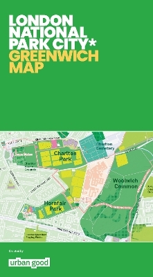
London National Park City: Greenwich Map
Seiten
2019
Urban Good (Verlag)
978-1-9160355-2-2 (ISBN)
Urban Good (Verlag)
978-1-9160355-2-2 (ISBN)
The most detailed and beautiful map of southeast London's green spaces. Covering the Royal Borough of Greenwich and surrounds, the map shows parks, woodlands, playing fields, allotments, rivers, walks, outdoor activities and much more. Printed on specialist ProGeo cartographic paper and bound in a cardboard cover, the folded map is 1270x950mm.
Urban Good Maps make green city maps that celebrate open space, walking and natural heritage in cities. The unique and eye-catching, colourful lay-out outlines walks, trails and identifies green spots, water spots and sports and activities center. Ideal for any city-dwellers in search of nature.A large-format, folded paper map with a protective card cover. Printed by the best cartographic press in the UK with special pantone inks to highlight amazing walks and fun activities. Double-sided, with a city atlas on the reverse. It shows Greenwich and the surrounding areas in detail as a green and blue landscape fit for outdoor exploration.
Urban Good Maps make green city maps that celebrate open space, walking and natural heritage in cities. The unique and eye-catching, colourful lay-out outlines walks, trails and identifies green spots, water spots and sports and activities center. Ideal for any city-dwellers in search of nature.A large-format, folded paper map with a protective card cover. Printed by the best cartographic press in the UK with special pantone inks to highlight amazing walks and fun activities. Double-sided, with a city atlas on the reverse. It shows Greenwich and the surrounding areas in detail as a green and blue landscape fit for outdoor exploration.
| Erscheint lt. Verlag | 31.7.2019 |
|---|---|
| Zusatzinfo | 1 Illustrations, unspecified |
| Sprache | englisch |
| Maße | 133 x 240 mm |
| Themenwelt | Reisen ► Karten / Stadtpläne / Atlanten ► Europa |
| ISBN-10 | 1-9160355-2-3 / 1916035523 |
| ISBN-13 | 978-1-9160355-2-2 / 9781916035522 |
| Zustand | Neuware |
| Informationen gemäß Produktsicherheitsverordnung (GPSR) | |
| Haben Sie eine Frage zum Produkt? |
Mehr entdecken
aus dem Bereich
aus dem Bereich
Straßen- und Freizeitkarte 1:250.000
Karte (gefalzt) (2023)
Freytag-Berndt und ARTARIA (Verlag)
12,90 €
Baskenland, Navarra, Aragon, Andorra, Katalonien
Karte/Kartografie (2023)
MAIRDUMONT (Verlag)
11,95 €
Karte (gefalzt) (2024)
Freytag-Berndt und ARTARIA (Verlag)
12,90 €


