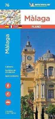
Malaga - Michelin City Plan 76
City Plans
Seiten
2019
Michelin Editions des Voyages (Verlag)
978-2-06-723699-8 (ISBN)
Michelin Editions des Voyages (Verlag)
978-2-06-723699-8 (ISBN)
Michelin City Plans come in practical formats, paper, laminated and accordian folds. Suited for tourist use and with clear precise mapping. Starting at 1/8000 scale and upwards
(Edition updated in 2019) Discover Malaga by foot, car or bike using Michelin Malaga City Plan (scale 1/10,000 cm). In addition to Michelin's clear and accurate mapping, this city plan will help you explore and navigate across Malaga's different districts thanks to its full index, its comprehensive key showing places of interest and tourist attractions, as well as practical information on public transport leisure facilities, service stations and shops!
For meetings, shopping trips or simply exploring, let MICHELIN CITY PLANS show you way!
* Car parks, one-way and pedestrian streets, public transport
* Practical information - from hospitals and service stations to entertainment and shops.
* Comprehensive street index
* Tourist sights, places and buildings of interest
* Useful numbers and internet sites
Our maps are regularly updated even if the ISBN does not change.
| Erscheint lt. Verlag | 15.3.2019 |
|---|---|
| Verlagsort | Paris |
| Sprache | englisch |
| Maße | 113 x 250 mm |
| Gewicht | 118 g |
| Themenwelt | Reisen ► Karten / Stadtpläne / Atlanten ► Europa |
| ISBN-10 | 2-06-723699-7 / 2067236997 |
| ISBN-13 | 978-2-06-723699-8 / 9782067236998 |
| Zustand | Neuware |
| Haben Sie eine Frage zum Produkt? |
Mehr entdecken
aus dem Bereich
aus dem Bereich
Karte (gefalzt) (2023)
Freytag-Berndt und ARTARIA (Verlag)
12,90 €
Straßen- und Freizeitkarte 1:250.000
Karte (gefalzt) (2023)
Freytag-Berndt und ARTARIA (Verlag)
12,90 €
Baskenland, Navarra, Aragon, Andorra, Katalonien
Karte/Kartografie (2023)
MAIRDUMONT (Verlag)
11,95 €


