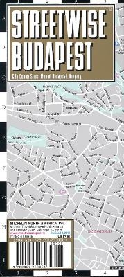
Streetwise Budapest Map - Laminated City Center Street Map of Budapest, Hungary
City Plans
Seiten
2018
Michelin Editions des Voyages (Verlag)
978-2-06-723006-4 (ISBN)
Michelin Editions des Voyages (Verlag)
978-2-06-723006-4 (ISBN)
- Titel ist leider vergriffen;
keine Neuauflage - Artikel merken
Zu diesem Artikel existiert eine Nachauflage
Michelin City Plans come in practical formats, paper, laminated and accordian folds. Suited for tourist use and with clear precise mapping. Starting at 1/8000 scale and upwards
REVISED 2018
Streetwise Budapest Map is a laminated city center map of Budapest, Hungary. The accordion-fold pocket size travel map has an integrated metro map including lines & stations.
Coverage includes:
Main Budapest Map Front 1: 17,000
Main Budapest Map Back 1:11,000
Budapest City Center Map 1:11,000
Millennium City Center Map 1:17,000
Budapest Metro Map
Dimensions: 4" x 8.5" folded, 8.5" x 27" unfolded
People say Budapest is the Paris of Central Europe. Maybe that statement is true because it combines a combination of western luxuries, architectural beauty, and cosmopolitan European traditions. But this baroque city is still connected to its Eastern European heritage with the steaming baths, incredibly complex language and lusty cuisine. Budapest straddles a curve in the river Danube which bisects two distinct parts. The east side is known as Pest and the west side is known as Buda, hence Budapest. It’s a very logical, well laid out city. Castle Hill is the premier destination for visitors and contains many of Budapest's most important monuments and museums, and great views of Pest across the blue Danube. Pastel houses lining cobbled streets and stone balustrade overlooks give this citadel a fairy tale quality, while bullet holes from the unsuccessful 1956 uprising pockmark many buildings.
The main map of Budapest covers a large part of the central city in detail and is fully indexed with hotels, sites, architecture, metro stations and parks. The City Center inset map expands the old city grid and enables you to stroll the old streets and absorb Hungarian history and culture at your leisure. The inset map of Budapest Metro facilitates your travel throughout the city. One example of the importance of on site research: when this Budapest map was first conceived in the early 1990 s we ran into a unique problem with sudden unannounced street name changes. Streets named after heroic Socialist revolutionaries were changed without notice. The streets were renamed after heroes of the Hungarian National Liberation. Other maps who rely on out of date documents for updating still reflect the old street names. Imagine publishing a map and unknowingly using names like Karl Marx Ave. and Lenin Square. Whoops!
Fortunately, with our STREETWISE® Budapest Map, we adhered to a policy of physically researching and updating the city, thereby avoiding these sorts of mistakes. Our pocket size map of Budapest is laminated for durability and accordion folding for effortless use. For a selection of the best restaurants and hotels, buy the red MICHELIN Guide Main Cities of Europe. For driving or to plan your trip to and from Budapest, use the Michelin Hungary Road and Tourist Map No. 732.
| Erscheint lt. Verlag | 15.4.2018 |
|---|---|
| Verlagsort | Paris |
| Sprache | englisch |
| Maße | 102 x 220 mm |
| Gewicht | 100 g |
| Themenwelt | Reisen ► Karten / Stadtpläne / Atlanten ► Europa |
| Reisen ► Reiseführer ► Europa | |
| ISBN-10 | 2-06-723006-9 / 2067230069 |
| ISBN-13 | 978-2-06-723006-4 / 9782067230064 |
| Zustand | Neuware |
| Haben Sie eine Frage zum Produkt? |
Mehr entdecken
aus dem Bereich
aus dem Bereich
Straßen- und Freizeitkarte 1:250.000
Karte (gefalzt) (2023)
Freytag-Berndt und ARTARIA (Verlag)
12,90 €
Karte (gefalzt) (2023)
Freytag-Berndt und ARTARIA (Verlag)
12,90 €
Östersund
Karte (gefalzt) (2023)
Freytag-Berndt und ARTARIA (Verlag)
12,90 €


