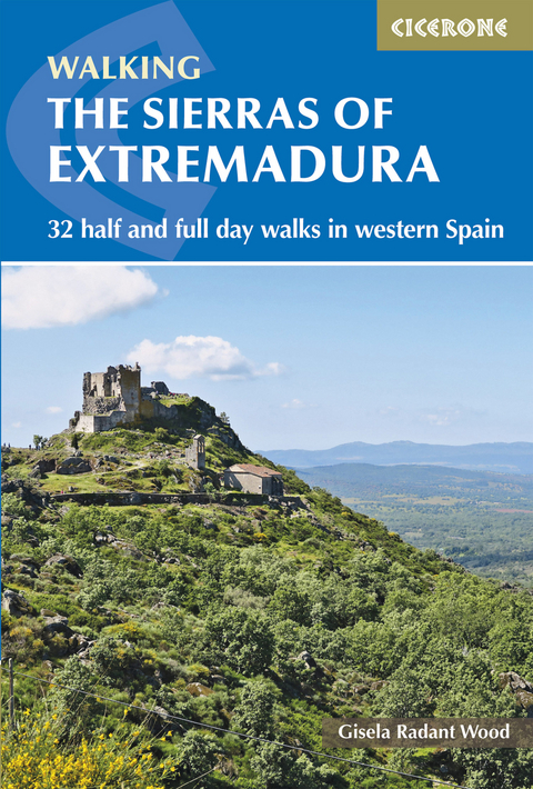
The Sierras of Extremadura
Cicerone Press (Verlag)
978-1-85284-848-4 (ISBN)
A guidebook to 32 walks in the unspoilt mountains of Extremadura in western Spain. Exploring diverse landscapes including La Garganta de los Infiernos Natural Park and the Sierra de Gata, Montes de Toledo and Sierra Morena, all of the routes involve some ascent but none require mountaineering skills.
Walks range from 6 to 19km (4–12 miles) and can be enjoyed in 2–6 hours. Some can be linked to create longer routes of up to 28km (17 miles).
Clear route description with 1:50,000 mapping
GPX files available to download
Information on refreshments, access, parking and water sources provided for each route
Advice on walking bases
Geology, history, plants and wildlife and local points of interest
Gisela Radant Wood is a walker, writer, photographer, avid reader and passionate about Extremadura. She has lived in the Sierra de Montánchez for the past 10 years, walking there on a regular basis. Home is a finca outside the village of Almoharín with a husband, a dog, seven sheep, occasional lambs, four hens and 150 olive trees. Ten years ago Gisela set up the website www.walkingextremadura.com and is actively involved in promoting the area as a walking paradise. This is her second book about walking in Extremadura. To her astonishment she has gained the reputation for knowing more about the best places to walk than the locals. Gisela loves the social side to walking with friends in the Almoharín walking group, but, really, prefers the quiet of walking alone in the countryside she loves.
Map key
Overview map
INTRODUCTION
Geography and geology
Animals and birds
Flowers and plants
Human history
Getting there
Getting around
When to go
Bases and accommodation
Food and drink
Language
Money
Communications
What to take on a walk
Waymarking
Maps
Health and emergencies
Using this guide
THE NORTHERN SIERRAS: THE SISTEMA CENTRAL
Sierra de Gata
Walk 1 San Martín de Trevejo and the Sierra de Eljas
Walk 2 Pico J&##xe1;lama
Walk 3 Puerto de Castilla and Pico Jañona
Walk 4 Castillo de Almenara and the Sierra de las Jañonas
Walk 5 Robledillo de Gata and Ovejuela
Sierra de B&##xe9;jar
Walk 6 La Garganta and El Nevero
Walk 7 La Muela and the forest track
Walk 8 The valley route to La Muela
Sierra de Gredos
Walk 9 Cascadas Nogaleas in the Montes de Tras la Sierra
Walk 10 Los Pilones and Puente Sacrist&##xe1;n
Walk 11 Jerte to Puente Nuevo in the Sierra de Tormantos
Walk 12 Puente los Papúos in the Montes de Tras la Sierra
Walk 13 The Jaranda valley
Walk 14 Guijo de Santa B&##xe1;rbara and El Trabuquete
THE CENTRAL SIERRAS: THE MONTES DE TOLEDO
Sierra de Mont&##xe1;nchez
Walk 15 Arroyomolinos
Walk 16 Torre de Santa María to Mont&##xe1;nchez
Walk 17 Torre de Santa María and the mills
Walk 18 The oak woods of Zarza de Mont&##xe1;nchez
Walk 19 Almoharín and the Sierra de San Cristobal
Walk 20 The Sierra de los Alijares
Walk 21 The Sierra de Santa Cruz
Sierra del Campillo and the Sierra de Juncaldilla
Walk 22 Garganta de Cuernacabras
Sierra de Guadalupe
Walk 23 Garciaz and Pico Venero
Walk 24 Cabañas de Castillo to Navezuelas
Walk 25 Navezuelas to Guadalupe
Sierra de la Pela
Walk 26 Orellana de la Sierra
THE SOUTHERN SIERRAS
Sierra de Peñas Blancas and Sierra de Juan Bueno
Walk 27 La Zarza
Sierra Grande de Hornachos
Walk 28 Hornachos
Sierra Morena
Walk 29 Cabeza la Vaca and the Sierra de Buitrera
Walk 30 Monasterio de Tentudía and Pico Tentudía
Walk 31 Forest circuit in the Sierra Tudía y Sus Faldas
Walk 32 Alto de Aguafría and the Sierra de Aguafría
Appendix A Route summary table
Appendix B Link route summary table
Appendix C Additional waymarked routes in the area
Appendix D Useful contacts
Appendix E Glossary
| Erscheinungsdatum | 25.10.2017 |
|---|---|
| Reihe/Serie | Cicerone guidebooks |
| Zusatzinfo | 86 colour photos and 40 colour maps |
| Verlagsort | Kendal |
| Sprache | englisch |
| Maße | 116 x 172 mm |
| Gewicht | 250 g |
| Themenwelt | Sachbuch/Ratgeber ► Sport |
| Reiseführer ► Europa ► Spanien | |
| Reisen ► Sport- / Aktivreisen ► Europa | |
| ISBN-10 | 1-85284-848-0 / 1852848480 |
| ISBN-13 | 978-1-85284-848-4 / 9781852848484 |
| Zustand | Neuware |
| Haben Sie eine Frage zum Produkt? |
aus dem Bereich
