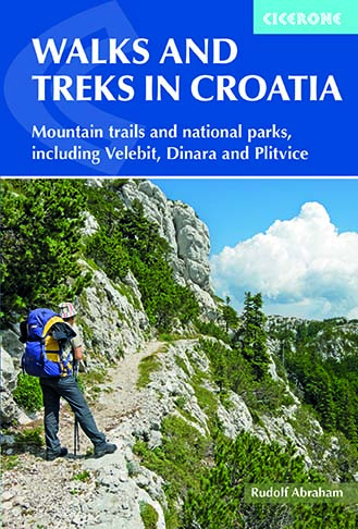
Walks and Treks in Croatia
Cicerone Press (Verlag)
978-1-85284-769-2 (ISBN)
A guidebook to 20 day walks and 7 short treks in the mountains and national parks of Croatia. Ranging from easy 2km strolls to strenuous hut-to-hut mountain treks, the routes showcase the diverse unspoilt landscapes, with highlights including UNESCO-listed Plitvice Lakes and Croatia’s highest summit, Dinara.
Covering the Zagreb region, Istria and the Opatija Riviera, Gorski Kotar, Velebit and Dalmatia, the day walks range from 2 to 21km (1–8 hours) and the treks from 16 to 75km (2–7 days).
Clear route description illustrated with 1:50,000 mapping
Refreshments and transport information for all routes, plus accommodation for the treks
Advice on planning and preparation
Geology, history, culture, plants and wildlife
Croatian glossary and menu decoder
Rudolf Abraham was born in London and began travelling at an early age in the UK, France and Spain. He lived in Croatia from 1999 to 2001, working as an English teacher in Zagreb, and has made numerous trips into the mountains of Croatia and Slovenia. In addition to this title, he has written guides for Cicerone on the Islands of Croatia, the Mountains of Montenegro and the Peaks of the Balkans Trail.
Map key
Overview map
Introduction
Geography and geology
History
Architecture, art and culture
Wildlife and plants
Climate
Getting to Croatia
Visas
Getting around
Accommodation
Food and drink
Language
Money
Postal services and telecommunications
Equipment
Maps
Walking and trekking in Croatia
What to do in an emergency
Using this guide
Part 1 Walks around Zagreb
Route 1 Grafičar, Sljeme
Route 2 Vrh Sljeme
Route 3 Veternica Cave
Route 4 Samoborsko gorje
Part 2 Istria and the Opatija Riviera
Route 5 Vrh Učka
Route 6 Pazinska jama
Part 3 Gorski kotar
Risnjak National Park
Route 7 Vrh Risnjak
Route 8 River Kupa source
Route 9 Risnjak, Snježnik and Hahlić
Skrad and Fužine
Route 10 Vražji prolaz (‘the devil's throat') and Zeleni vir
Route 11 Burnji Bitoraj
Route 12 Bajersko jezero and Vrelo cave
Velika kapela
Route 13 Bjelolasica, Bijele stijene and Samarske stijene
Route 14 Klek
Part 4 Velebit
Northern Velebit National Park and Central Velebit
Route 15 Mali Rajinac, Veliki Zavižan and Botanički vrt
Route 16 Northern Velebit and Central Velebit
Paklenica National Park and Southern Velebit
Route 17 Anica kuk
Route 18 Manita peć
Route 19 Južni Velebit (southern Velebit) and Paklenica
Part 5 The Dalmatian Hinterland
Route 20 Dinara
Route 21 Krka National Park
Route 22 Plitvice Lakes National Park
Part 6 Central Dalmatia
Route 23 Mosor
Route 24 Kozjak
Route 25 Biokovo traverse
Part 7 Southern Dalmatia
Route 26 Sniježnica (Ilijin vrh)
Route 27 Sveti Ilija (Pelješac)
Appendix A Route summary table
Appendix B Gateway cities - Zagreb, Rijeka, Zadar, Split
Appendix C Useful contacts
Appendix D Croatian language notes and glossary
Appendix E Other hiking areas in Croatia
Appendix F Further reading
| Erscheinungsdatum | 20.06.2019 |
|---|---|
| Reihe/Serie | Cicerone guidebooks |
| Zusatzinfo | 26 maps, 100 colour photos |
| Verlagsort | Kendal |
| Sprache | englisch |
| Maße | 116 x 172 mm |
| Gewicht | 320 g |
| Themenwelt | Sachbuch/Ratgeber ► Sport |
| Reiseführer ► Europa ► Kroatien | |
| Reisen ► Sport- / Aktivreisen ► Europa | |
| ISBN-10 | 1-85284-769-7 / 1852847697 |
| ISBN-13 | 978-1-85284-769-2 / 9781852847692 |
| Zustand | Neuware |
| Haben Sie eine Frage zum Produkt? |
aus dem Bereich


