AA Glovebox Atlas Ireland
Seiten
2017
|
6th Revised edition
Automobile Association (Verlag)
978-0-7495-7844-2 (ISBN)
Automobile Association (Verlag)
978-0-7495-7844-2 (ISBN)
- Titel erscheint in neuer Auflage
- Artikel merken
Zu diesem Artikel existiert eine Nachauflage
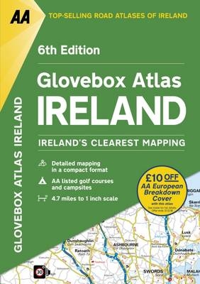
Ireland's clearest mapping in a handy format to fit perfectly into any car's glovebox.
Created from brand new mapping data, this atlas includes AA inspected camping sites and AA listed golf courses, picnic sites and ferry routes. Toll motorways and dual carriageways are clearly shown as well as tourist places of interest for tourists and locals.This handy A5 sized atlas is the perfect format to fit in the glovebox of your car and the 4.7 mile to 1 inch scales makes referencing easy on the go.
Created from brand new mapping data, this atlas includes AA inspected camping sites and AA listed golf courses, picnic sites and ferry routes. Toll motorways and dual carriageways are clearly shown as well as tourist places of interest for tourists and locals.This handy A5 sized atlas is the perfect format to fit in the glovebox of your car and the 4.7 mile to 1 inch scales makes referencing easy on the go.
AA Publishing is the UK's biggest travel publisher and one of the top 10 worldwide.
| Erscheinungsdatum | 22.04.2017 |
|---|---|
| Zusatzinfo | Colour Maps |
| Verlagsort | Basingstoke |
| Sprache | englisch |
| Maße | 152 x 210 mm |
| Themenwelt | Reisen ► Karten / Stadtpläne / Atlanten ► Europa |
| ISBN-10 | 0-7495-7844-0 / 0749578440 |
| ISBN-13 | 978-0-7495-7844-2 / 9780749578442 |
| Zustand | Neuware |
| Haben Sie eine Frage zum Produkt? |
Mehr entdecken
aus dem Bereich
aus dem Bereich
Buch | Spiralbindung (2024)
Freytag-Berndt und ARTARIA (Verlag)
29,90 €


