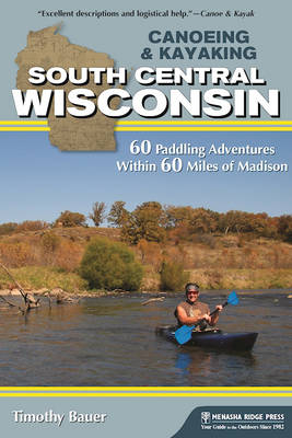
Canoeing & Kayaking South Central Wisconsin
Menasha Ridge Press Inc. (Verlag)
978-1-63404-020-4 (ISBN)
South-central Wisconsin provides an impressive array of opportunities for all types of paddling, including some of the very best day trips in the entire state and even Upper Midwest. Paddling South Central Wisconsin, by experienced paddler and author Timothy Bauer, guides all types of paddlers, whether veteran or novice, through whitewater adrenaline or flatwater calm routes near Madison, Rockford, Janesville, Waukesha, and Milwaukee. This paddling guide is the perfect companion for those seeking "the rowed less taken." It describes the best times to paddle 60 diverse routes, alerts readers to each paddle's difficulty level and estimated length, and suggests side trips, optional trip extensions, and alternate routes to paddle, depending on weather conditions. Easy-to-follow maps, complete with GPS coordinates and driving directions, add to this book's high value. In addition, the author provides contact information on local paddling clubs, outfitters, and Internet links.
A self-confessed "kayak junkie," Timothy Bauer came to paddling only in his early 30s. He resides in Madison, WI, around which he has been paddled several thousand miles on area creeks, lakes, and rivers.
Trip List
Northeast of Madison
Beaver Dam River: Beaver Dam to County Road J
Crawfish River A: Columbus to Astico Park
Crawfish River B: County Road I to County Road G
Duck Creek: Wyocena to Duck Creek Road
Fox River A: Indian Hills Campground to Portage Canal
Fox River B: Portage to Buffalo in Columbia and Marquette Counties
Horicon Marsh: Greenhead Landing to Bowling Green Park
Maunesha River: Marshall to Waterloo
Mecan River: 11th Road to Dixie Avenue
Montello River: County Road J to Montello Lake Boat Landing
Oconomowoc River: Loew Lake
Puchyan River: Green Lake Dam to County Road J
Rock River: Harnischfeger Park to Kanow Park
Rocky Run Creek and Wisconsin River: US 51 to County Road V
Token Creek: Portage Road to Cherokee Marsh
White River (Green Lake County): Neshkoro Dam to White River Road
Yahara River A: DeForest to Windsor
Southeast of Madison
Badfish Creek: Old Stage Road to Casey Road
Bark River A: Nemahbin Lake to Atkins-Olson Memorial Park
Bark River B: Rome Dam to Hebron
Bark River C: Koch Road to Burnt Village Park
Illinois Fox River: County Road H to County Road ES
Koshkonong Creek: Cambridge to Hoopen Road
Mukwonago River: County Road LO to County Road I
Pewaukee River and Illinois Fox River: Pewaukee to Waukesha
Red Cedar Lake State Natural Area: Cambridge in Jefferson County
Sugar River C: Avon Bottoms to Yale Bridge Road in Illinois
Turtle Creek A: Fairfield Area in Walworth and Rock Counties
Turtle Creek B: South O’Riley Road to Sweet-Allyn Park
Turtle Creek C: Sweet-Allyn Park to Dickop Street in Illinois
White River (Walworth County): Sheridan Springs Road to Burlington
Yahara River B: Dunkirk Dam to Rock River
Southwest of Madison
Governor Dodge State Park: Cox Hollow and Twin Valley Lakes
Little Platte River: Quarry Road to County Road O
Little Sugar River: Schneeberger Road to Albany
Pecatonica River A: County Road O to Darlington
Pecatonica River B: Roller Coaster Road to Walnut Road
Pecatonica River East Branch A: Hollandale to Blanchardville
Pecatonica River East Branch B: Blanchardville to Argyle
Pecatonica River East Branch C: Argyle to Blackhawk Memorial Park
Platte River: Platte Road to Big Platte Road
Sugar River A: Verona to Paoli in Dane County
Sugar River B: Brodhead Dam to Avon Bottoms
Baraboo River A: Wonewoc to La Valle
Baraboo River B: La Valle to Lake Redstone
Baraboo River C: Rock Springs to North Freedom
Baraboo River D: Baraboo Rapids
Black Earth Creek: Olson Road to Lions Park
Dell Creek and Mirror Lake: Dellwood and Lake Delton in Sauk County
Devil’s Lake State Park: Baraboo in Sauk County
Lemonweir River: Mauston Dam to Two Rivers Boat Landing
Neenah Creek A: Chauncey Street to County Road A
Neenah Creek B: County Road P to Muskrat Road
Neenah Creek C: Muskrat Road to County Road CX
Pine River A: Pier Natural Bridge Park to County Road AA
Pine River B: County Road AA to Bohmann Drive
Pine River C: Twin Bluffs Drive to Wisconsin River
Wisconsin River A: Upper and Lower Dells
Wisconsin River B: Prairie du Sac Dam to Spring Green
Wisconsin River C: Lone Rock to Blue River
| Erscheinungsdatum | 02.09.2016 |
|---|---|
| Reihe/Serie | Canoe and Kayak Series |
| Zusatzinfo | B&W photos throughout, 60 maps |
| Verlagsort | Birmingham |
| Sprache | englisch |
| Maße | 152 x 228 mm |
| Gewicht | 481 g |
| Themenwelt | Sachbuch/Ratgeber ► Gesundheit / Leben / Psychologie |
| Sachbuch/Ratgeber ► Sport ► Segeln / Tauchen / Wassersport | |
| Reiseführer ► Nord- / Mittelamerika ► USA | |
| ISBN-10 | 1-63404-020-1 / 1634040201 |
| ISBN-13 | 978-1-63404-020-4 / 9781634040204 |
| Zustand | Neuware |
| Haben Sie eine Frage zum Produkt? |
aus dem Bereich


