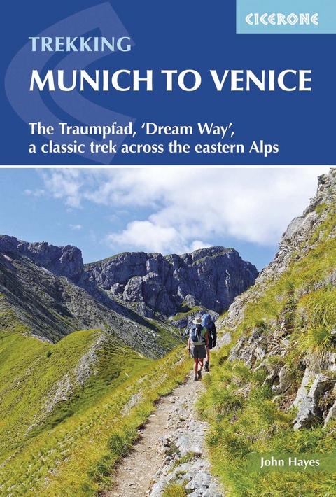
Trekking Munich to Venice
Cicerone Press (Verlag)
978-1-85284-804-0 (ISBN)
A guidebook to trekking the Traumpfad or 'Dream Way' from Munich's Mariënplatz to the Piazza San Marco in Venice. Covering 570km (354 miles), this long-distance trek through Germany, Austria and Italy takes around 1 month to hike and is suitable for most able walkers with a head for heights.
The route is described from north to south in 30 stages, each between 10 and 34km (6–21 miles) in length. Five alternate stages and a day spent traversing via ferrata in the Dolomites are also described.
1:100,000 mapping plus larger-scale urban maps for key locations
GPX files available to download
Handy route planner helps you plan your itinerary
Refreshment, transport and accommodation information given for each trek stage
Highlights include the Karwendel, Tux and Zillertal Alps and the Dolomites
John Hayes is a retired management consultant with degrees from Liverpool University and University College London. Immediately after finishing work in 2011 he embarked on an epic 5000km trek across Europe, walking from Tarifa in Spain to Budapest. John has written for numerous walking and trekking magazines. Having walked various parts of the Munich to Venice route on different visits to the Alps John, with his wife Christine, embarked on his first through walk in 2014 returning again in 2015 to complete additional research.
Map key
Overview map
Overview profile
Route summary table
Introduction
History of the region
The invention of a mountain pilgrimage
The route
The Alpine seasons
Alpine flowers, animals and birds
What's the walking like?
How hard is it?
How long will it take?
When to go
Accommodation
Hut life
Planning your walk
What to take
Finding your way
Using this guide
1 Munich to the Inn Valley
Stage 1 Munich to Wolfratshausen
Stage 2 Wolfratshausen to Bad Tölz
Stage 3 Bad Tölz to the Tutzinger Hütte
Stage 4 Tutzinger Hütte to Vorderriß
Stage 5 Vorderriß to the Karwendelhaus
Stage 6 Karwendelhaus to the Hallerangerhaus
Stage 7A Hallerangerhaus to Hall
Stage 7B Hallerangerhaus to Wattens
2 Inn Valley to Pfunders
Stage 8A Hall to the Glungezer Hütte
Stage 8B Wattens to the Lizumer Hütte
Stage 9 Glungezer Hütte to the Lizumer Hütte
Stage 10 Lizumer Hütte to the Tuxer Joch Haus
Stage 11A Tuxer Joch Haus to the Olpererhütte
Stage 11B Tuxer Joch Haus to the Geraerhütte
Stage 12A Olpererhütte to Stein
Stage 12B Geraerhütte to Stein
Stage 13 Stein to Pfunders
3 Pfunders to Alleghe
Stage 14 Pfunders to Kreuzwiesen Alm
Stage 15 Kreuzwiesen Alm to the Schlüterhütte (Rifugio Genova)
Stage 16 Schlüterhütte to the Puezhütte
Stage 17 Puezhütte (Rifugio Puez) to Rifugio Bo&##xe8;
Stage 18 Rifugio Bo&##xe8; to Rifugio Viel dal Pan
Stage 19 Rifugio Viel dal Pan to Alleghe
4 Alleghe to Belluno
Stage 20 Alleghe to Rifugio Tissi
Stage 21 Rifugio Tissi to Rifugio Bruto Carestiato
Stage 22 Rifugio Bruto Carestiato to Rifugio Pian de Fontana
Stage 23A Rifugio Pian de Fontana to Rifugio 7th Alpini
Stage 23B Rifugio Pian de Fontana to Belluno
Stage 24 Rifugio 7th Alpini to Belluno
5 Belluno to Venice
Stage 25 Belluno to Rifugio Col Visentin
Stage 26 Rifugio Col Visentin to Tarzo
Stage 27 Tarzo to Ponte della Priulä
Stage 28 Ponte della Priulä to Bocca Callalta
Stage 29 Bocca Callalta to Jesolo
Stage 30 Jesolo to Venice
Appendix A Route planner
Appendix B Accommodation along the route
Appendix C Useful contacts
| Erscheint lt. Verlag | 7.11.2016 |
|---|---|
| Reihe/Serie | Cicerone guidebooks |
| Zusatzinfo | 83 photos, 56 maps, 36 route profiles |
| Verlagsort | Kendal |
| Sprache | englisch |
| Maße | 116 x 172 mm |
| Gewicht | 310 g |
| Themenwelt | Sachbuch/Ratgeber ► Sport |
| Reisen ► Reiseführer ► Deutschland | |
| Reiseführer ► Europa ► Italien | |
| Reiseführer ► Europa ► Österreich | |
| Reisen ► Sport- / Aktivreisen ► Deutschland | |
| Reisen ► Sport- / Aktivreisen ► Europa | |
| ISBN-10 | 1-85284-804-9 / 1852848049 |
| ISBN-13 | 978-1-85284-804-0 / 9781852848040 |
| Zustand | Neuware |
| Haben Sie eine Frage zum Produkt? |


