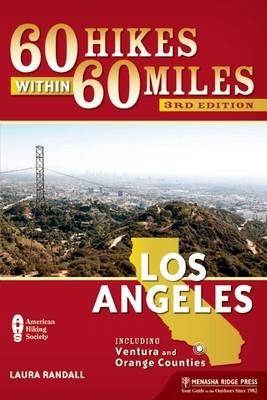
60 Hikes Within 60 Miles: Los Angeles
Menasha Ridge Press Inc. (Verlag)
978-1-63404-036-5 (ISBN)
60 Hikes Within 60 Miles: Los Angeles shows readers how to quickly drive to and enjoy the best hikes from the San Gabriel Mountains to the Pacific Ocean. With time, health, and pin money at a premium, this handy guide helps Angelenos get back to nature without going out of town. From Palos Verdes on the coast to Santa Clarita to the north and the expansive San Gabriel Mountains, it details 60 hikes and walks within roughly an hour's drive of Los Angeles, encouraging even the most time-starved trekkers to get on the trails and get healthy. Extensive at-a-glance information makes it easy to choose the perfect hike based on length, difficulty, scenery, or on a specific factor such as hikes good for families, runners, or birding. Each trail profile includes maps, directions, driving times, nearby attractions, and other pertinent details. Having lived in just about every area of Los Angeles, author Laura Randall provides key in-the-know information about traffic patterns, the best times to hike, how to avoid expensive parking fees, and the best burrito joints near the trail-head.
A native of suburban Philadelphia, Laura Randall lived in Washington, D.C. and San Juan, Puerto Rico before moving to the Los Angeles area in 1999. Her byline can be found in a variety of newspapers and consumer magazines, including the Los Angeles Times, the Washington Post, Sunset Magazine, and the Christian Science Monitor. From the Westside to the foothills of the San Gabriel Mountains, she has lived in many Los Angeles neighborhoods and can lead you to excellent trails in just about any pocket of the city. Randall is also the author of Peaceful Places: Los Angeles.
Overview Map
Overview Map Key
Acknowledgments
Foreword
Preface
60 Hikes by Category
Introduction
DOWNTOWN LOS ANGELES (including Griffith Park, Hollywood, Baldwin Hills)
Baldwin Hills: Kenneth Hahn State Recreation Area Trails
Burbank Peak to Mount Lee
Elysian Park: Angels Point to Bishops Canyon
Elysian Park: Wildflower Trail
Ernest E. Debs Regional Park: City View and Walnut Forest Trails
Griffith Park: Amir’s Garden
Griffith Park: Charlie Turner Trail
Griffith Park: Hollyridge Trail
Mount Washington: Jack Smith Trail
Runyon Canyon
WEST (including San Fernando Valley, Verdugo Mountains, Santa Monica Mountains)
Arroyo Sequit Trail
Caballero Canyon Trail
Calabasas Peak Motorway
Franklin Canyon: Ranch and Hastain Trails
Fryman Canyon Loop
Grotto Trail
Malibu Creek State Park: M*A*S*H Trail
Marvin Braude Mulholland Gateway Park: Hub Junction Trail
Paramount Ranch: Hacienda Trail to Backdrop Trail
Peter Strauss Trail
San Vicente Mountain: Old Nike Missile Site
EAST (including Glendale, Pasadena, San Gabriel Mountains)
Arroyo Seco: Gabrielino National Recreation Trail
Beaudry Loop
Brand Fire Road Trail
Cherry Canyon Park
Deukmejian Wilderness Park Trails
Eaton Canyon Falls and Henninger Flats
Josephine Peak
La Cañada Fire Road to Gabrielino National Recreation Trail
La Tuna Canyon
Legg Lake Loop Trail
Lower Arroyo Seco Trail
Millard Canyon: Sunset Ridge Trail
Monrovia Canyon Park: Bill Cull and Falls Trails
Mount Wilson Trail to Orchard Camp
Sam Merrill Trail to Echo Mountain
Stough Canyon Nature Center Trail
Switzer Falls via Bear Canyon Trail
West Fork Trail
COAST (including Malibu, Pacific Palisades, Palos Verdes)
Charmlee Wilderness Park Loop Trail
Corral Canyon Loop
Palos Verdes: Ocean Trails Reserve
Paseo Miramar Trail to Parker Mesa Overlook
Portuguese Bend Reserve: Burma Road Trail
Solstice Canyon and Rising Sun Trails
Temescal Ridge Trail
Will Rogers State Historic Park: Inspiration Point Loop Trail
ORANGE COUNTY AND LA PUENTE HILLS
Bolsa Chica Ecological Reserve, Huntington Beach
Crystal Cove State Park: El Moro Canyon Trail
Hacienda Hills Trail
Hellman Park: Peppergrass Trail to Rattlesnake Ridge Trail
Oak Canyon Nature Center: Bluebird Lane and Wren Way
Peters Canyon Regional Park: Lake View Trail
SIMI AND ANTELOPE VALLEYS
Corriganville Park: Interpretive and Loop Trails
Devil’s Punchbowl Natural Area: Devil’s Chair Trail
Ed Davis Park in Towsley Canyon: Canyon View Loop Trail
Hummingbird Trail
Pacific Crest Trail at Vasquez Rocks
Placerita Canyon: Walker Ranch
Wildwood Park: Lizard Rock
Appendix A: Outdoor Shops
Appendix B: Hiking Clubs and Organizations
Index
About the Author
Map Legend
| Erscheint lt. Verlag | 25.2.2016 |
|---|---|
| Reihe/Serie | 60 Hikes Within 60 Miles |
| Zusatzinfo | B&W photos throughout, 65 maps, 30 charts |
| Verlagsort | Birmingham |
| Sprache | englisch |
| Maße | 152 x 228 mm |
| Gewicht | 354 g |
| Themenwelt | Sachbuch/Ratgeber ► Sport |
| Reiseführer ► Nord- / Mittelamerika ► USA | |
| ISBN-10 | 1-63404-036-8 / 1634040368 |
| ISBN-13 | 978-1-63404-036-5 / 9781634040365 |
| Zustand | Neuware |
| Haben Sie eine Frage zum Produkt? |
aus dem Bereich


