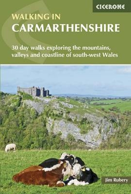
Walking in Carmarthenshire
Cicerone Press (Verlag)
978-1-85284-737-1 (ISBN)
A guidebook to 30 day walks in Carmarthenshire in south Wales, including parts of the Bannau Brycheiniog (Brecon Beacons) National Park and the Carmarthenshire Coast Path. The walks are mostly circular and vary in difficulty, from short, easy walks to more challenging routes in open country, with something for all levels of experience and fitness.
The walks range from 5–17km (3–11 miles) in length and take between 2 and 7 hours to complete. They are organised into six geographical areas covering the northwest of the county, the central region, the Cambrian Mountains, Y Mynydd Du (the Black Mountain), and Carmarthen Bay east and west.
1:50,000 OS maps included for each walk
Sized to easily fit in a jacket pocket
Refreshment and public transport options are given for each walk
Information given on local geology and wildlife
Easy access from Carmarthen, Llandeilo, Llanelli and Llandovery
Jim Rubery is a very keen participant in outdoor pursuits, having spent his spare time over the years climbing, mountaineering, walking, skiing, canoeing and even dabbling with caving and sailing. Jim has a regular walking column, 'Rambling with Rubery', in Yorkshire Life, Cheshire Life and Lancashire Life magazines. It is from his researches that his love of historical places has grown.
Map key
Overview map
Introduction
Landscape and geology
History
Nature reserves and wildlife habitats
Transport
Staying in Carmarthenshire
What to take
Maps and waymarking
Using this guide
In and around the Teifi Valley
Walk 1 Bronwydd and the Gwili Valley
Walk 2 Cenarth and Newcastle Emlyn
Walk 3 Drefach Felindre and the Woollen Trail
Walk 4 Llandysul and the Afon Tyweli
Castles, gardens and forests
Walk 5 Brechfa Forest West
Walk 6 National Botanic Garden and Paxton's Tower
Walk 7 Dryslwyn, Aberglasney and Golden Grove
Walk 8 Llandeilo and Dinefwr Park
The Cambrians of Carmarthenshire
Walk 9 Dolaucothi
Walk 10 Cil-y-cwm
Walk 11 Cynghordy
Walk 12 Llandovery
The high mountains of Y Mynydd Du
Walk 13 Mynydd Myddfai
Walk 14 Usk Reservoir
Walk 15 Carn Goch and the Afon Sawdde
Walk 16 Carreg Cennen Castle
Walk 17 Carmarthen Fan
Walk 18 Foel Fraith and Garreg Lwyd
History and heritage
Walk 19 Loughor Bridge to Llanelli North Dock
Walk 20 Llanelli North Dock to Burry Port Harbour
Walk 21 Cwm Lliedi Reservoir and Parc Howard
Walk 22 Burry Port Harbour to Kidwelly
Walk 23 Kidwelly and the Gwendraeth Valley
Dylan Thomas country
Walk 24 Llansteffan Castle
Walk 25 Llansteffan and Wharley Point
Walk 26 Laugharne North
Walk 27 Laugharne South
Walk 28 Pendine to Amroth
Walk 29 Meidrim
Walk 30 Llanboidy
Appendix A Walk summary table
Appendix B Useful contacts
| Erscheint lt. Verlag | 15.10.2015 |
|---|---|
| Zusatzinfo | 76 colour photos 40 OS map extracts |
| Verlagsort | Kendal |
| Sprache | englisch |
| Maße | 116 x 172 mm |
| Gewicht | 200 g |
| Themenwelt | Sachbuch/Ratgeber ► Sport |
| Reiseführer ► Europa ► Großbritannien | |
| ISBN-10 | 1-85284-737-9 / 1852847379 |
| ISBN-13 | 978-1-85284-737-1 / 9781852847371 |
| Zustand | Neuware |
| Haben Sie eine Frage zum Produkt? |
aus dem Bereich


