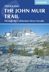
The John Muir Trail
Cicerone Press (Verlag)
978-1-85284-790-6 (ISBN)
A guidebook to trekking the John Muir Trail (JMT) from Happy Isles in Yosemite Valley to the summit of Mount Whitney and onto the trailhead at Whitney Portal. Covering 348km (216 miles), this long-distance trek through the Sierra Nevada mountains of California takes around 3 weeks to hike and is suitable for hikers with experience in remote high-mountain wilderness.
The route is described from north to south in 21 stages, each between 11 and 26km (7–16 miles). An optional ascent of Half Dome is also included, which involves some easy scrambling and requires a good head for heights.
Sketch maps included for the route
Ascent, descent and distance tables included for all stages
Lists of camp areas, ranger stations and bear box locations
Advice on trekking permits, transport to and from the trailheads, equipment, food and supplies, training
Route travels through 3 national parks: Yosemite, Kings Canyon and Sequoia
Alan Castle has trekked and cycled in over 30 countries within Europe, Asia, North and South America, Africa and Australasia. A member of the Outdoor Writers and Photographers Guild, he has written 18 guidebooks, several on long-distance mountain routes in France. An erstwhile national secretary and long-distance path information officer of the Long Distance Walkers Association, Alan now lives at the foot of the Moffat Hills in Scotland.
Route Map
Map Key
Summary Table: John Muir Trail
INTRODUCTION
Background
John Muir
Parks along the JMT
The Pacific Crest Trail
Using this Guide
Planning your Trip
Flights to California
Public Transport to and from the Trailhead
Booking Accommodation
Maps
Equipment
Food Supplies
General Fitness and Trail Fitness
Health and Medical Considerations
Water Purification
Coping with Altitude
Dealing with Bears
River Crossings
Other Natural Hazards
Low-Impact Trekking and National Park/Wilderness Regulations
Camp Routine
Time Difference
Public Holidays in the US
Money
Insurance
The Natural World
Geology of the Sierra Nevada
Vegetation and Flowers on the John Muir Trail
Birds of the John Muir Trail
Mammals along the Trail
TRAIL GUIDE
Day 1 Yosemite Valley (Happy Isles) to Half Dome Trail Junction/Sunrise Creek and the Ascent of Half Dome
Day 2 Half Dome Trail Junction/Sunrise Creek to Sunrise High Sierra Camp
Day 3 Sunrise High Sierra Camp via Cathedral Pass to Tuolumne Meadows
Day 4 Tuolumne Meadows to Upper Lyell Canyon
Day 5 Upper Lyell Canyon via Donohue Pass and Island Pass to Thousand Island Lake
Day 6 Thousand Island Lake to the Devil's Postpile
Day 7 The Devil's Postpile via Reds Meadow to Deer Creek
Day 8 Deer Creek to Tully Hole/Cascade Valley Junction
Day 9 Tully Hole/Cascade Valley Junction via Silver Pass to Edison Lake
Day 10 Edison Lake to Rosemarie Meadow
Day 11 Rosemarie Meadow via Seldon Pass to the Muir Trail Ranch
Day 12 Muir Trail Ranch to McClure Meadow
Day 13 McClure Meadow via Muir Pass to Unnamed Lake North-East of Helen Lake
Day 14 Unnamed Lake North-East of Helen Lake to Deer Meadow
Day 15 Deer Meadow via Mather Pass to Kings River
Day 16 Kings River via Pinchot Pass to Woods Creek
Day 17 Woods Creek via Glen Pass to Vidette Meadow
Day 18 Vidette Meadow via Forester Pass to Tyndall Creek
Day 19 Tyndall Creek to Guitar Lake
Day 20 Guitar Lake via Mount Whitney and Trail Crest to Trail Camp; and the ascent of Mount Whitney
Day 21 Trail Camp to Whitney Portal
Epilogue
Appendix 1 Camping Areas on the JMT
Appendix 2 Ranger Stations along the JMT
Appendix 3 Escape Routes on the JMT
Appendix 4 Bear Box Locations on the JMT
Appendix 5 Mountain Passes and Peaks on the JMT
Appendix 6 Useful Addresses and Websites in the UK and US
Appendix 7 Bibliography
Appendix 8 Trail Summary Table
| Erscheint lt. Verlag | 20.11.2018 |
|---|---|
| Reihe/Serie | Cicerone guidebooks |
| Zusatzinfo | 85 colour photos and 20 maps and profiles |
| Verlagsort | Kendal |
| Sprache | englisch |
| Maße | 116 x 172 mm |
| Gewicht | 250 g |
| Themenwelt | Sachbuch/Ratgeber ► Sport |
| Reiseführer ► Nord- / Mittelamerika ► USA | |
| Reisen ► Sport- / Aktivreisen ► Nord- / Mittelamerika | |
| ISBN-10 | 1-85284-790-5 / 1852847905 |
| ISBN-13 | 978-1-85284-790-6 / 9781852847906 |
| Zustand | Neuware |
| Haben Sie eine Frage zum Produkt? |
aus dem Bereich


