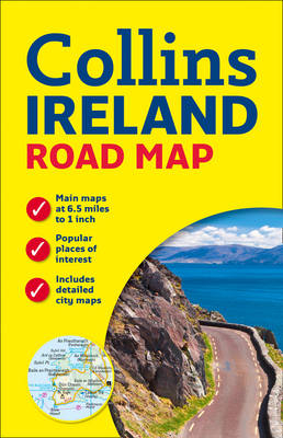
Ireland Road Map
2015
|
New edition
Collins (Verlag)
978-0-00-754398-4 (ISBN)
Collins (Verlag)
978-0-00-754398-4 (ISBN)
- Titel ist leider vergriffen;
keine Neuauflage - Artikel merken
Handy colour map of the whole of Ireland packed with detail and featuring clear and detailed mapping at a scale of 6.5 miles to 1 inch, ideal for easy journey planning. An essential purchase for motorists and perfect for both residents and visitors to Ireland.
FEATURES:
• All motorways, classified roads and many minor roads.
• Places of tourist interest shown on the mapping.
• Indexed street maps of 11 cities and towns – Dublin, Belfast, Cork, Limerick, Londonderry (Derry), Galway, Bangor, Waterford, Dun Laoghaire, Drogheda and Killarney.
• Speed enforcement zones and fixed location speed cameras clearly shown.
• Includes Blue Flag & Green Coast beaches.
• Distance chart; distances marked on the roads in miles and kilometres.
• Attractive layer colours showing land height.
Explore the world through accurate and up-to-date mapping.
| Erscheint lt. Verlag | 12.3.2015 |
|---|---|
| Zusatzinfo | Index |
| Verlagsort | London |
| Sprache | englisch |
| Maße | 140 x 245 mm |
| Gewicht | 140 g |
| Themenwelt | Reisen ► Karten / Stadtpläne / Atlanten ► Europa |
| Reiseführer ► Europa ► Irland | |
| Naturwissenschaften ► Physik / Astronomie ► Astronomie / Astrophysik | |
| Technik | |
| ISBN-10 | 0-00-754398-0 / 0007543980 |
| ISBN-13 | 978-0-00-754398-4 / 9780007543984 |
| Zustand | Neuware |
| Haben Sie eine Frage zum Produkt? |
Mehr entdecken
aus dem Bereich
aus dem Bereich
Karte (gefalzt) (2024)
Lonely Planet Global Limited (Verlag)
7,45 €

