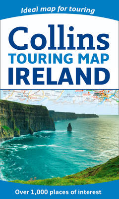
Ireland Touring Map
2014
|
New edition
Collins (Verlag)
978-0-00-754968-9 (ISBN)
Collins (Verlag)
978-0-00-754968-9 (ISBN)
- Titel erscheint in neuer Auflage
- Artikel merken
Zu diesem Artikel existiert eine Nachauflage
Large full colour map of the whole of Ireland showing the road network in detail, and with a special emphasis on places of tourist interest.
This map has a handy touring scale of 7.5 miles to 1 inch (1:475,200). It has over 20 categories of tourist information depicted on the map with clear, colourful red and yellow symbols. There is a full index to place names and places of interest.
INCLUDES:
• All classified and most minor roads.
• Railway network and ferry routes.
• Viewpoints and sandy beaches.
• Speed enforcement zones and safety camera locations.
• Index to 20 categories of tourist information.
• Includes castles, historic houses, gardens, beaches and golf courses.
Explore the world through accurate and up-to-date mapping.
| Erscheint lt. Verlag | 13.3.2014 |
|---|---|
| Zusatzinfo | Index |
| Verlagsort | London |
| Sprache | englisch |
| Maße | 139 x 237 mm |
| Gewicht | 110 g |
| Themenwelt | Reisen ► Karten / Stadtpläne / Atlanten ► Europa |
| ISBN-10 | 0-00-754968-7 / 0007549687 |
| ISBN-13 | 978-0-00-754968-9 / 9780007549689 |
| Zustand | Neuware |
| Haben Sie eine Frage zum Produkt? |
Mehr entdecken
aus dem Bereich
aus dem Bereich
Karte (gefalzt) (2023)
Freytag-Berndt und ARTARIA (Verlag)
12,90 €
Straßen- und Freizeitkarte 1:250.000
Karte (gefalzt) (2023)
Freytag-Berndt und ARTARIA (Verlag)
12,90 €
Östersund
Karte (gefalzt) (2023)
Freytag-Berndt und ARTARIA (Verlag)
12,90 €


