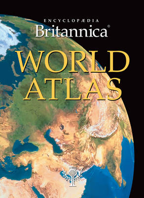
Encyclopaedia Britannica World Atlas
Seiten
2010
|
Revised edition
Encyclopaedia Britannica, Incorporated (Verlag)
978-1-61535-359-0 (ISBN)
Encyclopaedia Britannica, Incorporated (Verlag)
978-1-61535-359-0 (ISBN)
- Titel ist leider vergriffen;
keine Neuauflage - Artikel merken
Track the planet's longest rivers, discover the huge varieties of terrain, gain insight into the Earth's global climate and learn about each region's ever fluctuating populations and political boundaries with the new Encyclopadia Britannica World Atlas. Explore all countries and regions of the world with this trusted and in-depth resource, with features ranging from high definition satellite images to detailed thematic maps about major world issues. Updated for 2010, this atlas provides a complete picture of our 21st-century world with clarity, detail and precision. It allows you to travel around our planet without leaving your seat and helps you understand the world around you. - Provides balanced coverage of all world regions and offers confidence in knowledge on a global scale. - Global thematic maps supply a thorough examination of the world by showing the Earth's place in the Universe, its physical forms and processes, as well as life on earth and ecological issues. - With maps created through the full benefit of satellite imaging, laser measurements and other modern and accurate mapping techniques the world's physical relief is brought to life with extensive detail.
- World Overview, an analytic 33-page introductory section, enhances research with facts and statistics on thought-provoking global topics such as climate change, economic growth and immigration trends. - Find places quickly with a clearly styled index of more than 100,000 placenames, each with its geographical coordinates, variant language spellings and historical forms. - Each section begins with a beautiful 8-page introductory spread detailing the current ecological and political standings of each continent, followed by comprehensive and up-to-date maps of the region's countries. - Highly detailed terrain models and sensitive colour schemes give an unsurpassed impression of the Earth.
- World Overview, an analytic 33-page introductory section, enhances research with facts and statistics on thought-provoking global topics such as climate change, economic growth and immigration trends. - Find places quickly with a clearly styled index of more than 100,000 placenames, each with its geographical coordinates, variant language spellings and historical forms. - Each section begins with a beautiful 8-page introductory spread detailing the current ecological and political standings of each continent, followed by comprehensive and up-to-date maps of the region's countries. - Highly detailed terrain models and sensitive colour schemes give an unsurpassed impression of the Earth.
| Erscheint lt. Verlag | 16.8.2010 |
|---|---|
| Zusatzinfo | Over 200 colour maps and illus |
| Verlagsort | Chicago |
| Sprache | englisch |
| Maße | 265 x 365 mm |
| Themenwelt | Reisen ► Karten / Stadtpläne / Atlanten ► Welt / Arktis / Antarktis |
| Schulbuch / Wörterbuch | |
| ISBN-10 | 1-61535-359-3 / 1615353593 |
| ISBN-13 | 978-1-61535-359-0 / 9781615353590 |
| Zustand | Neuware |
| Informationen gemäß Produktsicherheitsverordnung (GPSR) | |
| Haben Sie eine Frage zum Produkt? |
Mehr entdecken
aus dem Bereich
aus dem Bereich
mit Fakten und Infos zu allen Kontinenten
Buch | Hardcover (2024)
Kosmos Kartografie in der Franckh-Kosmos Verlags-GmbH & Co. …
24,00 €


