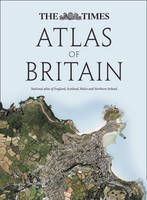
The Times Atlas of Britain
Seiten
2010
Times Books (Verlag)
978-0-00-734583-0 (ISBN)
Times Books (Verlag)
978-0-00-734583-0 (ISBN)
- Titel erscheint in neuer Auflage
- Artikel merken
Zu diesem Artikel existiert eine Nachauflage
The first ever national Atlas of Britain to be published for over 40 years. This first edition of The Times Atlas of Britain is perfect for finding out more about Britain, discovering your county or just exploring the country. Includes England, Wales, Scotland and Northern Ireland.
An authoritative and prestigious atlas with detailed mapping and geographical information about Britain. England, Wales, Scotland and Northern Ireland are given comprehensive coverage along with every county.
Fully up-to-date reference maps, statistics, images and historical mapping give an exceptionally detailed view of Britain. A brand new atlas in the Times range covering the whole of Great Britain.
The following features are included in this unique atlas:
• 160 pages of Times reference mapping
• 17 city centre maps
• 450 photographs
• 90 historical maps
• 100,000 words of text
Pages on each county contain the following:
• flag/crest
• description
• at a glance statistics
• photographs
• modern map in Times mapping style
• historical map of county from the Bartholomew archive
• fascinating descriptions from John Bartholomew's "Gazetteer of the British Isles" 1887
• list of well-known people born in the county
• quotes from celebrities about the county
Play The Times Atlas of Britain Challenge and test your geographical knowledge! Find it online at www.atlasofbritain.com or on Facebook.
‘I love maps and atlases and The Times Atlas is the best for the clarity of the cartography’ Chris Bonington
A benchmark of cartographic excellence, trusted by governments, media and international organisations alike. The Times Comprehensive Atlas of the World is the flagship publication and leads this iconic range. There’s an edition for every occasion from the pocket-sized Mini, the everyday Reference to the Universal, the popular choice for gift buyers
| Erscheint lt. Verlag | 2.9.2010 |
|---|---|
| Verlagsort | London |
| Sprache | englisch |
| Maße | 270 x 366 mm |
| Gewicht | 3465 g |
| Themenwelt | Reisen ► Karten / Stadtpläne / Atlanten ► Europa |
| ISBN-10 | 0-00-734583-6 / 0007345836 |
| ISBN-13 | 978-0-00-734583-0 / 9780007345830 |
| Zustand | Neuware |
| Haben Sie eine Frage zum Produkt? |
Mehr entdecken
aus dem Bereich
aus dem Bereich
Buch | Spiralbindung (2024)
Freytag-Berndt und ARTARIA (Verlag)
29,90 €


