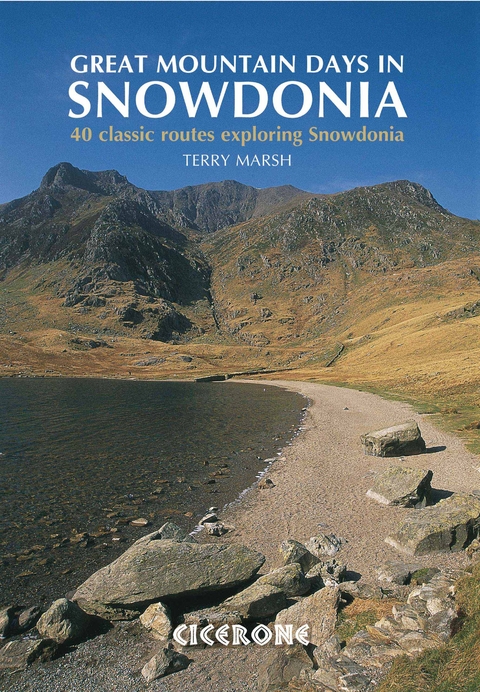
Great Mountain Days in Snowdonia
Cicerone Press (Verlag)
978-1-85284-581-0 (ISBN)
A guidebook to 40 great mountain walks and scrambles in Snowdonia. The inspirational routes in this larger format book range right across the Snowdonia National Park and are divided into 8 geographical regions: Snowdon and Moel Eilio, the Glyderau, the Carneddau, Eifionydd, Siabod and the Moelwynion, Rhinogydd (the Harlech Dome), Migneint and the Arans and Cadair Idris and the Tarrens.
All routes are graded, from moderate to strenuous, and illustrated with Harvey map extracts, topo diagrams by Mark Richards and lots of stunning photographs. Some routes include mild scrambling or long days in rugged country, and many can be enjoyed all year round. The walks have been chosen to encourage you to try something new in this much-loved region, while at the same time offering clear descriptions of classic routes for those new to Snowdonia.
Terry Marsh is a full-time writer and photographer specialising in the outdoors. His involvement with Snowdonia began in 1970 when he moved to Bangor, and soon became a voluntary warden in the Snowdonia National Park. His first book was 'The Summits of Snowdonia', followed a year later by 'The Mountains of Wales'. This is his seventh book for Cicerone.
Preface
Introduction
About this guide
Weather to walk?
Before you start
Recreation and the mountain environment
The Walks
SNOWDON AND MOEL EILIO
1. Snowdon Horseshoe
2. The Rhyd Ddu Path and the Snowdon Ranger
3. The Watkin Path and Yr Aran
4. The Pyg Track and the Miners' Track
5. Moel Eilio Horseshoe
GLYDERAU
6. The Glyders by the Bristly Ridge
7. Y Garn to Elidir Fawr and Carnedd y Filiast
8. Tryfan
9. Bwlch Tryfan, Y Foel Goch, Gally yr Ogof and Cefn y Capel
CARNEDDAU
10. Conwy Mountain
11. Tal y Fan
12. Drum, Foel-fras, Garnedd Uchaf, Drosgl and the Aber falls
13. Llyn Anafon and the eastern Carneddau
14. Pen yr Ole Wen, Carnedd Dafydd, Carnedd Llywelyn and Pen yr Helgi Du
15. Cwm Eigiau Horseshoe
16. Creigiau Gleision and Llyn Cowlyd
17. Llyn Geirionydd and Llyn Crafnant
18. The Carneddau: end-to-end
EIFIONYDD
19. Mynydd Mawr
20. The Nantlle Ridge
21. Moel Hebog, Moel yr Ogof and Moel Lefn
SIABOD AND THE MOELWYNION
22. Aberglaslyn, Llyn Dinas and Cwm Bychan
23. Moel Siabod
24. Cnicht and Cwm Croesor
25. Moelwyn Mawr and Moelwyn Bach
26. Moel Meirch and Ysgafell Wen
RHINOGYDD (THE HARLECH DOME)
27. Bwlch Tyddiad and Bwlch Drws Ardudwy
28. Rhinog Fawr
29. Rhinog Fach and Rhinog Fawr
30. Y Llethr and Diffwys
MIGNEINT AND THE ARANS
31. Carnedd y Filiast
32. Arenig Fawr and Moel Llyfnant
33. Rhobell Fawr
34. Aran Benllyn
35. Aran Fawddwy
CADAIR IDRIS AND THE TARREN HILLS
36. Cyfrwy, Pen y Gadair and Mynydd Pencoed
37. Pen y Gadair from Ty Nant
38. Mynydd Pencoed, Pen y Gadair and Mynydd Moel
39. Tyrrau Mawr and Craig y Llyn
40. The Tarren Hills
Appendix 1: Concise Walk Reference and Personal Log
Appendix 2: Bibliography and Further Reading
Appendix 3: Glossary of Welsh Words
Index
| Erscheint lt. Verlag | 22.5.2017 |
|---|---|
| Reihe/Serie | Cicerone guidebooks |
| Zusatzinfo | 40 map extracts, 40 topos and over 200 colour photographs |
| Verlagsort | Kendal |
| Sprache | englisch |
| Maße | 170 x 240 mm |
| Gewicht | 670 g |
| Themenwelt | Sachbuch/Ratgeber ► Sport |
| Reisen ► Sport- / Aktivreisen ► Europa | |
| ISBN-10 | 1-85284-581-3 / 1852845813 |
| ISBN-13 | 978-1-85284-581-0 / 9781852845810 |
| Zustand | Neuware |
| Haben Sie eine Frage zum Produkt? |
aus dem Bereich
