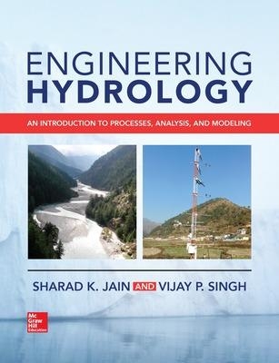
Engineering Hydrology: An Introduction to Processes, Analysis, and Modeling
McGraw-Hill Education (Verlag)
978-1-259-64197-8 (ISBN)
Understand the fundamentals, methods, and processes of modern hydrology
This comprehensive engineering textbook offers a thorough overview of all aspects of hydrology and shows how to apply hydrologic principles for effective management of water resources. It presents detailed explanations of scientific principles along with real-world applications and technologies. Engineering Hydrology: An Introduction to Processes, Analysis, and Modeling follows a logical progression that builds on foundational concepts with modern hydrologic methods. Every hydrologic process is clearly explained along with current techniques for modeling and analyzing data. You will get practice problems throughout that help reinforce important concepts.
Coverage includes:
•The hydrologic cycle
•Water balance
•Components of the hydrologic cycle
•Evapotranspiration
•Infiltration and soil moisture
•Surface water
•Groundwater
•Water quality
•Hydrologic measurements
•Streamflow measurement
•Remote sensing and geographic information systems
•Hydrologic analysis and modeling
•Unit hydrograph models
•River flow modeling
•Design storm and design flood estimation
•Environmental flows
•Impact of climate change on water management
Sharad K. Jain, Ph.D. is head of the Water Resources Systems Division at the National Institute of Hydrology in Roorkee, India. He has published 215 journal papers and served as author or editor for 9 books. Vijay P. Singh, Ph.D. is Distinguished Professor & Chair of Water in the Department of Biological and Agricultural Engineering at Texas A&M University. Dr. Singh has published nearly 800 journal articles and has served as author or editor for over 75 books, including the second edition of Chow’s Handbook of Applied Hydrology.
Preface
Acknowledgments
Part 1 Preliminaries
1 Introduction
1.1 What Is Hydrology?
1.2 A Brief History of Hydrology
1.2.1 Hydrology in Ancient Times—The Case of India
1.2.2 Development of Hydrology, from 1850 Onward
1.2.3 Future Directions
1.3 Why This Book—and Why Now?
1.3.1 Who Is the Intended Readership of This Book?
1.3.2 Organization of This Book
1.4 Summary
1.5 Questions
1.6 References
2 The Hydrologic Cycle
2.1 Introduction
2.2 Components of the Hydrologic Cycle
2.2.1 Atmospheric Component
2.2.2 Surface Components
2.2.3 Importance of the Components of the Hydrologic Cycle
2.3 Scales for the Study of the Hydrologic Cycle
2.3.1 Global Scale
2.3.2 Catchment Scale
2.3.3 Time Scales in the Hydrologic Cycle
2.4 Carbon and Nitrogen Cycles and Their Relation with the Hydrologic Cycle
2.4.1 Carbon Cycle
2.4.2 Nitrogen Cycle
2.4.3 Linkages Among Hydrologic, Carbon, and Nitrogen Cycles
2.5 Influence of Human Activity and Land-Use Changes on the Hydrologic Cycle
2.5.1 Effects of Agricultural Changes
2.5.2 Effects of Urbanization
2.5.3 Effects of Forest Activities
2.5.4 Effects of Structural Changes
2.5.5 Changes in Water Quality
2.6 Impact of Climate Change on the Hydrologic Cycle
2.7 Summary
2.8 Questions
2.9 Activities
2.10 References
3 Water Balance
3.1 Water Balance—The Mathematical Representation of the Hydrologic Cycle
3.2 Forms of the Water Balance Equation
3.3 Closure of the Water Balance Equation
3.4 Global Water Balance
3.4.1 Continental Water Balance
3.4.2 River Basin Water Balance
3.4.3 The Impact of Natural and Human-Induced Changes on Water Balance
3.5 Summary
3.6 Questions
3.7 References
Part 2 Hydrologic Components
4 Precipitation and Interception
4.1 Precipitation
4.2 Cloud Formation
4.2.1 Classification of Precipitation
4.2.2 Cloud Types
4.3 Observation of Precipitation
4.3.1 Rainfall Measurement
4.3.2 Nonrecording Rain Gauges
4.3.3 Self-Recording Rain Gauge (SRRG)
4.3.4 Tipping-Bucket Rain Gauge
4.3.5 Precipitation Measurement by Weather Radar
4.4 Processing of Rainfall Data
4.4.1 Internal Consistency Check
4.4.2 Scrutiny of Precipitation Data by Multiple Time Series Analysis
4.4.3 Scrutiny by Statistical Tests
4.4.4 Correction and Completion of Rainfall Data
4.4.5 Spatial Consistency Check
4.5 Spatial Averaging of Rainfall Data
4.5.1 Arithmetic Average
4.5.2 Thiessen Polygon Method
4.5.3 Isohyetal Method
4.5.4 Kriging
4.6 Estimation of Missing Data
4.6.1 Normal Ratio Method
4.6.2 Inverse Distance Power Method
4.6.3 Relation Between Point and Areal Rainfall
4.7 Disaggregation of Rainfall Data
4.8 Snow Data
4.8.1 Observation of Snow Data
4.8.2 Measurement of Snow by Remote Sensing
4.9 Regional/Global Meteorological Data Sets
4.10 Rainstorm Analysis
4.11 Interception
4.12 Summary
4.13 Questions
4.14 References
5 Evapotranspiration
5.1 Introduction
5.1.1 Definitions
5.1.2 Evaporation Process
5.1.3 Physics of Evaporation
5.2 Factors Affecting Evaporation
5.2.1 Temperature
5.2.2 Processing of Temperature Data
5.2.3 Solar Radiation
5.2.4 Sunshine Duration
5.2.5 Relative Humidity
5.2.6 Wind Speed
5.2.7 Atmospheric Pressure
5.2.8 Water Quality
5.2.9 Water Depth and Soil Type
5.3 Measurement of Evaporation
5.3.1 The U.S. Weather Bureau Class A Land Pan
5.3.2 Analysis of Pan Evaporation Data
5.3.3 Estimation of Lake Evaporation from Pan Measurements
5.4 Determination of Evaporation from Water Bodies
5.4.1 Water Budget
5.4.2 Energy Budget
5.4.3 Combination Method
5.5 Transpiration
5.6 Evapotranspiration
5.6.1 Measurement of Evapotranspiration
5.7 Estimation of Evapotranspiration
5.7.1 FAO-56 Penman-Monteith Method for the Estimation of ET
5.7.2 Bowen Ratio Energy Balance (BREB) Method
5.7.3 Limits on Evapotranspiration
5.7.4 The Budyko Curve
5.8 Reduced-Set Methods for Evapotranspiration Estimation
5.8.1 Temperature-Based Evapotranspiration Estimation Methods
5.8.2 The Hargreaves-Samani Method
5.8.3 The Thornthwaite Method
5.8.4 The Blaney-Criddle Method
5.9 Radiation-Based Methods
5.9.1 The Priestley-Taylor Method
5.9.2 The Turc Method
5.9.3 The Jensen and Haise Method
5.9.4 Reduced-Set PM
5.9.5 Comments on Reduced-Set Methods
5.10 Emerging Methods for ET Estimation
5.10.1 Eddy Covariance Technique
5.10.2 Remote Sensing for Measurement of Evaporation and Evapotranspiration
5.11 Application of Evapotranspiration in Hydrology
5.12 Questions
5.13 References
6 Infiltration and Soil Moisture
6.1 Infiltration Process
6.2 Soil and Its Hydrologic Properties
6.2.1 Soil Profile
6.2.2 Soil Texture
6.2.3 Soil Water Content
6.3 Soil Water
6.3.1 Movement of Soil Water
6.3.2 Antecedent Moisture Condition
6.4 Measurement of Soil Water Properties
6.4.1 Particle Size Distribution
6.4.2 Soil Moisture Characteristic Curve
6.5 Estimation of Soil Water Properties
6.6 Governing Equations of Soil Water Movement
6.7 Solving the Richards Equation
6.8 Generalized Infiltration Model
6.9 Empirical Infiltration Models
6.9.1 Kostiakov Model
6.9.2 Horton Equation
6.9.3 Philip Two-Term Method
6.9.4 Green-Ampt Model
6.9.5 Green-Ampt Model for Rainfall Infiltration Case
6.10 Applications of Infiltration Theory
6.11 Questions
6.12 References
7 Surface Water
7.1 Catchments
7.1.1 Delineation of Catchments
7.1.2 Channel Networks
7.2 Hydrographs
7.2.1 Elements of Hydrographs
7.2.2 Hydrograph Time Characteristics
7.3 Components of Streamflow
7.3.1 Surface Runoff
7.3.2 Interflow
7.3.3 Direct Runoff
7.3.4 Baseflow
7.4 Catchment Response Mechanisms
7.4.1 Hydrograph Development: Small Elemental Area
7.4.2 Hydrograph Development: Small Natural Catchment
7.4.3 Overland Flow Generation
7.5 Factors Affecting Runoff
7.5.1 Properties of a Rainstorm
7.5.2 Topography and Orientation
7.5.3 Size and Shape
7.5.4 Soils and Geology
7.5.5 Land Use and Land Cover
7.6 Baseflow Separation
7.6.1 Hydrograph Separation
7.6.2 Separation Using Digital Filters
7.6.3 Chemical and Isotope Techniques
7.7 Summary
7.8 Questions
7.9 References
8 Groundwater
8.1 Definitions and Notation
8.1.1 Groundwater
8.1.2 Aquifers
8.1.3 Types of Aquifers
8.1.4 Confined Aquifer
8.1.5 Leaky Aquifer
8.1.6 Perched Aquifer
8.1.7 Water Table
8.1.8 Phreatic Surface
8.1.9 Groundwater Basin
8.1.10 Recharge Area
8.1.11 Porosity
8.1.12 Void Ratio
8.1.13 Permeability
8.1.14 Hydraulic Conductivity
8.1.15 Anisotropy and Heterogeneity
8.1.16 Transmissivity
8.1.17 Specific Yield
8.1.18 Specific Retention
8.1.19 Compressibility and Effective Stress
8.1.20 Specific Storage
8.1.21 Storativity
8.1.22 Hydraulic Diffusivity
8.2 Geologic Formations
8.2.1 Unconsolidated Rocks
8.2.2 Semiconsolidated Rocks
8.2.3 Consolidated Rocks
8.2.4 Geologic Controls
8.2.5 Formations as Aquifers
8.3 Groundwater Flow Equations
8.3.1 Darcy’s Law
8.3.2 Continuity Equation
8.3.3 Governing Equations
8.3.4 Governing Equations for Confined Aquifers
8.3.5 Governing Equations for Unconfined Aquifers
8.3.6 Well Hydraulics
8.3.7 Recharge and Groundwater Runoff
8.3.8 Stream-Aquifer Interaction
8.4 Summary
8.5 Questions
8.6 References
9 Water Quality
9.1 Introduction
9.2 Sources of Contaminants
9.3 Quality of Water
9.4 Chemical Contaminants
9.5 Surface Water Quality
9.6 Subsurface Water Quality
9.7 Characteristics of Water Quality
9.7.1 Units of Measurement
9.7.2 Chemical Relationships
9.7.3 Physical Characteristics
9.7.4 Chemical Characteristics
9.7.5 Biological Characteristics
9.8 Analytical Concepts
9.8.1 Biochemical Oxygen Demand
9.8.2 Nitrification
9.8.3 Denitrification
9.8.4 Oxygen Depletion
9.8.5 Reoxygenation Coefficient
9.8.6 Deoxygenation Coefficient
9.9 Nonpoint Source Pollution
9.9.1 Pollutants in Urban Runoff
9.9.2 Pollutants in Agricultural Runoff
9.9.3 Pollution in Subsurface Waters
9.10 Water Quality Management
9.11 Summary
9.12 Questions
9.13 References
Part 3 Measurements
10 Hydrologic Data Observation Networks
10.1 Hydrometeorological Data Networks
10.1.1 Types of Hydrometeorological Networks
10.1.2 Steps in Network Design
10.1.3 Assessment of Data Needs
10.2 Integration of Networks
10.3 Precipitation Data Networks
10.3.1 Design of Optimal Rain Gauge Network
10.3.2 Cv-Based Technique
10.3.3 Location of Rain Gauge Stations
10.4 Networks for Other Hydrometeorological Data
10.5 River Gauging Networks
10.5.1 Design of River Gauging Networks
10.5.2 Evaluation of Networks
10.5.3 Site Selection Surveys
10.5.4 Hydraulic Engineering for Selection of Sites for River Gauging Stations
10.5.5 General Consi
derations About River Gauging Networks
10.6 Groundwater Monitoring Networks
10.7 Water Quality and Sediment Measuring Stations
10.8 International Standards for Hydrometry
10.9 Reference Climate and Water Data Networks
10.9.1 Global Climate Networks
10.9.2 Country-Level Networks
10.9.3 U.S. Climate Reference Network
10.9.4 Reference Climatological Stations in the United Kingdom
10.10 Recent Advances in Hydrometry
10.11 Summary
10.12 Questions
10.13 References
11 Streamflow Measurement
11.1 River Stage and Discharge
11.1.1 Station Control
11.2 Measurement of River Stages
11.2.1 Manual Means to Measure River Stages
11.2.2 Direct Depth Sounding
11.2.3 Water Level Recorder
11.2.4 Radar Water Level Measurement
11.3 Measurement of Discharge
11.3.1 Direct Determination of Discharge
11.3.2 Velocity-Area Methods
11.3.3 Measurement of Velocity
11.3.4 Moving Boat Method
11.4 Computation of Discharge
11.4.1 Indirect Methods of Discharge Determination
11.4.2 Estimation of Discharge by the Slope-Area Method
11.5 Estimation of Discharge by Using Artificial Structures
11.6 Advanced Discharge Measurement Techniques
11.6.1 Dilution Methods for Measuring Discharge
11.6.2 Acoustic Doppler Current Profiler
11.7 Streamflow Measurement Under Difficult Conditions
11.8 Stage-Discharge Rating Relationship
11.8.1 Simple Rating Curve
11.8.2 Compound Rating Curve
11.8.3 Hysteresis in Rating Curves
11.8.4 Extrapolation of Rating Curves
11.9 New Techniques for Development of Stage-Discharge Relation
11.9.1 Entropy
11.9.2 Uncertainty in Rating Curves
11.10 Summary
11.11 Questions
11.12 References
12 Remote Sensing and Geographic Information Systems
12.1 Remote Sensing
12.1.1 Components of a Remote Sensing System
12.1.2 Remote Sensing Sensors
12.1.3 Resolution of Remote Sensing Data
12.1.4 Reflectance Characteristics of Earth Features
12.1.5 Remote Sensing Platforms
12.2 Remote Sensing Data Analysis
12.2.1 Steps in Digital Image Processing
12.2.2 Spectral Indices
12.2.3 Change Detection
12.3 Selected Space Programs
12.4 Geographic Information Systems
12.4.1 Geographic Data Types
12.4.2 GIS Data Structure
12.4.3 Geographic Coordinate Systems
12.5 GIS-Based Analysis of Spatial Data
12.5.1 Digital Elevation Model
12.5.2 Analysis of Geographic Data Using a GIS
12.6 Applications of Remote Sensing and Geographical Information Systems to Water Resources Problems
12.7 Summary
12.8 Questions
12.9 References
Part 4 Analysis and Modeling
13 Rainfall-Runoff Modeling
13.1 Computation of Hydrograph Volume
13.1.1 Regression Method
13.1.2 Simple Linear Regression
13.1.3 Nonlinear Regression
13.1.4 Multiple Regression
13.1.5 Stepwise Regression
13.2 Soil Conservation Service–Curve Number Method
13.2.1 Curve Number Estimation
13.2.2 SCS Land Cover Complex Classification
13.2.3 SCS Soil Group Classification
13.2.4 Antecedent Soil Moisture Condition
13.2.5 Major Strengths and Weaknesses of SCS-CN Methodology
13.3 Estimation of Peak Discharge
13.3.1 Rational Formula
13.3.2 Peak Discharge–Volume Relation
13.4 Rainfall-Runoff Relationship for Different Durations
13.4.1 Daily Rainfall-Runoff Relationship
13.4.2 Monthly Rainfall-Runoff Relationships (Rain-Fed Catchments)
13.4.3 Regression Models for Seasonal Rivers
13.4.4 Filling in Missing Data
13.4.5 Comments on Regression
13.5 Models for Estimating a Hydrograph
13.6 Soil Erosion and Sediment Yield
13.7 Snowmelt Runoff Modeling
13.7.1 Temperature Index Method
13.7.2 Energy Balance
13.8 Summary
13.9 Questions
13.10 References
14 Unit Hydrograph Models
14.1 Introduction
14.2 Factors Affecting Unit Hydrograph Shape
14.3 Derivation of a Unit Hydrograph
14.3.1 Using Data of a Single-Peak Storm
14.3.2 Derivation of Unit Hydrograph from Data of Multiperiod Storm
14.4 Instantaneous Unit Hydrograph
14.4.1 S-Curve Hydrograph
14.5 Change of Unit Period of Unit Hydrograph
14.5.1 Superimposition Method
14.5.2 S-Curve Method
14.5.3 Relation Between S-Curve and Unit Hydrograph
14.6 Synthetic Unit Hydrograph
14.6.1 The Snyder Method
14.6.2 Soil Conservation Service Dimensionless Hydrograph
14.7 Conceptual Models of UH Derivation
14.7.1 Linear Reservoir Concept
14.7.2 Nash Model
14.7.3 Dooge Model
14.7.4 Geomorphological Instantaneous Unit Hydrograph
14.8 Summary
14.9 Questions
14.10 References
15 Flow Routing
15.1 Introduction
15.2 Muskingum Method of Channel Routing
15.2.1 Parameter Estimation and Interpretation
15.2.2 Routing Procedure
15.2.3 Accounting for Lateral Inflow
15.3 The Saint-Venant Equations
15.3.1 Solution of Saint-Venant Equations
15.3.2 Implicit Methods of Solving Saint-Venant Equations
15.3.3 Kinematic Wave Modeling
15.3.4 Application of KW Theory
15.3.5 Diffusion Waves
15.4 Muskingum-Cunge Method
15.4.1 Estimation of Muskingum-Cunge Parameters
15.4.2 Flood Routing by the Muskingum-Cunge Method
15.4.3 Advantages and Limitations of the Muskingum-Cunge Method
15.5 Muskingum Method and Diffusion Wave Approximation
15.5.1 Kinematic Wave Approximation and Muskingum Method
15.5.2 Another Kinematic Approximation Through Numerical Integration
15.5.3 Diffusion Wave Approximation
15.6 Reservoir Routing
15.6.1 Reservoir Routing Techniques
15.6.2 Modified Puls Method
15.6.3 Mass Curve Method
15.6.4 Reservoir Routing with Controlled Outflow
15.6.5 Major Applications of Storage Routing
15.6.6 General Observations on Reservoir Routing
15.7 Summary
15.8 Questions
15.9 References
16 Pollutant Modeling
16.1 Elements of Transport Process
16.1.1 Advection
16.1.2 Dispersion and Diffusion
16.1.3 Adsorption and Desorption
16.1.4 Growth and Decay
16.1.5 Volatilization
16.1.6 Dissolution-Precipitation
16.2 Transformation of Pollutants in the Environment
16.3 Elements of Pollutant Modeling
16.4 Pollutant Transport in Urban Watersheds
16.5 Pollutant Transport in Agricultural Runoff
16.6 Pollutant Transport in Streams
16.7 Pollutant Transport in Unsaturated Flow
16.8 Pollutant Transport in Groundwater
16.9 Numerical Solution of Convective (or Kinematic Wave) Approximation
16.10 Another Numerical Solution of Convective (Kinematic Wave) Approximation
16.11 Solution by Numerical Integration
16.12 Modeling of Dissolved Oxygen in Streams
16.12.1 Model Formulation
16.12.2 Numerical Solution
16.13 Summary
16.14 Questions
16.15 References
17 Environmental Flows
17.1 Ecohydrology
17.1.1 River Health
17.1.2 River Health Assessment Tools
17.2 Trade-Off Between Development and Conservation
17.3 Environmental Flows
17.3.1 Definition of Environmental Flows
17.3.2 Typical Stages of an Environmental Flow Assessment
17.3.3 Objectives and Factors Governing Environmental Flows
17.3.4 Locations and Reasons for Estimation of Environmental Flows
17.4 Methodologies to Assess Environmental Flow Requirements
17.4.1 Hydrological Methods
17.4.2 Range of Variability Approach
17.4.3 Hydrology- and Hydraulics-Based Methods
17.4.4 Hydraulic Rating Methods
17.4.5 Hydrobiology Methods
17.4.6 Building Block Methodology
17.4.7 Ecological Limits of Hydrologic Alteration
17.4.8 Habitat Simulation Methods
17.4.9 Methodology for Environmental Flow Assessment
17.4.10 Sediment Aspects
17.5 Implementation of Environmental Flows
17.6 Summary
17.7 Questions
17.8 References
Part 5 Hydrologic Design
18 Statistical Analysis of Hydrological Data
18.1 Basic Concepts
18.1.1 Probability
18.1.2 Properties of a Random Variable
18.1.3 Outliers
18.2 Key Statistical Measures of Data
18.2.1 Central Tendency
18.2.2 Measure of Dispersion or Spread
18.2.3 Measures of Symmetry
18.3 Graphical Presentation of Data
18.3.1 Box Plots
18.3.2 Quantiles
18.3.3 Quartiles
18.3.4 Return Period
18.4 Probability Distributions
18.4.1 Normal or Gaussian Distribution
18.4.2 Log-Normal Distribution
18.4.3 Extreme Value Type 1 Distribution
18.4.4 Gamma Distribution
18.4.5 Log Pearson Type III Distribution
18.4.6 Discrete Probability Distributions
18.4.7 Binomial Distribution
18.5 Point and Interval Estimates
18.5.1 Confidence Intervals for the Mean
18.5.2 Standard Error
18.6 Parameter Estimation Methods
18.6.1 Method of Moments
18.6.2 Method of Moments for Discrete Systems
18.6.3 Method of Maximum Likelihood
18.6.4 Method of Least Squares
18.6.5 Method of L-Moments
18.6.6 Bias in Parameter Estimation
18.7 Summary
18.8 Questions
18.9 References
19 Correlation, Regression, Hypothesis, and Trend Analysis
19.1 Covariance and Correlation
19.1.1 Serial Correlation or Autocorrelation
19.1.2 Cross-Correlation
19.1.3 Inferences on Correlation Coefficients
19.1.4 Kendall’s Correlation Coefficient
19.2 Regression
19.3 Simple Linear Regression
19.3.1 Estimation of Regression Parameters 19.3.2 Goodness of Regression
19.3.3 Extrapolation
19.3.4 Nonlinear Regression
19.4 Multiple Linear Regression
19.4.1 Estimation of Multiple Regression Coefficients
19.4.2 Stepwise Regression
19.4.3 Regression After Transforming Data
19.4.4 Comments on Multiple Regression
19.5 Hypothesis Testing
19.5.1 Test Statistic
19.5.2 Significance Level
19.6 Probability Functions for Hypothesis Testing
19.6.1 Normal Distribution
19.6.2 Student’s t‑Distribution
19.6.3 Test Concerning Population Mean
19.6.4 F‑Distribution
19.6.5 Tests Concerning Variances of Two Populations
19.7 Trend Analysis
19.7.1 Magnitude of Trend
19.7.2 Significance of Trend: Mann-Kendall Test
19.8 Summary
19.9 Questions
19.10 References
20 Hydrologic Modeling
20.1 History of Hydrologic Modeling
20.2 Types of Hydrologic Models
20.2.1 Black-Box Models
20.2.2 Lumped Conceptual Models
20.2.3 Fully Distributed, Physically Based Models
20.2.4 Advantages and Limitations of Physically Based Distributed Models
20.2.5 Statistical Models
20.3 Model Calibration and Validation
20.3.1 Objective Function and Measures of Model Performance
20.3.2 Manual Calibration
20.3.3 Automatic Calibration
20.4 Optimization Methods for Calibration of Hydrologic Models
20.4.1 Local Search Methods
20.4.2 Global Search Methods
20.5 Model Validation
20.5.1 Calibration Data
20.5.2 Equifinality of Parameters
20.5.3 Sensitivity Analysis
20.6 Uncertainty in Model Calibration
20.7 Summary
20.8 Questions
20.9 References
21 Design Storm and Design Flood Estimation
21.1 Design Flood Estimation
21.2 Approaches to Design Flood Estimation
21.3 Design Storm
21.3.1 Design Storm Selection
21.3.2 Design Storm Duration
21.3.3 Depth-Duration Analysis
21.4 Depth-Area-Duration Analysis
21.4.1 Rainfall Intensity–Duration–Frequency Analysis
21.5 Storm Transposition
21.6 Maximization of Selected Storms
21.7 Estimation of Probable Maximum Precipitation
21.8 An Illustrative Example for Design Flood Estimation
21.9 Summary
21.10 Questions
21.11 References
22 Climate Change and Its Impact on Water Resources
22.1 Introduction
22.2 Causes of Climate Change
22.2.1 Greenhouse Effect
22.2.2 Evidence of Climate Change
22.3 Simulation of Behavior of the Climate System
22.3.1 Global Climate Models
22.3.2 Coupled Model Systems
22.4 Methodology to Study Impacts of Climate Change on Water Resources
22.4.1 Scenarios and Their Purpose
22.4.2 Representative Concentration Pathways
22.5 Downscaling Climate Data
22.5.1 Dynamical Downscaling
22.5.2 Statistical (or Empirical) Downscaling
22.5.3 Transfer Function–Based Methods
22.5.4 Weather Generators
22.5.5 Weather Typing
22.5.6 Predictors and Predictands in Statistical Downscaling
22.6 Climate Change: Adaptation and Mitigation
22.6.1 Adaptation and Mitigation Strategies
22.6.2 Land-Use Management
22.6.3 Afforestation and Reforestation
22.7 Impacts of Climate Change on Water Resources
22.7.1 Impacts on Surface Water and Groundwater
22.7.2 Adaptation Needed in the Water Sector
22.8 Summary
22.9 Questions
22.10 References
Index
| Erscheinungsdatum | 07.03.2019 |
|---|---|
| Zusatzinfo | 225 Illustrations |
| Verlagsort | OH |
| Sprache | englisch |
| Maße | 185 x 241 mm |
| Gewicht | 1279 g |
| Themenwelt | Naturwissenschaften ► Geowissenschaften ► Hydrologie / Ozeanografie |
| Technik ► Bauwesen | |
| ISBN-10 | 1-259-64197-X / 125964197X |
| ISBN-13 | 978-1-259-64197-8 / 9781259641978 |
| Zustand | Neuware |
| Informationen gemäß Produktsicherheitsverordnung (GPSR) | |
| Haben Sie eine Frage zum Produkt? |
aus dem Bereich


