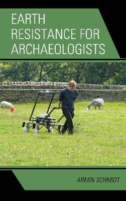
Earth Resistance for Archaeologists
Seiten
2013
Altamira Press (Verlag)
978-0-7591-1204-9 (ISBN)
Altamira Press (Verlag)
978-0-7591-1204-9 (ISBN)
Earth Resistance for Archaeologists, written by the foremost expert in the field, provides archaeologists with the know-how required to exploit the significant potential of earth resistance and gain archaeological insights from intelligently interpreted data.
Earth Resistance for Archaeologists, written by the foremost expert in the field, provides archaeologists with the know-how required to exploit the significant potential of earth resistance methods. A wide variety of possible uses are presented, including cases where earth resistance surveys succeeded in mapping buried archaeological remains that magnetometer surveys were unable to detect. Examples include earth resistance data from many archaeological sites, including in England, Scotland, Nepal, Bangladesh, and more. The archaeological features that can be detected through earth resistance methods are varied, ranging from ditches, pits, and grave cuts to stone and brick foundations, and even include whole landscapes. Whereas area surveys were traditionally the most common earth resistance method, depth profiling and vertical imaging have become well-developed tools that allow electrical depth investigations in three dimensions. Both techniques are described in detail and archaeologists will be able to apply them in their work. Content is equally relevant for environmental investigations.
Earth Resistance for Archaeologists, written by the foremost expert in the field, provides archaeologists with the know-how required to exploit the significant potential of earth resistance methods. A wide variety of possible uses are presented, including cases where earth resistance surveys succeeded in mapping buried archaeological remains that magnetometer surveys were unable to detect. Examples include earth resistance data from many archaeological sites, including in England, Scotland, Nepal, Bangladesh, and more. The archaeological features that can be detected through earth resistance methods are varied, ranging from ditches, pits, and grave cuts to stone and brick foundations, and even include whole landscapes. Whereas area surveys were traditionally the most common earth resistance method, depth profiling and vertical imaging have become well-developed tools that allow electrical depth investigations in three dimensions. Both techniques are described in detail and archaeologists will be able to apply them in their work. Content is equally relevant for environmental investigations.
Armin Schmidt, a geophysicist and honorary research fellow at Bradford University and Durham University in the United Kingdom, is the world’s foremost authority on the use of earth resistance for surveying and mapping archaeological sites.
Introduction
Chapter 1: Electrical Currents in the Ground
Chapter 2: Results from the Homogenous Ground
Chapter 3: The Electrical Signature of Features in the Ground
Chapter 4: Resistivity Imaging
Chapter 5: Implications for Field Practice
Chapter 6: Data Treatment
Chapter 7: Case Studies and Data Interpretation
Chapter 8: Conclusion
Bibliography
Index
About the Author
| Erscheint lt. Verlag | 21.4.2013 |
|---|---|
| Reihe/Serie | Geophysical Methods for Archaeology |
| Verlagsort | California |
| Sprache | englisch |
| Maße | 160 x 236 mm |
| Gewicht | 463 g |
| Themenwelt | Geisteswissenschaften ► Archäologie |
| Naturwissenschaften ► Geowissenschaften ► Geophysik | |
| ISBN-10 | 0-7591-1204-5 / 0759112045 |
| ISBN-13 | 978-0-7591-1204-9 / 9780759112049 |
| Zustand | Neuware |
| Haben Sie eine Frage zum Produkt? |
Mehr entdecken
aus dem Bereich
aus dem Bereich
How Numerical Models Revealed the Secrets of Climate Change
Buch | Hardcover (2020)
Princeton University Press (Verlag)
43,65 €


